
Torrential rain as Ex-Tropical Cyclone Alfred marches inland
Ex-Tropical Cyclone Alfred made landfall at about 8pm AEST on Saturday evening, and is now pushing inland, producing relentless heavy rain as it goes.
Despite Ex-Tropical Cyclone Alfred being downgraded on Saturday ahead of landfall, it still packed strong to gale-force winds over southeast Qld. Sustained winds of 65 to 80 km/h were recorded at Redcliffe and Toowoomba overnight, with peak gusts peaking at 104km/h and 98km/h respectively.
While some gusty winds are being experienced, for the most part, winds are now dying down as the system weakens and moves further inland.
Since landfall, a convergence line on Alfred’s eastern flank has moved over the coast, and is producing relentless heavy falls, with some very-intense rainfall rates.
Parts of Hervey Bay and K’gari (Fraser Island) were inundated after an intense, near-stationary thunderstorm formed on Sunday morning. 224.2mm fell at Hervey Bay in the 3 hours to 7:40am, including 108.4mm in 1 hour. All up from the storm, Hervey Bay recorded 319.2mm over a 12-hour period. The 24-hour total to 9am of 261.4mm is easily the wettest day on record of any month for that site in its 26 years of history.
Video: Lightning, radar and satellite showing the intense, near-stationary storm over Hervey Bay on Sunday morning.
Across northeast NSW and southeast Qld, widespread falls of 80-160mm were recorded in the 24hrs to 9am, and up to 322mm, which fell at Mt Glorious.
Over the past four days, the highest totals in each state have been:
- 815mm at Dorrigo, NSW
- 809mm at Upper Springbrook, Qld
Rain is still falling, so some of these areas, especially around Springbrook in the Gold Coast Hinterland, are likely to see weekly falls exceed 1 metre.
The rainfall at Dorrigo over the last several days is feeding into the Clarence River, with the major flood mark of 5.4m reached at 3pm Sunday at Grafton.
Heavy rainfall is continuing over southeast Qld on Sunday, primarily from Brisbane to the NSW border as well as the Murwillumbah area in NSW. 24hr rainfall totals of about 150-200mm are expected by 9am Monday, with isolated areas possibly seeing falls of 300-450mm. Amongst this, any thunderstorms that form are likely to produce intense rainfall with 3-hour totals of 150-250mm possible.

Image: Access-C Brisbane forecast 24-hour rainfall over southeast Qld.
Further west, rainfall will pick up in the Darling Downs region in Qld and the Northern Tablelands, Slopes and Plains regions in NSW late on Sunday. This area is expected to receive 60-120mm, with isolated falls around 150mm, largely falling in a 12-hour period. While this rain is heavy for this region, recent conditions have been dry, so the soil should be able to absorb more rainfall than areas in the east. This reduces the risk of major flooding, but some minor to moderate flooding is still possible, most likely as flash-flooding.
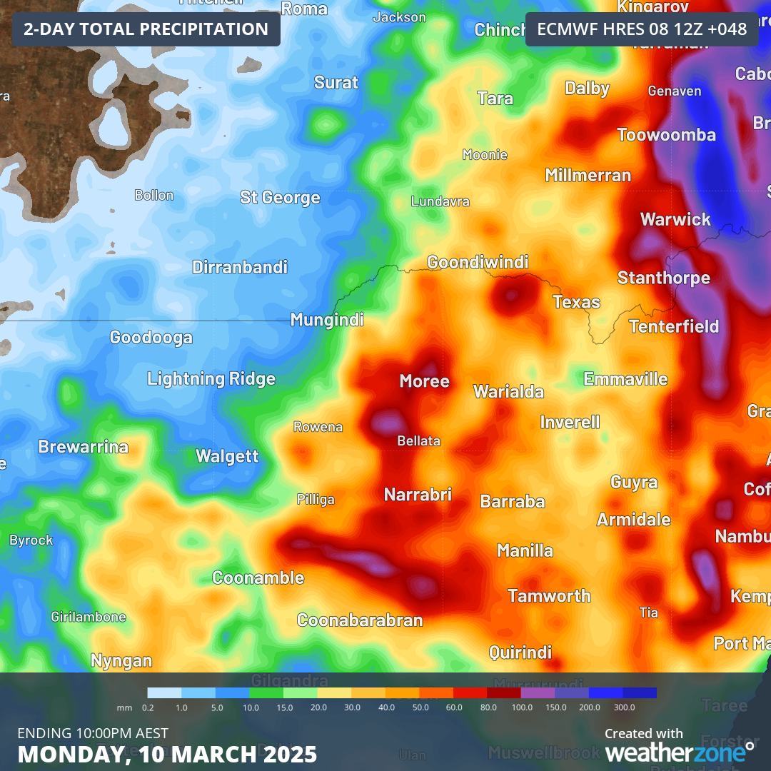 Image: ECMWF forecast 48-hour rainfall over northern NSW and southwest Qld.
While Ex-Tropical Cyclone Alfred has now made landfall, the severe weather will continue until Monday evening, with flooding extending beyond that. To see the latest warnings, please visit Weatherzone.com.au.