Tornado tears through Bunbury as severe thunderstorms continue in southwest WA
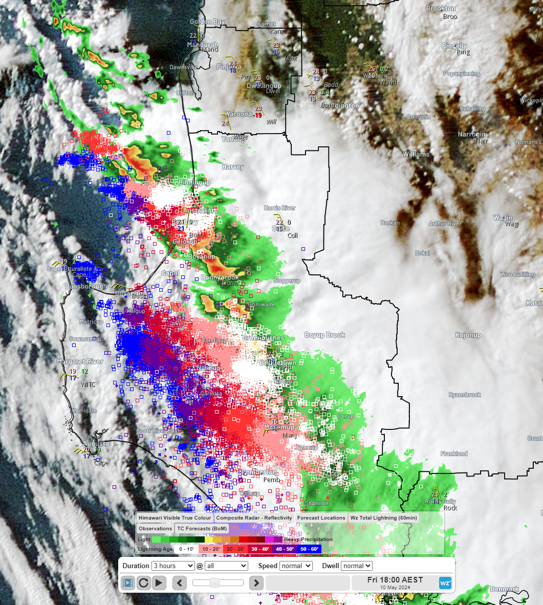
On Thursday we wrote about severe thunderstorms forecast to impact southwest WA today: Severe thunderstorms to hit WA on Friday. Severe thunderstorms started hitting the Margaret River and Busselton areas in the early afternoon, reaching Bunbury around 4pm where a tornado tore through the town. The tornado caused extensive damage, causing thousands of homes to lose power and destroying a PCYC building with dozens of people inside.
Tornado rips through Bunbury, two people rushed to hospital - ABC News

Image: Himawari-9 satellite, WZ lightning and BOM radar at 4pm WST
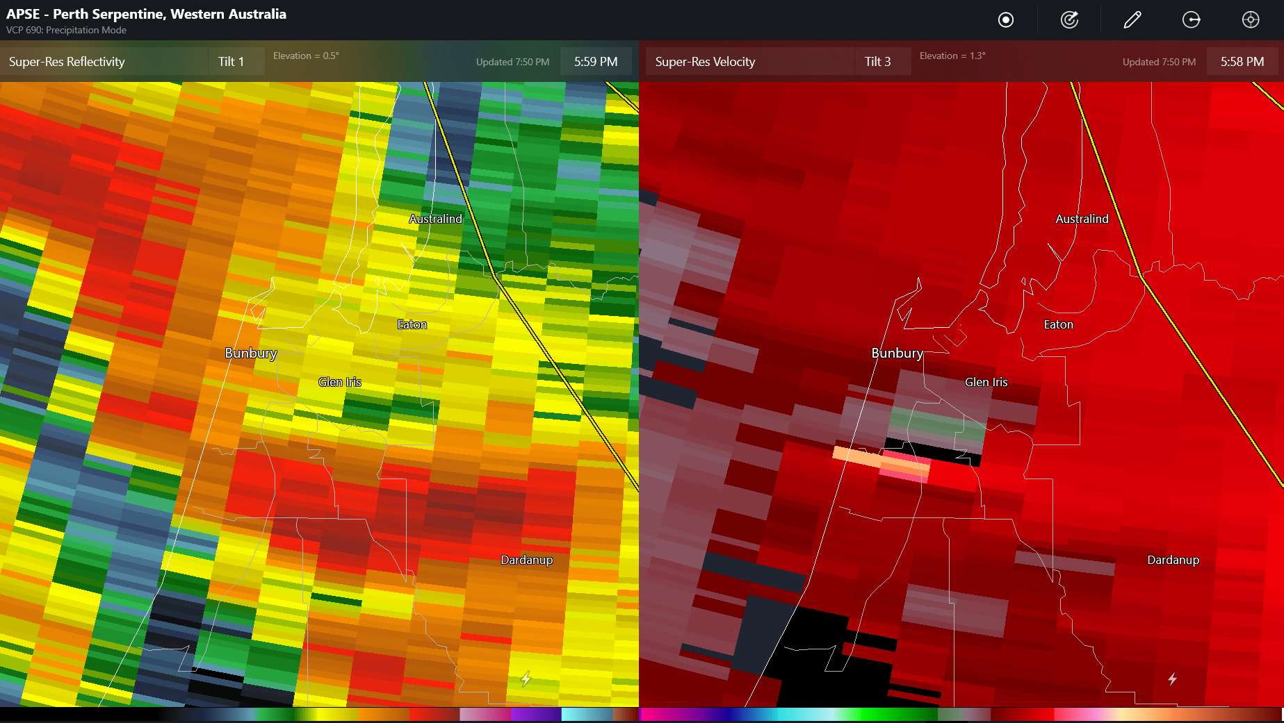
The doppler velocity radar imagery (on the right) from 4pm WST seems to suggest rotation consistent with the damage and video footage of a tornado. The green indicates winds moving to the north, while red is moving to the south, potentially indicating rotation. The reflectivity imagery (on the left) shows strong precipitation cores.

Image: Radar reflectivity left, doppler velocity right. Source: radarscope (DTN, BOM)
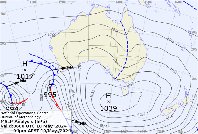
These thunderstorms have been triggered by a trough ahead of a cold front that can be seen in the MSLP chart below. Cool season thunderstorms like these in southern Australia don’t have as much buoyant energy as summer thunderstorms but the wind shear makes up for it. Wind shear is the change in wind speed and direction with height. Wind shear is a key ingredient for making storms severe. These types of systems are the most common types to produce southern Australia’s tornados including for southwest WA.

Image: BOM MSLP chart at 2pm WST
Severe storms are ongoing and will continue into the evening. Keep up to date with the latest warnings here: Western Australia Warnings Summary (bom.gov.au)