Thunderstorms to impact eastern Australia this weekend
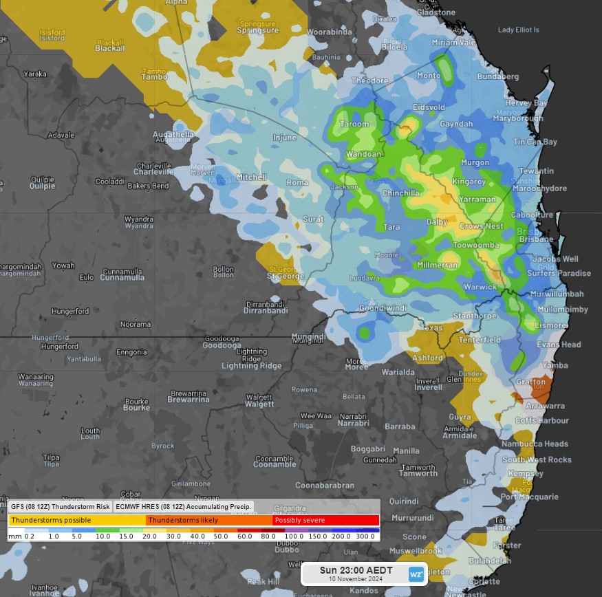
A trough and low-pressure system will develop over the east coast during the weekend, causing showers and thunderstorms over northeast NSW and southeast Queensland, with accumulating falls of 10 to 30mm during the weekend.

Image: GFS Thunderstorm Risk and ECMWF Accumulating Precipitation on Sunday, November 10, 2024.
Clouds will develop from late Saturday morning in eastern Queensland and will spread in the afternoon. Thunderstorms will bring damaging winds, lightning strikes, and hail, which may also cause flash flooding over Wide Bay and Burnett, southern Central Highlands and Coalfields, and eastern Maranoa and Warrego, as well as Northern Rivers and Northern Tablelands in NSW.
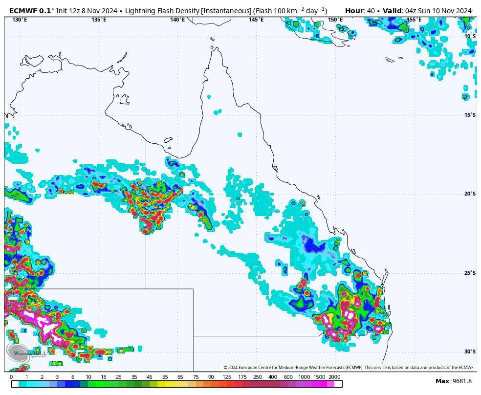
Tomorrow, the trough and low will cause thunderstorms over the Southeast Coast (including Brisbane), Darling Downs and Granite Belt, Maranoa and Warrego, Wide Bay and Burnett, and Northern Rivers and Northern Tablelands in NSW. Some storms may be severe, with heavy rainfall, damaging winds, and hail, in addition to a high density of lightning strikes on Sunday afternoon.
The map below shows the density of lightning strikes on Sunday 10th at 4pm AEST, with more than 2,000 lightning strikes per 100km.

Image: Lightning Flash Density on Sunday, November 10, 2024, according to the ECMWF-HRES model (Source: WeatherBell).
For detailed forecast and warning to your region here.