
Thundersnow is go!
A rare outbreak of thundersnow has swept across the Australian Alps on Tuesday afternoon, as a brief burst of heavy snowfalls was accompanied by multiple lightning strikes.
As you can clearly see on the graphic below taken at 2:30 pm AEST, numerous lightning strikes occurred as a cold front crossed the mainland alpine region accompanied by heavy snowfalls.
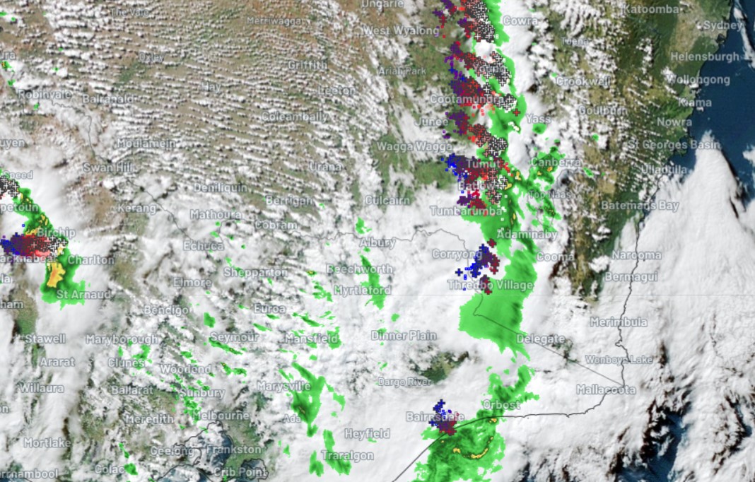
Look closely towards the top of the green precipitation blob straddling the NSW/Vic border and you can see a large agglomeration of strikes situated right over Thredbo Village, which is just a few kilometres south of Mt Kosciuszko.
Yes, we've seen thundersnow this Tuesday on the very rooftop of Australia. And if you're wondering how we know it was snowing at the time, here's a pair of time-stamped snow cam images to prove it!
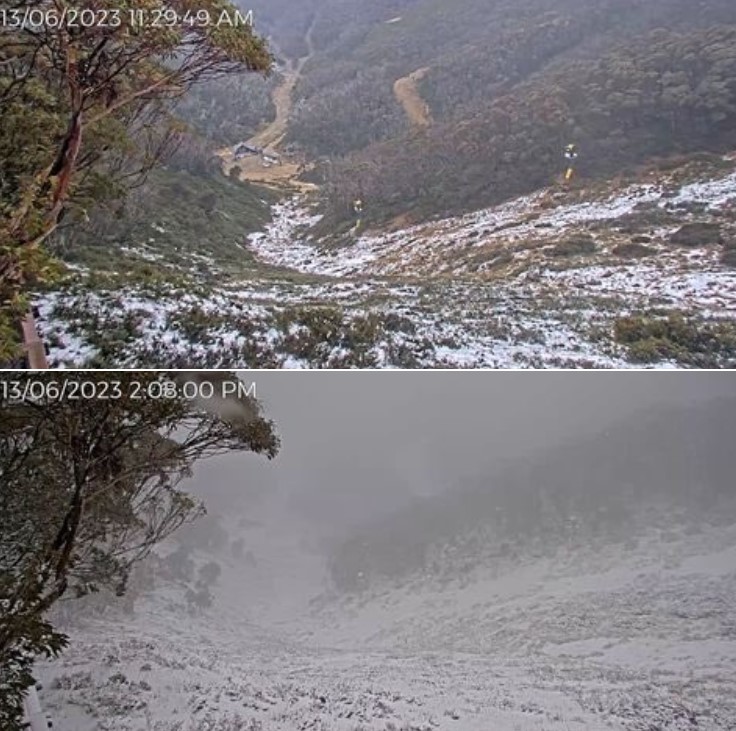
Image: This pair of images taken less then three hours apart is actually from Mt Hotham in Vic. Lightning also moved through the Vic Alps en route to the NSW Snowy Mountains. Source: ski.com.au.
Now as any weather-lover knows, thunderstorms and lightning are usually associated with warm air.
So how do thunder and lightning happen when it's cold enough for snow?
We actually discussed this here at Weatherzone a couple of years ago during a spectacular thundersnow outbreak in the Victorian Alps (check out the video from Mt Buller which is still live in our story).
As Weatherzone meteorologist Ben Domensino explained then:
"With most thunderstorms, you have relatively warm air sitting below cooler air, which creates an unstable atmosphere and causes the warmer air to rise.
In snowy areas, there is generally only a small temperature contrast between the surface and upper levels, so there's usually not enough instability to create the uplift needed for thunderstorm development.
But when you've got a very cold airmass, there can be enough of a temperature contrast between surface and upper level temperatures to make storms."
In the case of the current event, it's also likely that precipitation cooling effect kicked in, lowering the air temp and snow level as the short-lived but intense storm passed through the mountains.
Meanwhile, all mainland alpine resorts are reporting subzero temps by 3:30 pm in the wake of Tuesday's cold front. That said, the coldest air is still to arrive, and the snow level should drop to around 1000 meters above sea level this evening as further bands of showers arrive.
Around 10 to 20 centimetres of snow is expected from this current system at higher levels. That, combined with snowmaking, should be enough to crank up lifts on beginner slopes at all resorts, after a disappointing opening weekend with no skiing or boarding at most resorts.
Looking further ahead, an even stronger snowy system could eventuate early next week. At this stage, some long-range models predict it will be a classic snowy Aussie cold outbreak with heavy snowfalls, while others are less bullish. We'll definitely keep you updated on that one.
AND IN TODAY'S OTHER UNUSUAL LIGHTNING AND THUNDER NEWS...
RARE INVERSION THUNDER IN SYDNEY