Three winter records could fall in Brisbane this week
Brisbane is experiencing an unseasonably warm week, with the potential for winter maximum, minimum and prolonged warmth records to be broken.
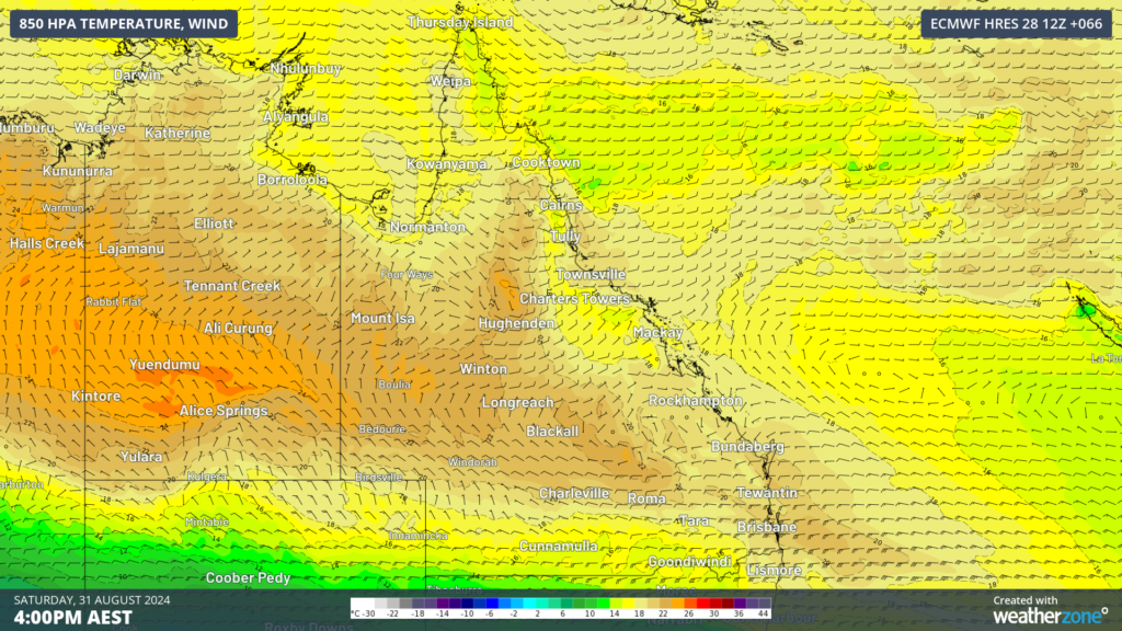
This unusually warm end to winter is being driven by unseasonably warm airmass lingering over central and northern Australia. This, in turn, is in response to a stubborn high-pressure system and prevailing warm and dry westerly winds as a series of cold fronts sweep across southern Australia.
The map below shows the warm airmass around 1.5km above the surface forecast for Saturday, with westerly winds dragging it all the way to the coast.

Image: 850hPa temperature and wind at 4pm AEST on Saturday, August 31, according to ECMWF.
The warmest days in Brisbane are forecast to be Friday and Saturday with temperatures of 34 and 35 to 36°C forecast consecutively. While minimums on Friday, Saturday and Sunday night should only drop to around 19 to 20°C.
There are at least two records that could fall in Brisbane during the next week:
- The daytime temperature on Saturday is forecast to reach 35 to 36°C. This temperature could break the previous winter record of 35.4°C, set back in August 2009.
- Brisbane’s minimum temperature on Friday night should only drop to around 20°C, potentially breaking the winter record of 19.4°C set in August 2006. Saturday and Sunday nights minimums are forecast to be around 19°C.
- The maximum temperature will reach above 31°C for the final three days of August, breaking the previously set record of two days in August 2009.
Looking ahead, the temperatures should finally drop into the 20’s from Tuesday, September 3 as the high pressure system moves further east directing a cooler southeasterly flow over the city.