
Thredbo felt like minus 13.5 degrees at midday
Snow fell across the mountains of NSW, Victoria, and Tasmania this mid-October Monday, as a cold burst of polar air surged northwards.
By mid-morning, snow had fallen to relatively low levels, with flakes settled on the ground as low as 700 metres above sea level in Tasmania, and as low as 1100 metres in the Snowy Mountains of NSW, with the level in Victoria somewhere in between.

This property east of Jindabyne, NSW, is at about 1150m asl and copped a brief burst of white on Monday. Source: Phil Richmond.
For those of you who love the snow and can't take your eyes off the snow cams even outside of winter, there was an interesting sight early on Monday.
As you can see on the time-stamped snow cams, there was a distinct snowline just after 9 am about a third of the way down from the top of the Front Vally run at Perisher in NSW.
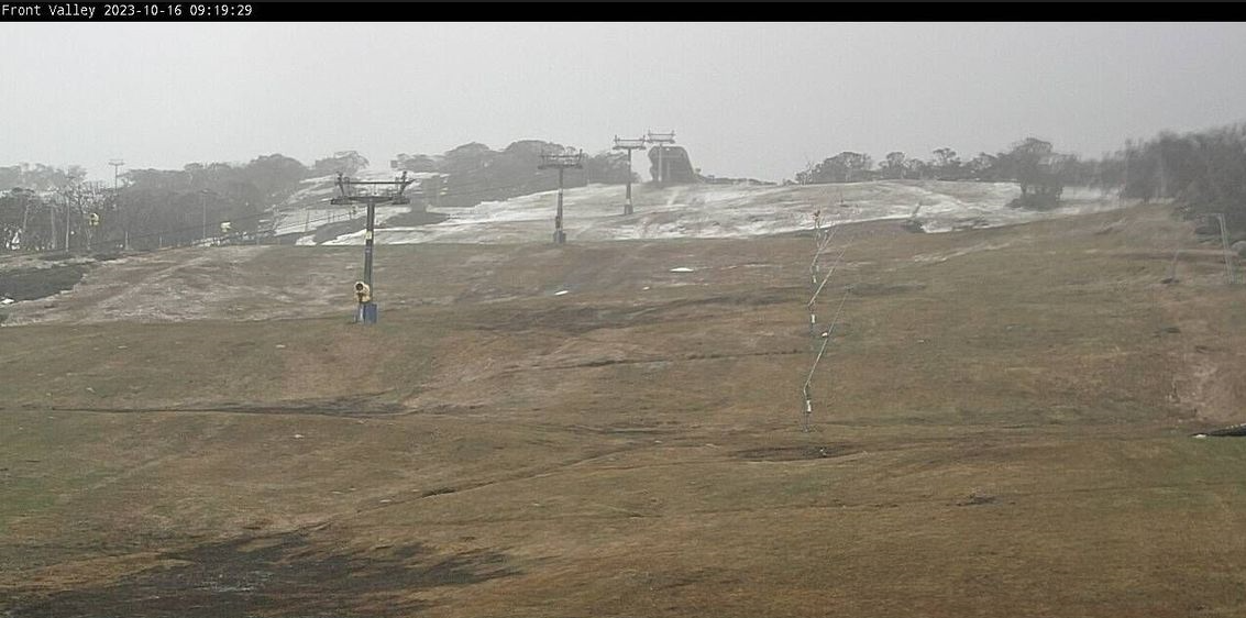
Image: It started only just cold enough for snow on Monday morning but the level soon dropped. Source: ski.com.au.
That means the level of settled snow was originally at about 1800 metres, though as the second image clearly shows, it soon dropped as colder air arrived with a band of moisture.
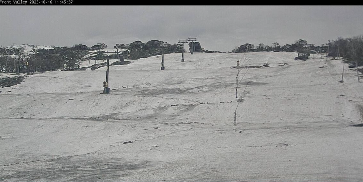
Image: Quick, hire a toboggan before it goes! Source: ski.com.au.
You can see the cold air arriving on Monday morning on the three-hour loop below, which shows the tell-tale speckled cloud pattern which almost always accompanies southern Australia’s coldest weather systems.
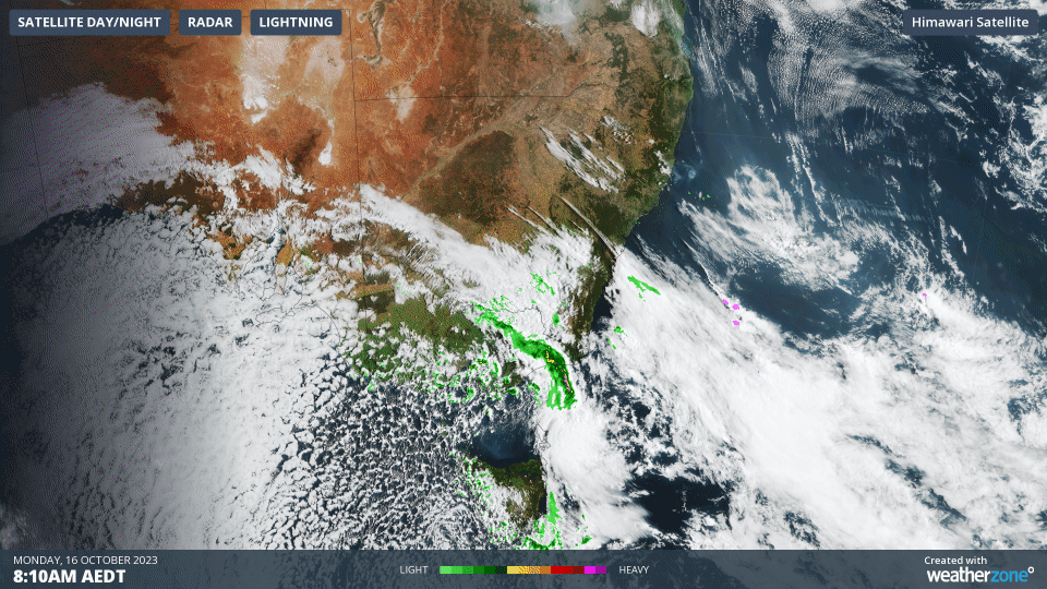
Weatherzone meteorologist Ben Domensino has written before about why speckled cloud fields have that distinctive appearance, explaining that:
- These clouds form when very cold air moves over a relatively warm area of ocean, causing a large number of individual cumulus clouds to develop over a broad area.
- Each of these cloud cells can produce rain, hail, snow and thunderstorms, with patches of clear sky in between.
As you'd expect with all that cold air, it’s a miserable wintry old day anywhere from about Canberra southwards.
- At 11:30 am, Melbourne was shivering through a temp of just 11°C
- At 11:30 am, Canberra was sitting on 11.7°C while at 1 pm, the capital had dropped to a bone-chilling 5.7°C under heavy showers.
- At 11:30 am, Sydney was enjoying a balmy 24.1°C, although the cooler air should arrive there later.
- At 11:30 am, Thredbo Top Station was a bitterly cold -4.3°C. By midday the mercury had risen to a not much warmer -3.6°C with an apparent (or "feels like") temperature of -13.5°C.
Both Canberra and Melbourne should return to tops in the mid-20s by Wednesday or Thursday, while the snow at the snowfields probably won’t last beyond about Tuesday morning, so if you've got Monday off and feel like a snap road trip to throw a snowball, now's your chance.