
These weather maps show what Victoria has in store on Wednesday
Catastrophic fire danger, powerful winds and temperatures in the mid-forties will create a dangerous day of weather in western Victoria on Wednesday.
The maps below show what’s in store for Victoria on Wednesday.
Temperature
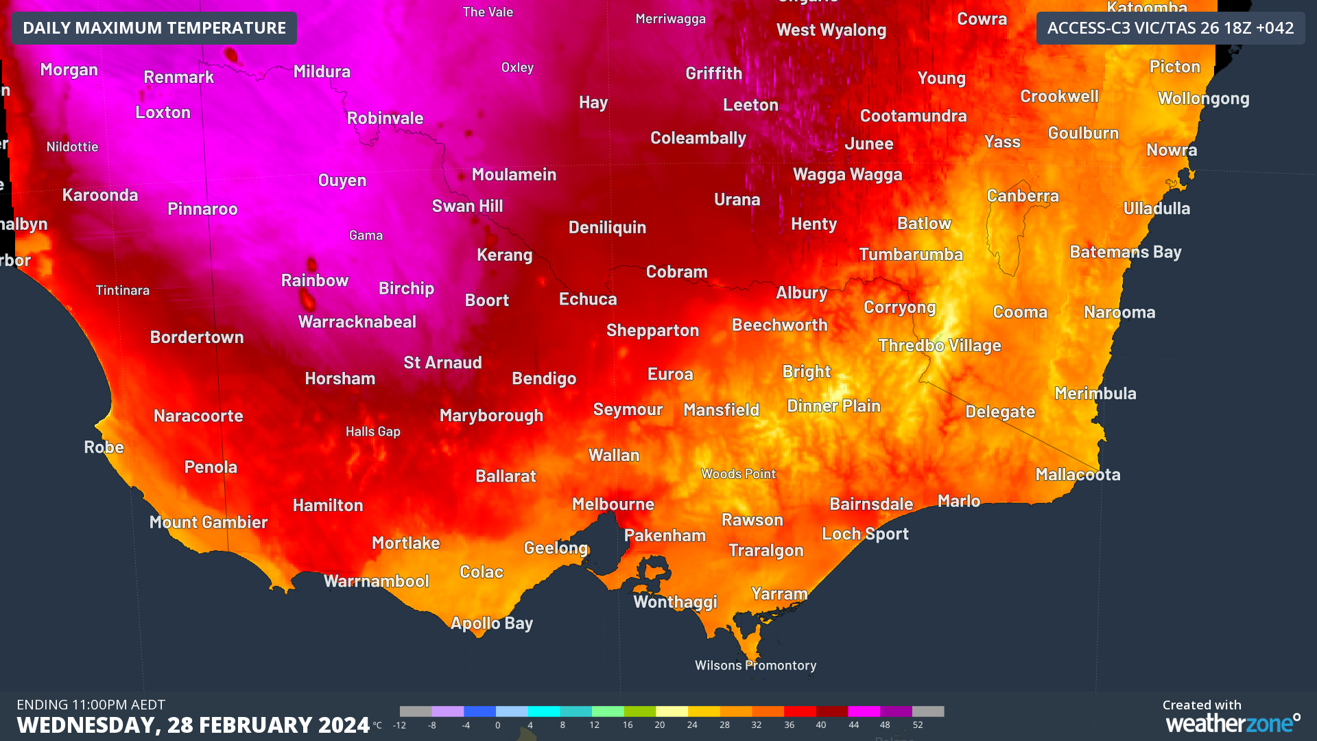
Image: Forecast maximum temperature on Wednesday, February 28, according to the ACCESS-C model.
A very hot air mass will be driven over Vic on Wednesday, thanks to strengthening north to northwesterly winds ahead of an approaching cold front.
The map above shows that surface air temperatures could reach around 44 to 45ºC in northwest Vic and nearby areas of NSW and SA on Wednesday afternoon. Temperatures above 40ºC could also extend south into the Wimmera district and east into the North Central district. Further south, maximum temperature are predicted to hit the mid-to-high thirties in parts of the south and southwest, including Melbourne.
Wind
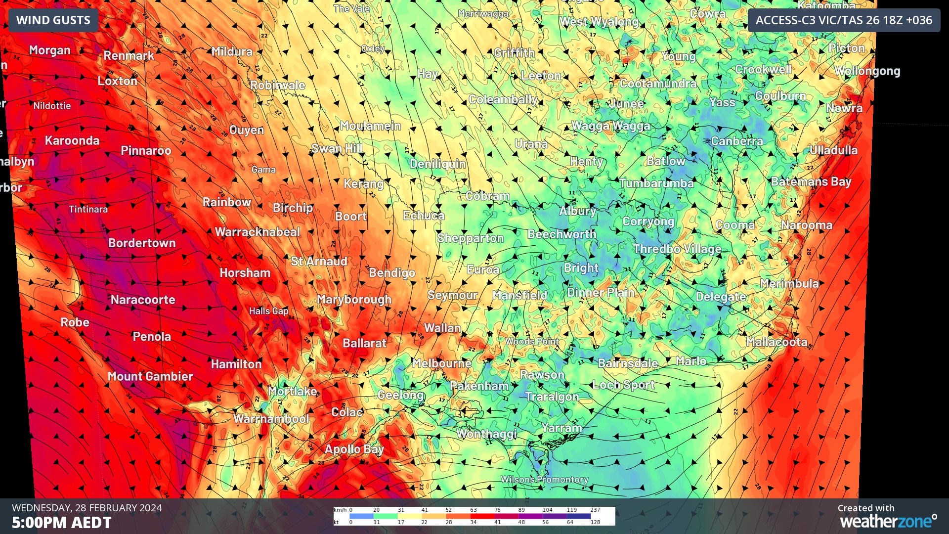
Image: Forecast wind gusts at 4pm AEDT on Wednesday, February 28, according to the ACCESS-C model.
Hot northerly winds will strengthen ahead of a blustery and cool west to southwesterly change on Wednesday. This change is expected to enter the state’s west in the afternoon and reach central Vic in the evening, arriving in Melbourne around 10 to 11 pm at this stage.
Winds will be strong ahead of, with and behind Wednesday’s cool change, which will create very dangerous conditions for any fires that are burning in the western half of the state. This elevated fire danger will be compounded by dry vegetation and little or no rainfall from the frontal system.
Forecast models suggest average wind speeds could reach around 50 km/h in parts of western Vic on Wednesday afternoon, with gusts potentially exceeding 80km/h in some areas.
Fire danger
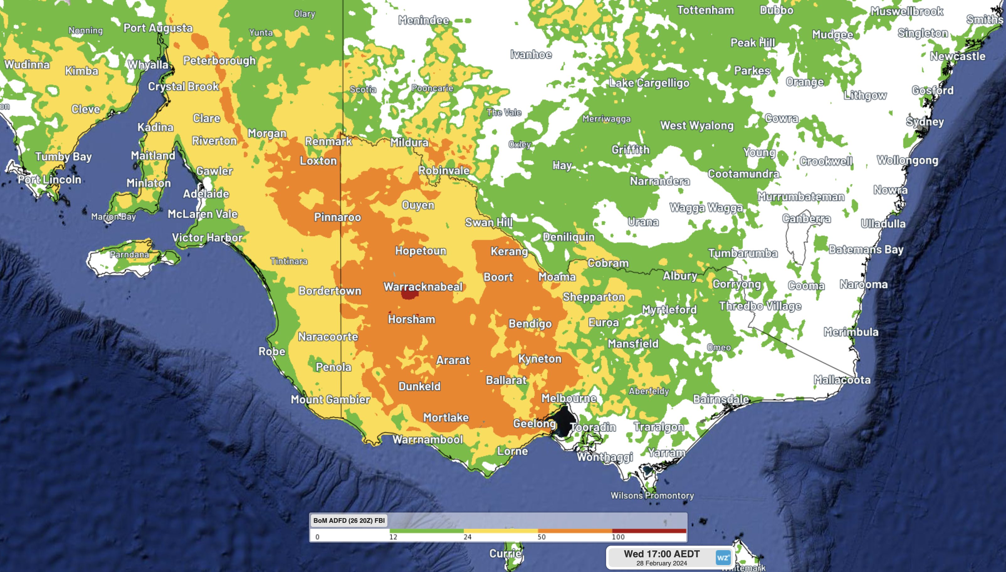
Image: Modelled Fire Behaviour Index (FBI) values on Wednesday, February 28.
The combination of hot, dry and windy weather, in addition to plenty of dry vegetation, will create Extreme to Catastrophic fire danger ratings in the western half of Vic on Wednesday. Extreme fire danger will also extend into parts of eastern SA and southwest NSW.
The highest fire danger on Wednesday is likely to occur in the Wimmera district in western Vic, where the most dangerous combination of heat and wind is expected to develop.
Be sure to check the latest weather and fire warnings throughout Wednesday if you live in southeastern Australia.