
The unwelcome drop-in: Tasman Low pays a visit to Lord Howe Island
Earlier this week, we mentioned that a Tasman Low would come barrelling into the nation’s southeast over the weekend and early next week. But first it had to make a bit of a whirlwind pit stop, like a road-tripper raiding the snack aisle at the servo mid-journey.
As the low took sustenance from warmer waters in the upper Tasman and gained in strength, it brought damaging winds and potentially dangerous surf conditions to Lord Howe Island between Friday afternoon and early Saturday morning, and is now set to unleash damaging winds on Tasmania.
Sustained winds of 50-70km/h pummelled Lord Howe Island between midday Friday and 1:30am Saturday, with Lord Howe Island airport recording peak wind gusts of 94-96km/h between 2:30 and 3 o’clock on Friday afternoon. Several further instances of wind gusts exceeding 80km/h were observed in the subsequent hours, with another potentially damaging wind gust of 93km/h observed at the aptly named Windy Point just after midnight.
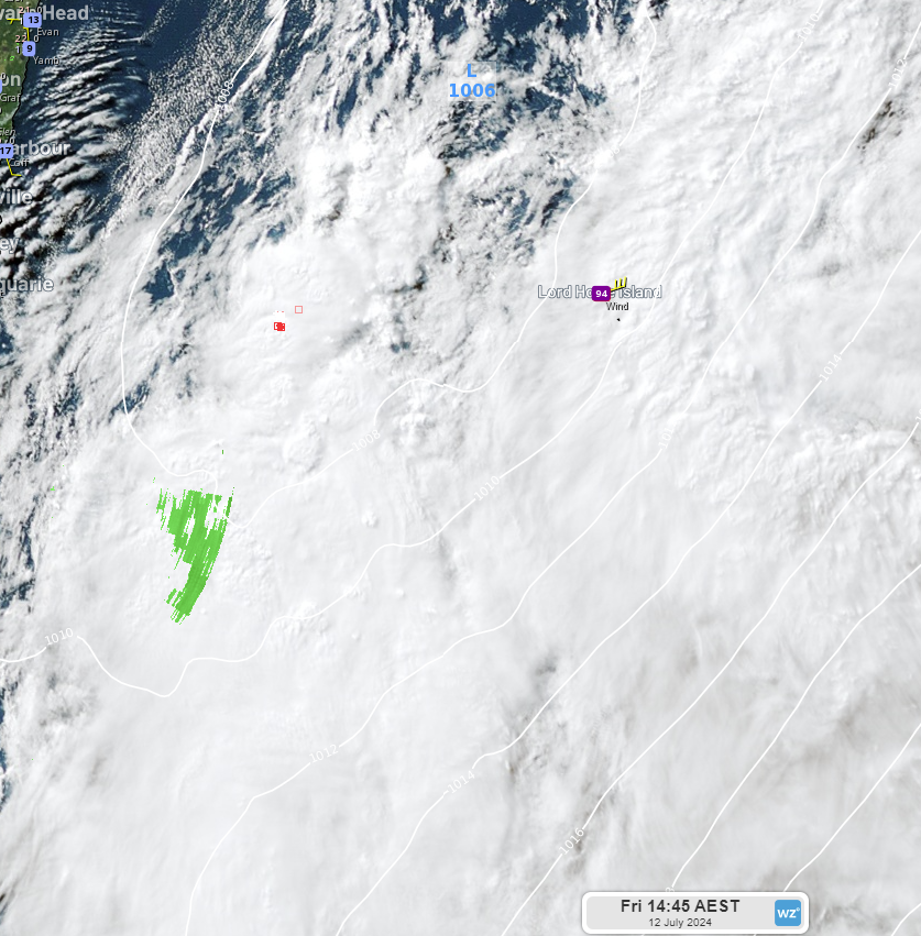 Image: Himawari satellite imagery with mean sea level pressure and observed wind gusts at Lord Howe Island airport Friday, July 12 2024.
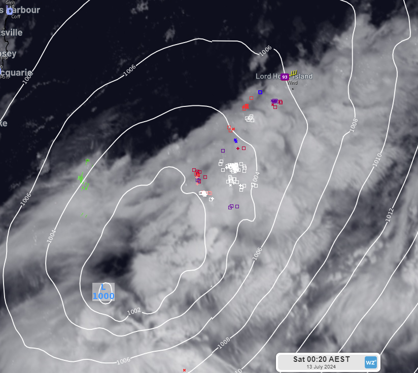 Image: Himawari satellite imagery with mean sea level pressure and observed wind gusts at Lord Howe Island airport Saturday, July 13 2024.
These winds may have also whipped up some ferocious surf, with the Bureau of Meteorology consistently warning of damaging surf conditions, waves of up to 6m and coastal erosion since Thursday afternoon. Unfortunately, sea and swell observations at Lord Howe Island are currently unavailable.
The low is now heading towards Tasmania and, as you can see from the image below, damaging winds are expected over Tasmania’s east coast from Sunday afternoon.
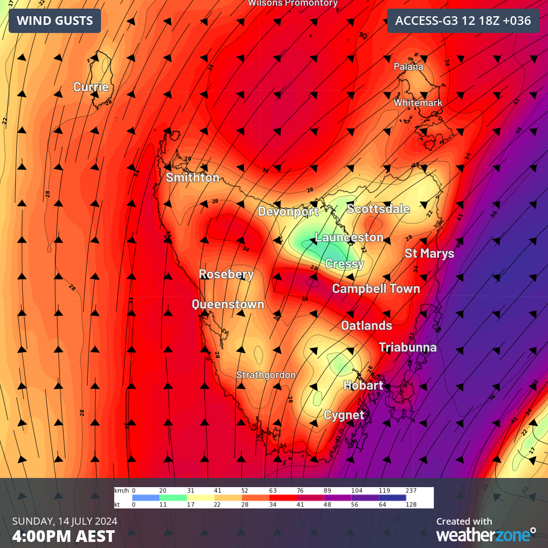
Image: Forecast wind gusts at 4pm AEST Sunday, 14 July 2024 according to the Access-G model.
The subsequent images also show that there is the potential for damaging winds to impact Tasmania’s west coast and across elevated northern areas of the state from late Sunday evening and into Monday. Damaging winds may also develop about Victoria’s coastline from early Monday morning.
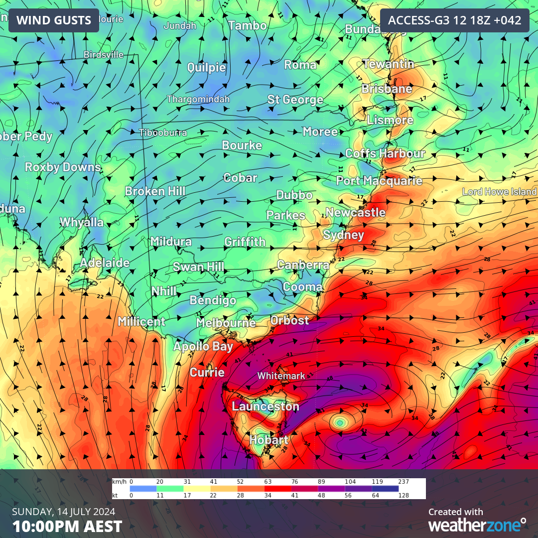
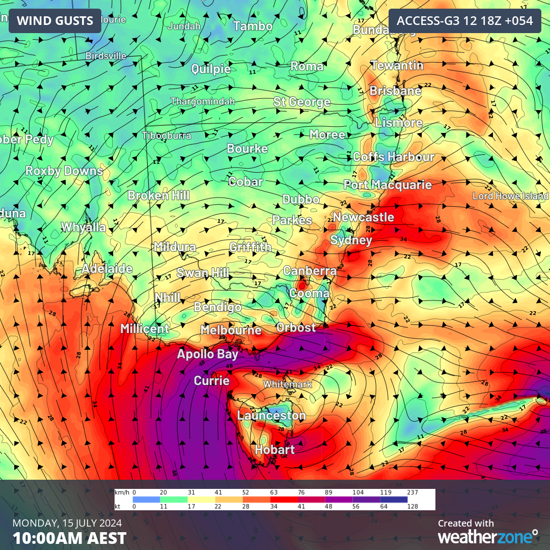 Images: Forecast wind gusts at (top) 10pm AEST Sunday, 14 July 2024 and (bottom) 10am Monday, 15 July 2024 according to the Access-G model.
The forecast images shown here are only one model’s interpretation of how the wind situation may unfold, with some uncertainty still lingering between different models regarding the exact location, timing and strength of the worst winds. As this is a rapidly evolving situation, please make sure you stay up to date with the latest severe weather warnings here.