The heat is looking to ramp up in Brisbane tomorrow!
Much like their Big Bash Team: the Brisbane Heat, Brisbane city will well and truly live up to its reputation on Monday, as a blast of heat and high humidity get set to make for a sultry day.
Maximum temperatures in Brisbane generally lurk about the 30-degree mark during the month of January, and 2024 has been no exception. The average maximum temperature for Brisbane this month has been 30.3 degrees. The highest temperature Brisbane has seen this year has been 34.0 degrees, reached around 2:00pm last Friday.
Not to add, that the humidity experienced in Brisbane is making temperatures feel 5-8 degrees warmer than they actually are.
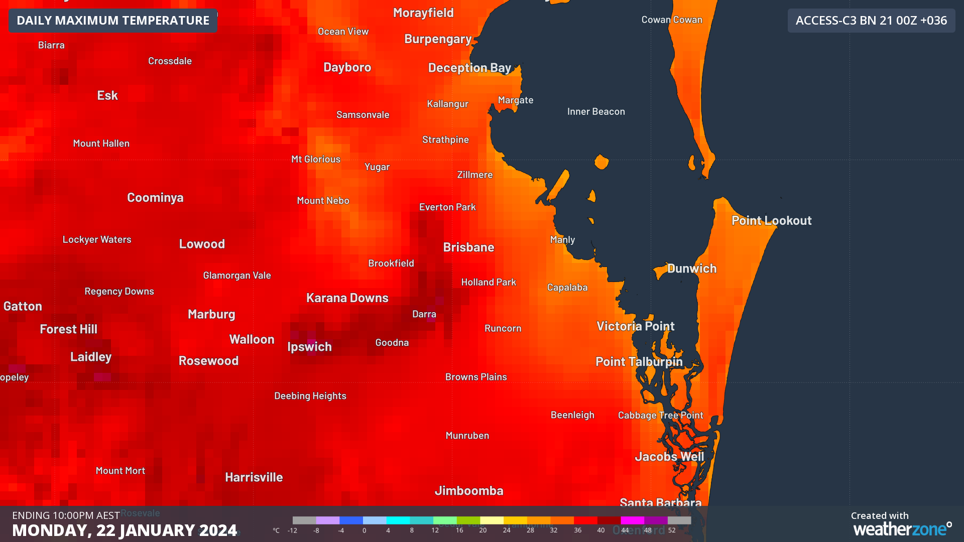
So, it's not the best news for our fellow Brisbanites when we see heat closing in on the city tomorrow, with actual temperatures looking to peak well above 35 degrees (Fig. 1). Clear skies, calm winds and the lack of a cooling ocean breeze (as winds, including a seabreeze look to be weak) means that there is nothing to stop the glaring sun from ramping up the heat in the afternoon, with the high humidity making it feel even hotter.

Fig. 1) Maximum daily temperature for Brisbane as shown by ACCESS-C (Sun 21 00Z)
A severe heat wave warning has been issued for Queensland’s Southeast Coast by the Bureau of Meteorology, including Brisbane (Fig. 2). Please see the Bureau’s heatwave warning here: https://www.weatherzone.com.au/warning/IDQ21013

Fig. 2) Heatwave map of areas in the Southeast Coast with severe heatwave conditions building in the 72 hours leading up to 5:00pm Monday 22nd.
In addition, a significant southerly change in winds tomorrow evening will drop temperatures by 3-4 degrees. However, this change will also stimulate cloud build up over the state capital overnight. These clouds are likely to trap the remainder of the previous day’s heat, making it an uncomfortably hot and humid morning come Tuesday 23rd.
On a more positive note, Monday looks to be the hottest day over the next few days, as ocean breezes work to drop afternoon temperatures closer to average January temperatures once more, although the humidity will stay high for many days yet.