The Australian deserts do not escape from the rain
If you live in eastern NSW and you are missing blue skies, don't think that you would find it in central Australia as significant rain is set to develop.
A deep low pressure trough off the northwest Kimberley coast has been generating heavy rain in northern WA during the last few hours. Truscott and Kununurra have collected 102 and 56mm, respectively, during the 24-hour period to 9am on Saturday.
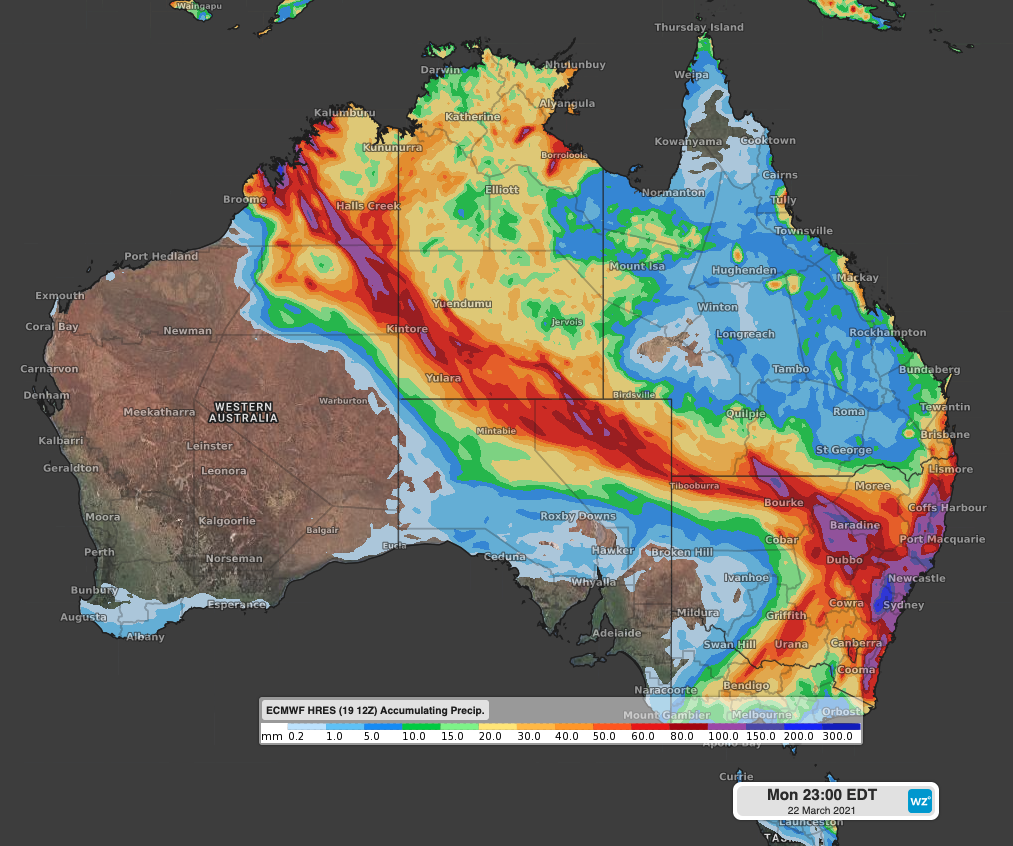
An upper level trough will help to transfer the tropical moisture-laden air over the Kimberley to central Australia. As a consequence, a rain band will affect parts of WA interior, central and southern NT, northern SA, and southwestern Queensland, including large desert regions such as the Great Sandy, Tanami, and Simpson.
Widespread falls between 20 and 40mm are expected across central Australia accumulated during Sunday and Monday. Some models indicate localised heavier totals, possibly exceeding 60mm, enough to cause flooding in these arid areas.
 Image: Forecast accumulated rain from Saturday to Monday, according to the ECMWF-HRES model.
The extensive cloud band and associated rain will spread to parts of the Upper Western of NSW and nearby areas of the Channel Country and Marona and Warrego during Monday. These outback areas may see daily falls exceeding 50mm.
A flood watch has been issued for Lasseter, Tanami, Simpson, Macdonnell, Finke and Southern Barkly inland rivers. With this unusual rain event in Australia's outback, you can keep track of the latest weather warnings here.