Temperatures to seesaw in Europe this week
Europe will experience dynamic weather during the coming week. The first part of the week will feature mild temperatures with storms in the south, then later in the week an Arctic outbreak will send a reminder that winter is approaching.
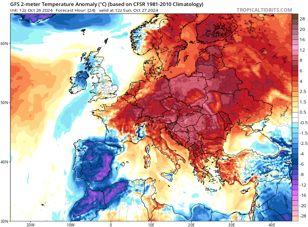
High pressure stretching horizontally across Continental Europe will lead to mild temperatures reaching the mid-teens and generally dry conditions until about Thursday. The Iberian Peninsula will be cooler and wetter due to a slow-moving low pressure system nearby.

Image: 2m temperature anomaly for 12Z Sunday October 27th. Source: tropicaltidbits.com
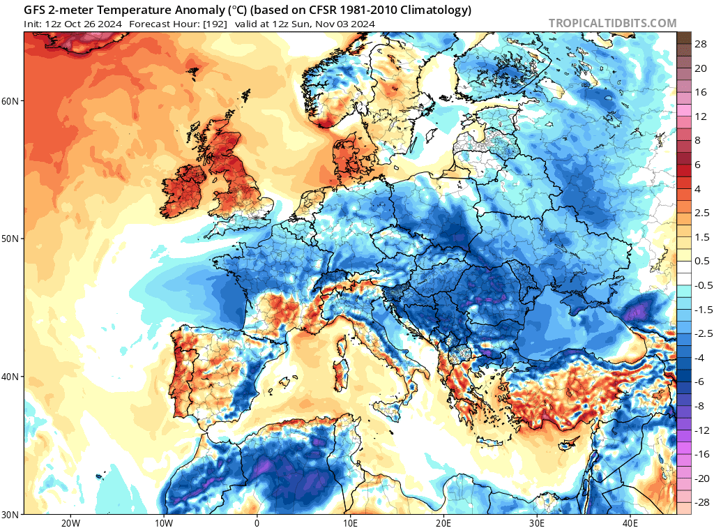
From Friday, the pattern will shift. A deep low-pressure system moving over northern Scandinavia and Russia, together with a high to the west of the UK, will send bitterly cold winds from the north, sending temperatures into single digits (below freezing in some parts), and dropping snow over the Alps.

Image: 2m temperature anomaly for Sunday 12Z November 3rd. Source: tropicaltidbits.com
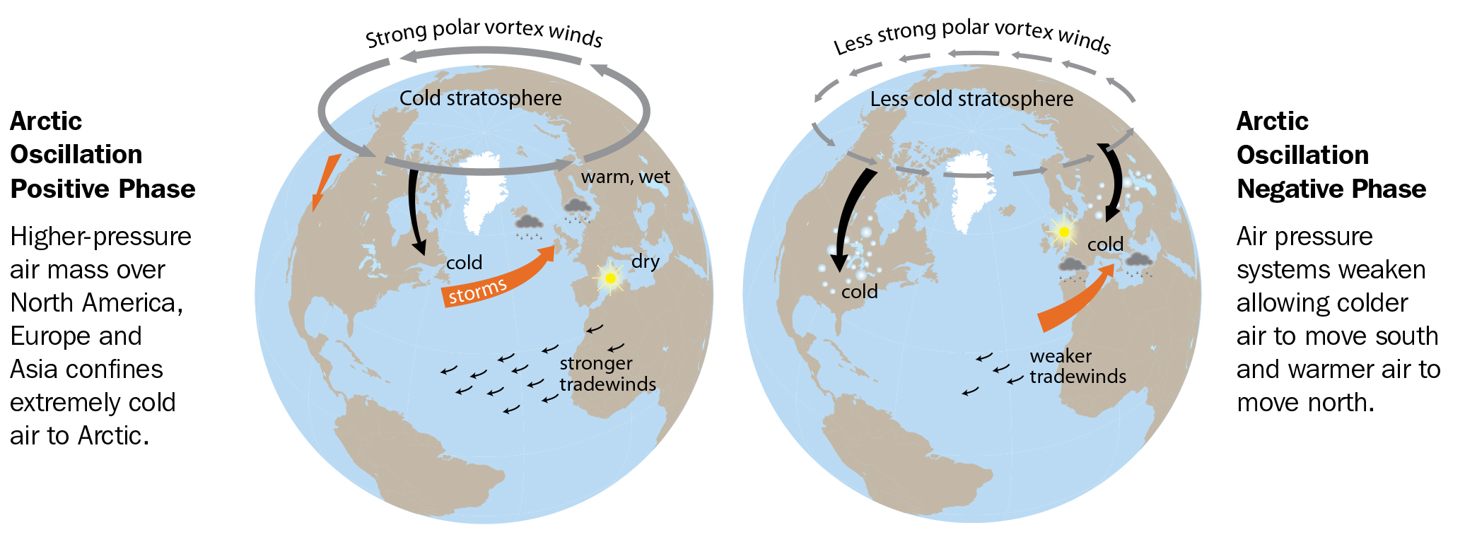
The flip in weather comes from a flip in the Northern Annular Mode or Arctic Oscillation (AO), which corresponds to our Southern Annular Mode. The Arctic Oscillation is currently in the positive phase but it is forecast to turn negative at the start of November. The negative phases of each of these oscillations tends to allow cold air to move further away from the poles into the midlatitudes.

Image: Arctic Oscillation diagram. Source: National Snow and Ice Data Center