Temperatures plunging in southeastern Australia
A cold air mass spreading over southeastern Australia is causing huge temperature contrasts between some of Australia largest capital cities today.
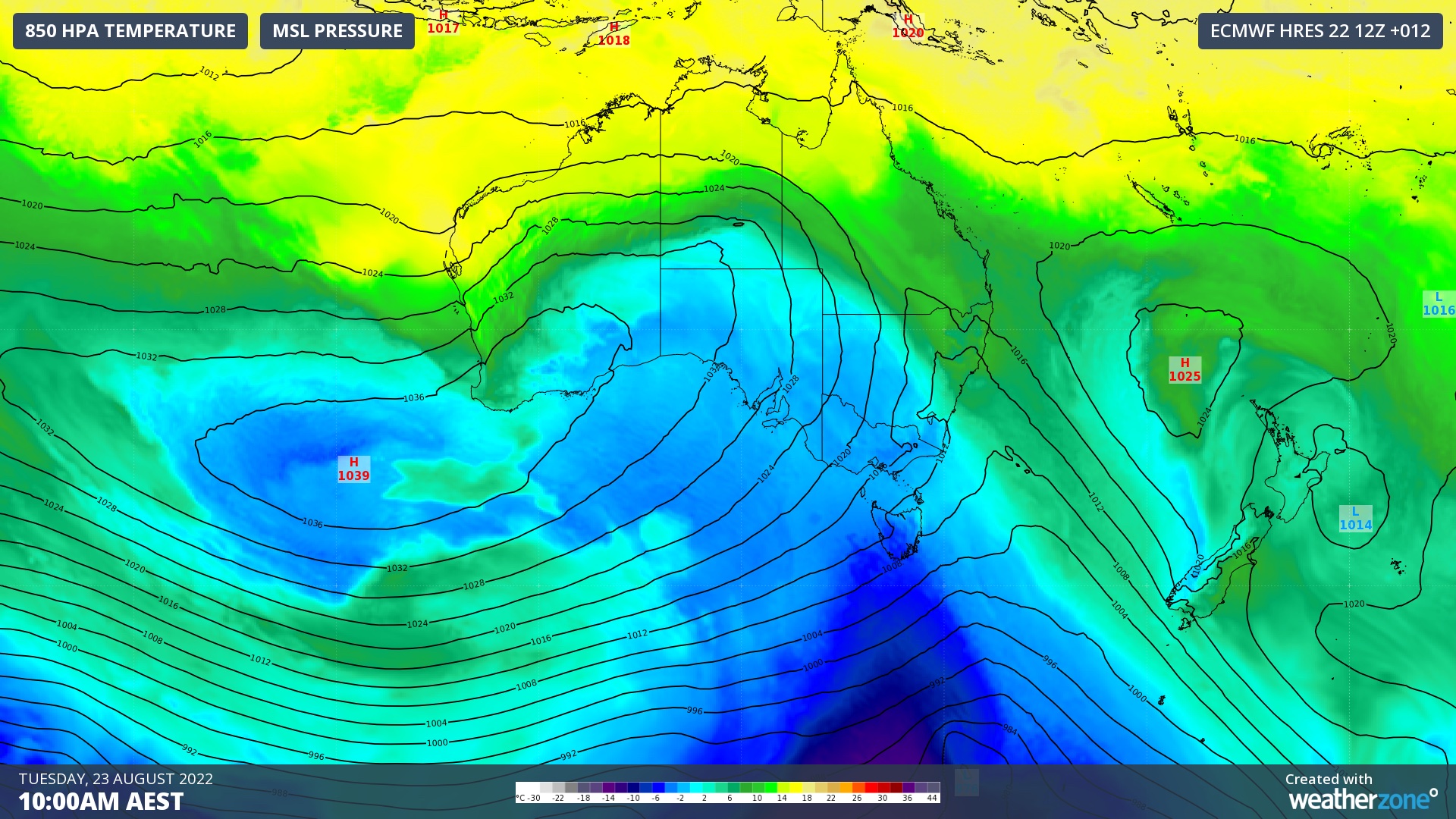
A pool of air that originated near Antarctica has been spreading over Australia’s southern and southeastern states during the last couple of days, in the wake of a strong cold front.

Image: Modelled air temperature around 1.5 kilometres above the ground, combined with mean sea level pressure isobars, showing a very cold air mass located over southern Australia on Tuesday morning.
After reaching Adelaide, Hobart and Melbourne on Monday, the cold front will continue to move further north over NSW and southern QLD on Tuesday.
Canberra reached 9.2ºC shortly after 7am on Tuesday as relatively warm air passed over the ACT ahead of the approaching cold front. However, the mercury then plummeted by 5ºC in one hour as the front arrived around 8:30am local time.
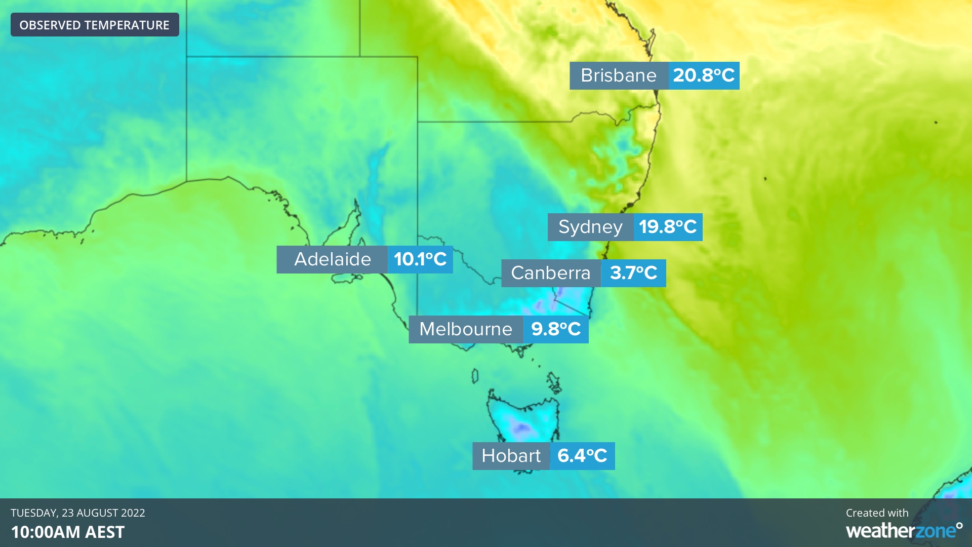
By 10am AEST on Tuesday, there was a large temperature contrast across southeastern Australia. Much of NSW and QLD were still enjoying warmer air ahead of the front, while southern NSW, the ACT, VIC, TAS and most of SA were enduring much colder air in its wake.

Image: Observed temperatures at 10am AEST in Australia’s southeastern capital cities.
Anywhere south of today’s cold front will struggle to warm up much due to lingering cold air and southerly winds. Areas north of the front will enjoy pleasant temperatures until the front arrives and causes abrupt cooling, rain and blustery winds.
The cold front should reach Sydney around 1 to 2pm local time and get to Brisbane this evening sometime between 8 and 10pm. Sydney should cool by around 10ºC in one or two hours when the front arrives, with cloud, wind and rain exacerbating the cold change. The cooling will be less abrupt for Brisbane.
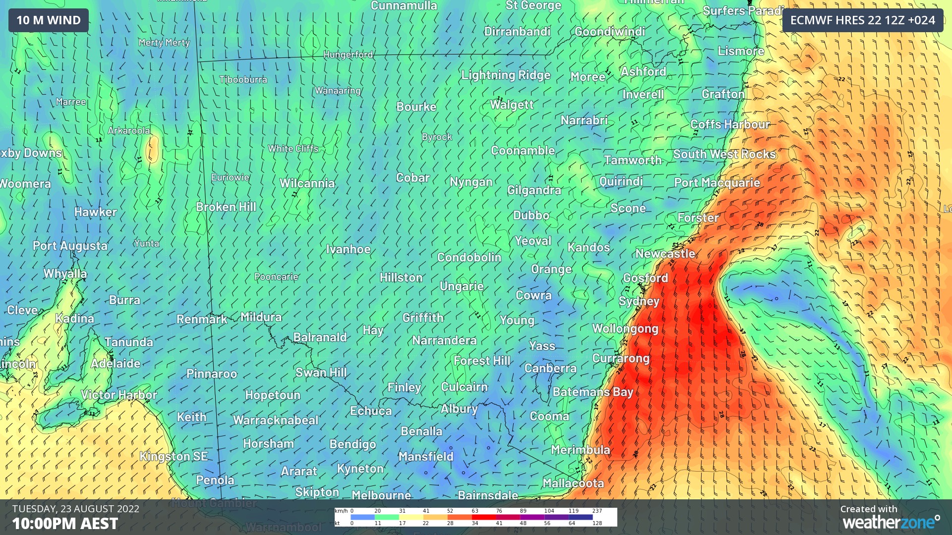
Southerly winds will also strengthen along the NSW coast and ranges with and in the wake of the front, causing dangerous conditions in some coastal waters on Tuesday and Wednesday. As a result, a hazardous surf warning and gale wind warning have been issued along most of the coast.

Image: Forecast wind speed and direction at 10pm AEST on Tuesday, August 23.
This cold outbreak has also caused snow to reach the lowest levels so far this season in parts of southeastern Australia. The lowest snow on Tuesday morning was falling in Tasmania, where flakes were reported down to around 300 metres above sea level.