
Temperature seesaw: warmest days since April forecast for the southeast late this week
A strong cold front finally got us. Sparking up a lightning show, squally winds then alpine snow as it crossed on Thursday, the post-frontal cold air really got streaming on Friday.
Helped by a low over Bass Strait that kept winds going, Melbourne's Friday maximum of 11.7°C was its coldest September day since 2004; Adelaide's 13.4°C its coldest for September since 2018. Neither capital felt above single digits all day. Canberra was cool, but not unusually so for the country's coldest capital. 11.4°C–what it topped out at on Friday–is not unusual there in early spring.
The low drove the strongest wind gusts in years over near-coastal areas between Melbourne and Robe, including 122km/h at Mt William, 111km/h at Cape Jaffa, 107 km/h at Port Fairy, 106km/h at Warrnambool and Portland, and 100km/h at Cape Otway. Even Melbourne Airport's 89km/h and Melbourne's 70 km/h were the strongest in nearly one and two years, respectively.
Twenty centimetres of snow falling over the resorts (Hotham won, with 22cm) is also making for some happy faces this Saturday.
Now the nights are about to get cold as the winds drop out behind the front. And then...
Warmth will return. A tongue of heat will be drawn ahead of a trough mid-week, peaking between Thursday and Saturday. Forecast temperatures for Adelaide, Melbourne, Canberra and Sydney on Thursday and/or Friday are the warmest since April or March. That translates to 30 degrees plus for western Sydney, inland NSW and SA.
Given the abysmally wet and cloudy conditions last year, it'll probably also wind up being the warmest September day since at least 2021 for these areas.
Be ready to swap out the beanies for the sunhats.
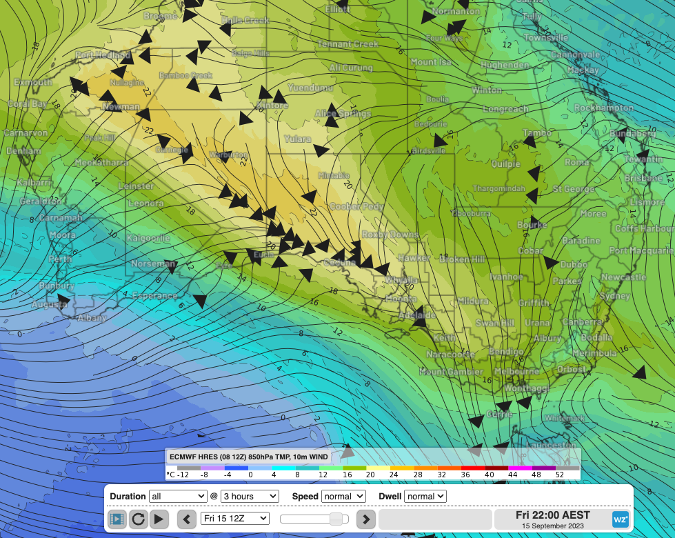
Image: Forecast temperature at approximately 1500m elevation with surface wind streamlines for Friday 15th September, 2023. Elevated temperatures are a good forecasting tool as they are less prone to errors from complex air and ground interactions. As a rule of thumb, adding 15°C to the 1500m temperature in a dry atmosphere will give you a good estimate of the maximum surface temperature.
Image: Maximum forecast temperatures Friday 8th September compared to Friday 15th September.