
Teeth-chattering temps in the NT
In what appears to be a fear-of-missing-out (FOMO) weather scenario, our Northern Territory has been the latest victim of cold temperatures this weekend after seeing its southern neighbours be a little too free with the chill. This comes, as if on cue, with the beginning of winter, after above-average maximum temperatures were seen in the month of May.
Whilst 30+ degree maximums mostly dominate the north, even at this time of year, Saturday saw the easing of the usually gusty southeasterly winds, keeping maximums in the high 20s for much of the Top End.
Early on both Saturday and Sunday morning, temperatures dropped to the mid-teens and below across the Top End as light winds blew cold, dry air across the region. Take a look at all those blues in the figure below.
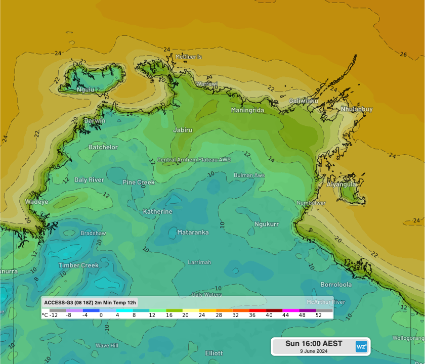
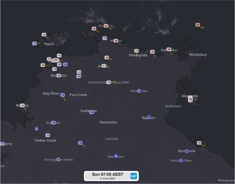
Images: (Top): Forecast 12-hour minimum temperature to 4pm on Sunday, 9th June using the ACCESS-G3 Sat 18Z model, and (Bottom): Observed temperatures at 6:35am ACST on Sunday, 9th June, including wind speed and direction with Himawari satellite imagery.
Between Friday night to Saturday afternoon:
- Darwin Airport dropped to 15.5ºC, the lowest June minimum since 2019 and the lowest temperature for any month since July 2023.
- Croker Island Airport dropped to 16.1ºC, the lowest June minimum since at least 2013 and the lowest temperature for any month since July 2023.
- Gove Airport maxed out at 26.8ºC, the lowest maximum temperature for any month since August 2022.
On Sunday:
- Delamere dropped to 9.3ºC, the lowest June minimum since 2011 and the lowest temperature for any month since May 2020.
- Pirlangimpi dropped to 12.5ºC, the lowest June minimum since 2011 and the lowest temperature for any month since July 2022.
- Temperatures are forecast to reach 25ºC at Elliott, about 3ºC lower than the June maximum average, and 29ºC at Darwin, about 2ºC lower than the June maximum average.
Despite the cold temperatures, we should be reminded that we are well and truly in the Top End's bushfire season, being in the dry season now. Bushfires which are now under control were burning across Central Arnhem on Saturday.
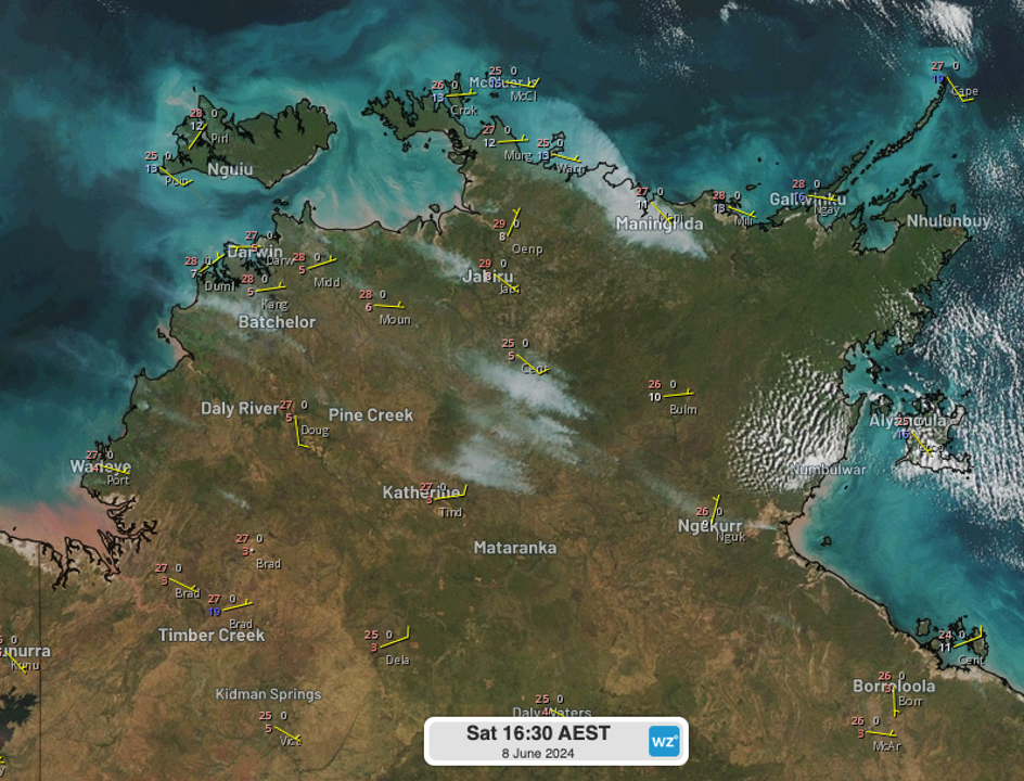
Image: Himawari satellite imagery of the NT's Top End on Saturday afternoon, showing the extent of the bushfires, as well as temperatures, dewpoints and wind speed & direction.
Remember to stay up to date with the latest forecasts and warnings on our website.