Tassie to get wet and white
Rain and highland snow are heading the way of Tasmania as we move towards the weekend, after western parts of the state received good falls of rain in the 24 hours to 9 am Thursday, with lighter showers continuing throughout the day.
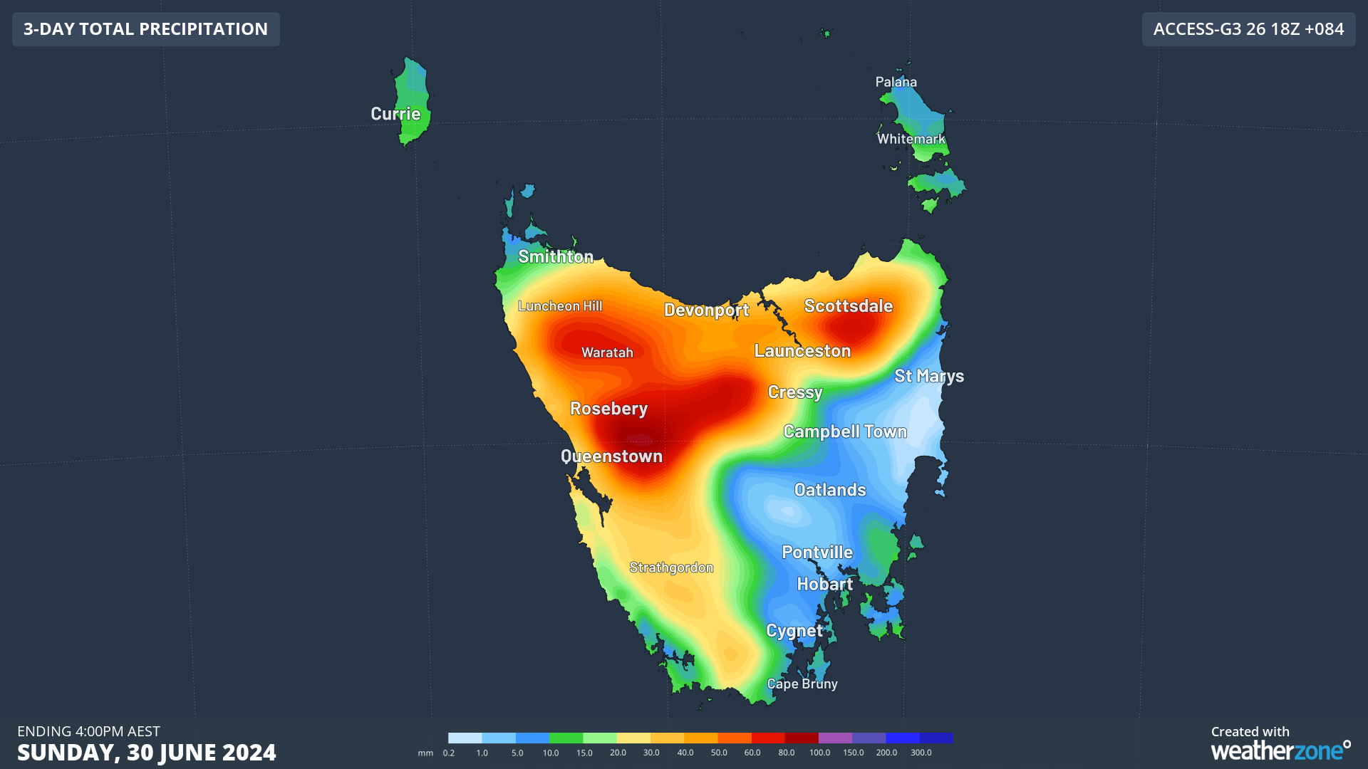
The chart below shows the expected precipitation totals up until 4 pm Sunday, according to the BoM's ACCESS-G model.

Like the rain that has already fallen this week, the model predicts that the heaviest falls will be in the west and northwest of the state as well as in the Central Highlands.
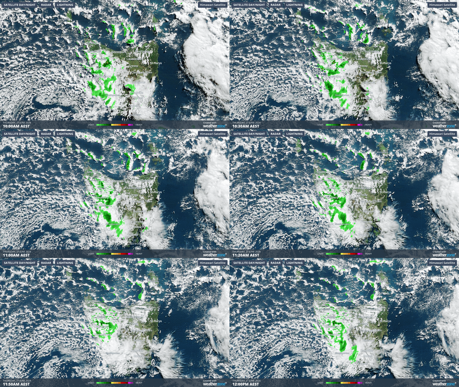
This is due to a continuation of weather coming out of the west northwest, as you can clearly see on the two-hour loop below to midday Thursday.
That loop also clearly illustrates the way that the Central Highlands act as a rain shadow, shielding Hobart from most of the rain that comes out of the west.

See how the green blobs of rain on the radar seem to evaporate before reaching the east coast of the Apple Isle? If you've ever wondered why Hobart is Australia’s second-driest capital (behind Adelaide), there's your answer.
Meanwhile the rain in western and elevated parts of Tasmania should become quite heavy at times in the next 48 hours, as northwesterly winds persist. Northwesterlies tend to bring more moisture to Tasmania than cooler southwesterlies.
As southwesterly winds start to spread across the state later on Saturday in the wake of a cold front, temperatures will drop and the snow line will lower, but showers won’t be quite as heavy or persistent.
In the big picture, this is all good news for Tasmania, even if Hobart and parts of eastern Tassie could use a little more rain.

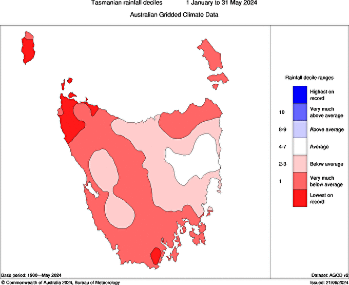
Image: Rainfall deciles for Tasmania (from Jan 1 to end of May, 2024) Source: BoM.
Tasmania has been drier than usual so far this year across almost the whole state, with very much below average rainfall in about half the state, and record low rainfall totals in some spots.