Tasmania under Flood Watch as wind and rain intensify
Just another glorious day in Tassie...
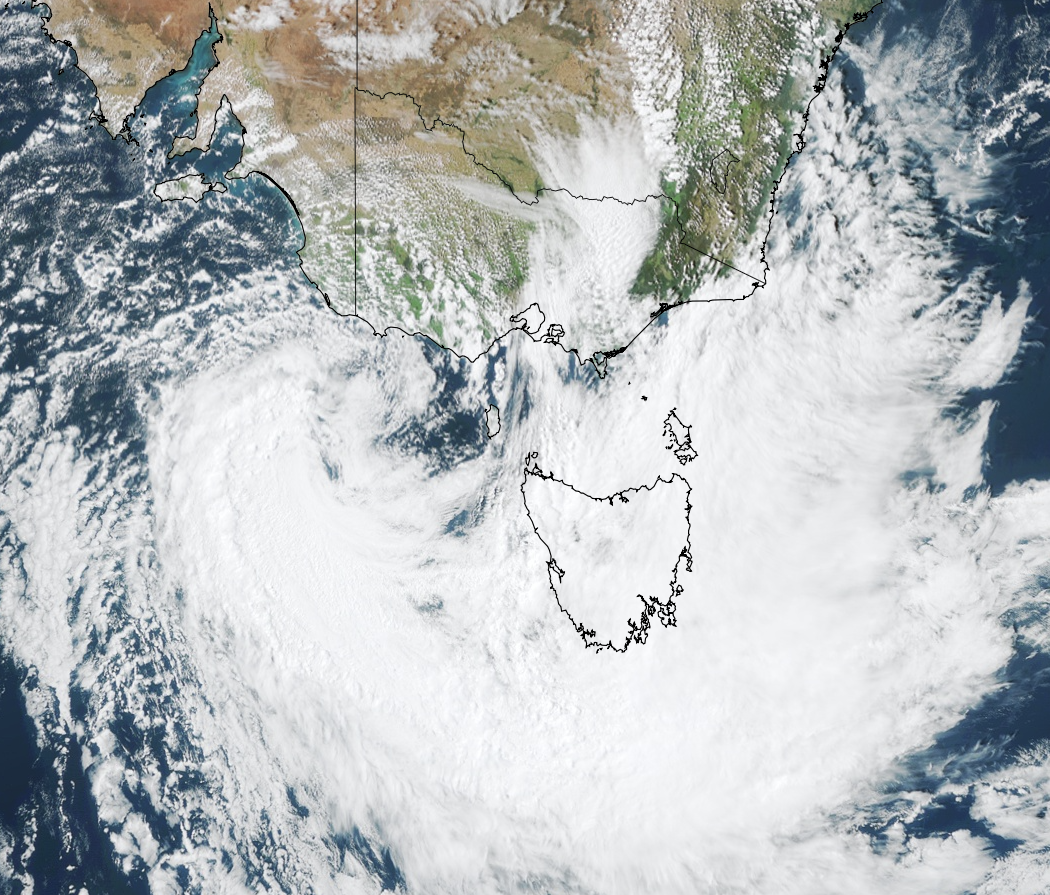
A deepening low-pressure system just off the coast of Victoria is beginning to make its presence felt in the nation’s southeast. This morning, Mount Read in Tasmania recorded a 104km/h wind gust, with sustained wind speeds of 91km/h, exceeding the Bureau of Meteorology’s Severe Weather Warning forecast estimates of 50-60km/h sustained winds and 80-90km/h gusts. Cape Grim also gave forecast estimates a run for their money, recording sustained wind speeds of 83km/h and a wind gust of 96km/h this morning.

Image: Visible true colour satellite image from Himawari-8 at 4:30pm AEDT Saturday 21st October
While gusty winds were generally confined to Tassie’s western alps and exposed parts of its northwestern coastline this morning, winds are starting to pick up in the state’s east, with Dunalley recording a wind gust of 80km/h earlier this afternoon.
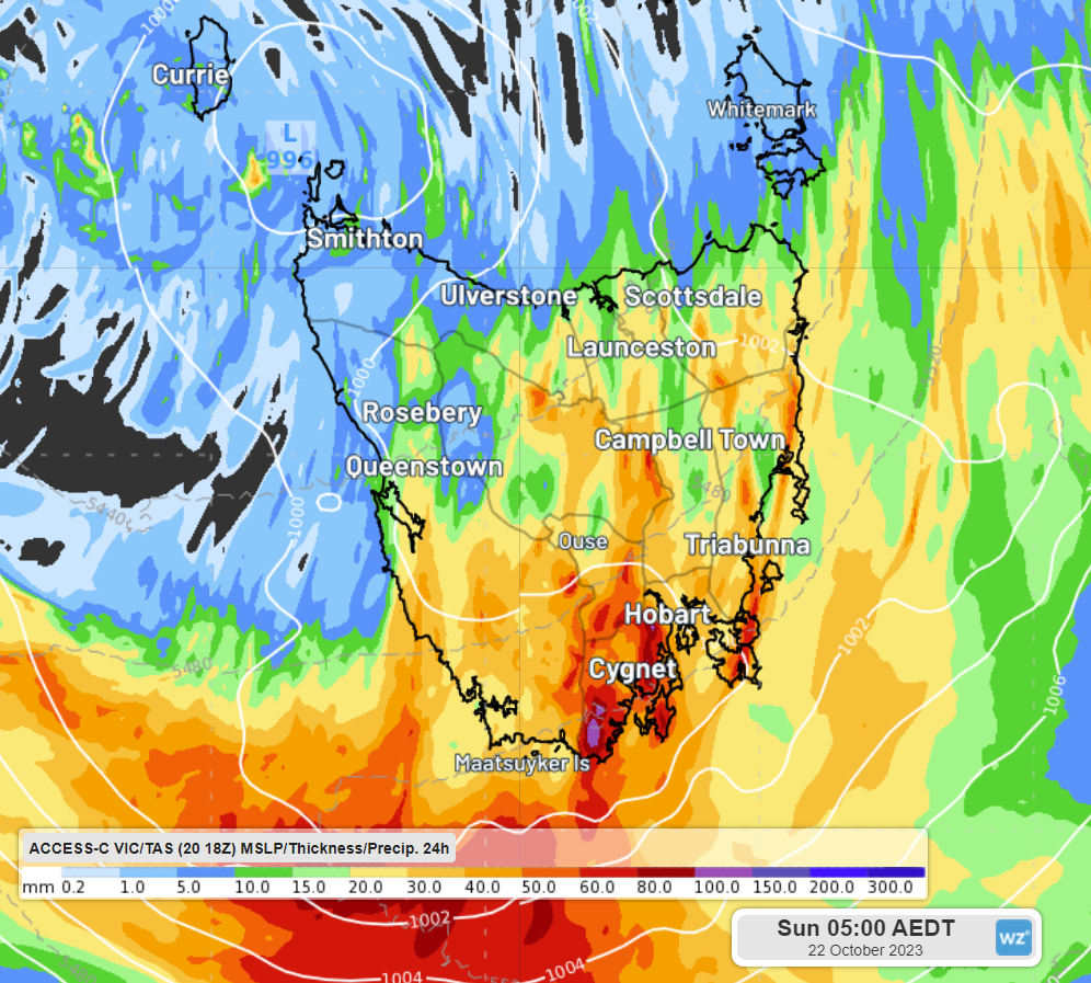
It’s likely to remain pretty gusty until the wee small hours of tomorrow as the low centres itself over the state. As it does so, it’ll also bring some heavy rain to eastern and southern areas, with most models agreeing that 10-30mm of rain could fall in the state’s east in less than 3 hours before dawn tomorrow. 24-hour rainfall totals in the parts of the state’s south are likely to exceed 40mm, possibly even exceeding 80mm in localised areas. Given these forecast estimates, a Flood Watch has been issued for minor flooding in parts of the North, North East, Huon, Derwent and South East catchments for tomorrow morning.

Image: 24-hour precipitation to 5am AEDT Sunday 22nd October, according to Access-C VIC/TAS regional model
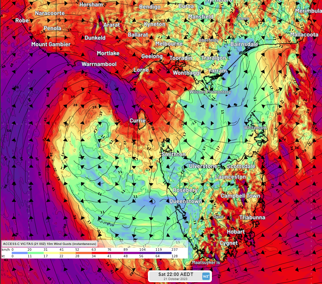
Meanwhile, Victoria and SA should escape the worst of the rain, but gusty winds are expected in those states this evening and early tomorrow morning, particularly in SA’s southeast and Victoria’s southern and alpine areas, as well as the Snowy Mountains of NSW.

Image: 10m wind gusts at 10pm AEDT Saturday 21st October, according to Access-C VIC/TAS regional model
Severe Weather Warnings for damaging winds have been issued by the Bureau of Meteorology for these states, so it’s time to batten down the hatches.