Tasmania on repeat
It’s been another wet and windy 24 hours for Tasmania as yet another front has crossed the state.
Northern and northwestern parts of the state took the brunt of the rainfall, with widespread falls of 25-50mm across the north and falls exceeding 50mm in some locations. Notable figures, for the 24 hours to 9am this morning include: Henty Canal Chainage (65mm), Lake Margaret (64mm), Mount Read and Pine Tree Rivulet (56mm) and Mount Victoria (53mm). Whilst the north did see the most rainfall, there were decent falls of up to 25mm across the south, with the east coast rounding out with largely below 10mm.
Tasmanian's have had their fair share of wind over the last couple of weeks, with Maatsuyker Island equalling its strongest-ever wind gust of 200km/h at the end of July, as written here: https://www.weatherzone.com.au/news/tasmania-equals-wild-wind-record-with-200-kmh-gust/1419116.
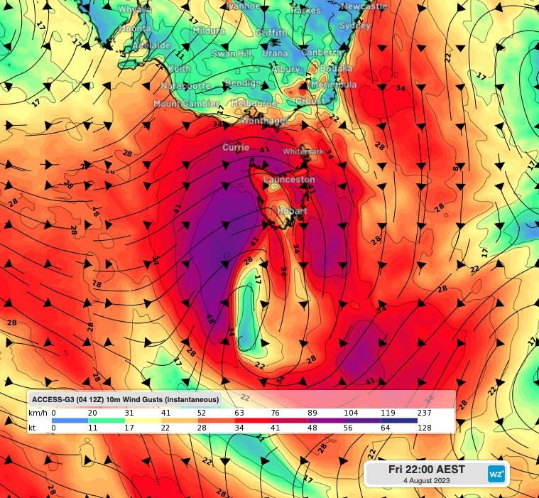
 Access-G 10m wind gusts over Tasmania leading into the early hours of the morning on Saturday 5th
Whilst winds didn't peak close to this overnight, there were still some fairly blustery conditions around. Maatsuyker Island took out the top spot again with a gust of 122km/h around 1.45am this morning, with Mount Wellington not too far behind at 107km/h. Other notable wind gusts include Hogan Island and the Hartz Mountains at 98km/h, Cape Grim with 87km/h and Cape Bruny at 82km/h.
High pressure will continue to build today as this current frontal system continues to the east, with the high drifting over the region until at least Tuesday, bringing much more settled conditions than of late.