Sydney’s six day dry spell broken to start the weekend
Sydneysiders had been enjoying a seemingly rare and very welcome dry spell dating back to last weekend, however on Friday afternoon the skies darkened once again and the rain began to fall across the city.
The rain was caused largely by the remnants of the northwest cloudband that stretched across the country this week. Another factor that contributed to Sydney receiving rainfall, was the passage of a trough making its way up the east coast. This trough helped to drive southerly winds across the city, not only bringing in plenty of rain but also keeping the temperatures below 14 degrees for the entire afternoon (yesterday’s maximum temperature of 14.4 degrees was achieved just before midday).
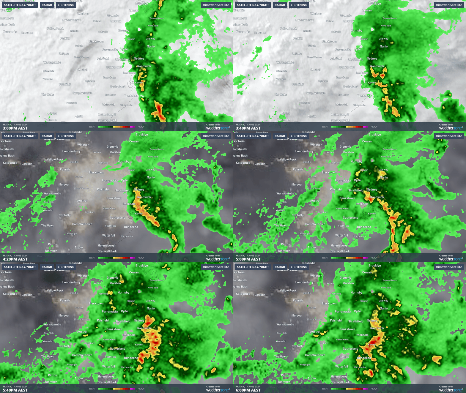
Rain persisted across the city through much of the afternoon, spreading to the western suburbs by the evening with virtually every rain gauge across the Sydney basin registering some rain by the end of the night.

GIF: Rainfall spreading across Sydney during Friday afternoon
By 9am this morning, Observatory Hill, Sydney’s main weather station, had picked up 70.2mm, marking the third day of more than 50mm of rain since the start of June. This takes the recorded total so far, only halfway through the month, to 282.2mm the wettest month since October 2022.
Significant totals were recorded elsewhere around eastern Sydney & the Central Coast including:
- Little Bay – 100.0mm
- Sans Souci – 75.0mm
- Sydney Ap – 67.4mm
- Kincumber – 51.5mm
- Manly – 42.0mm
- Gosford – 37.0mm
Across regional NSW, some decent rainfall totals were also recorded at:
- Ulladulla – 59.2mm
- Williamtown – 49.4mm
- Nobby’s Head – 48.2mm
- Orange Ap -14.6mm
- Murrurundi Gap – 14.6mm
Thankfully, rainfall is clearing for Sydney’s western suburbs this afternoon and should clear from the east this evening, and the sun looks set to come out on Sunday.