Sydney's floodwaters visible from the edge of space
It's always heartbreaking to see floodwaters from up close, and our thoughts remain with the many people who will be mopping up in NSW and Queensland for weeks and months to come.
It's also dramatic to take a step back – or in this case 786 km upwards to the very limit of the thermosphere – and view the floodwaters from a satellite's perspective.
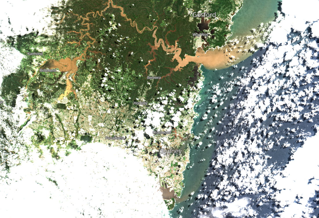
These remarkable images of the Sydney region were captured by the Sentinel Hub satellites. In the first image below, you can see the muddy Hawkesbury River emptying out into the Tasman Sea, all the way south to Botany Bea, where if you look closely you'll notice Sydney Airport's dual north/south runways.

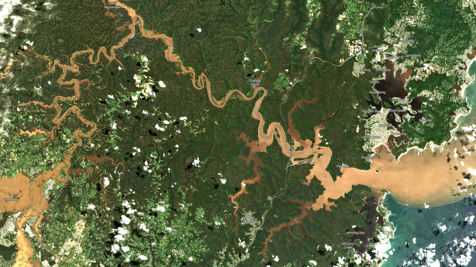
Below is a closer view of the Hawkesbury River, as it flows from south to north along Sydney's western flank. The large brown area in the bottom left of the image is the inundated Richmond/Windsor floodplain.

The river then turns northeast, then southeast, before emptying out into the sea at Broken Bay, with Gosford and the Central Coast located north of the brown outflow.
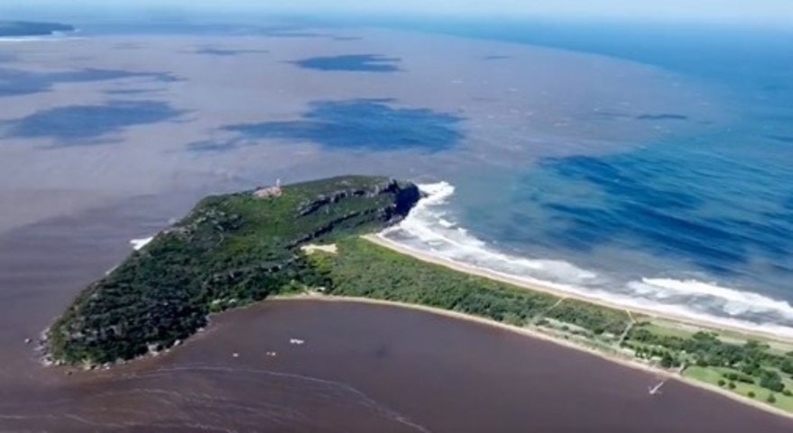
The contrast between the blue and brown areas where the Hawkesbury meets the sea can be seen in much greater detail here in this still image of drone footage, which was captured in this story which we published on Thursday.

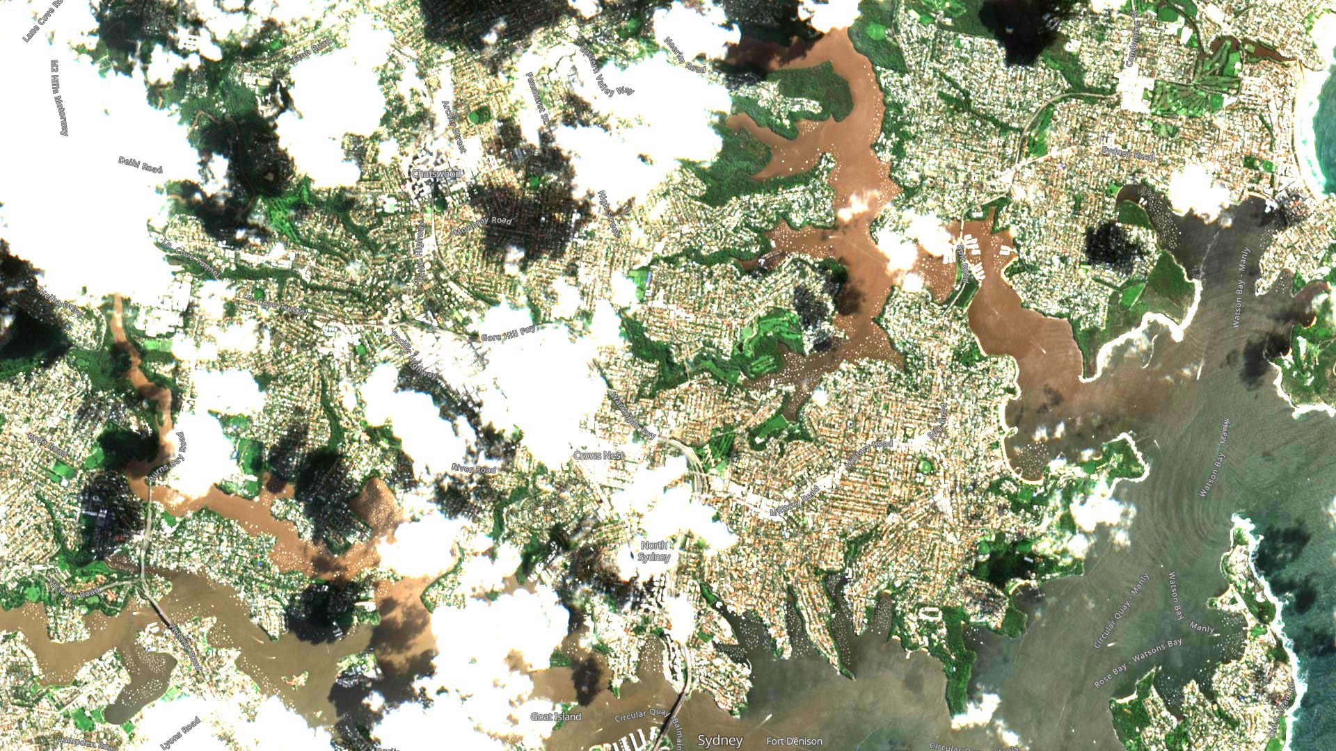
Now here's a closer view of Sydney Harbour. The Sydney Harbour Bridge is at the centre bottom of the image (with wharves to its left). Middle Harbour is the muddy arm towards the top of the picture. Closer to the heads at the far right of the image, the influence of the ocean can be clearly seen diluting the floodwaters.

The good news is that little or no rain has been recorded across the Sydney basin and surrounds for at least two days now, and a mostly fine Saturday is ahead, with the chance of showers on Sunday.
Showers will also be around in the new week, but they should be light compared to what Sydney experienced during its 16-day, 617.4 mm deluge, with nothing more than a few millimetres in the forecast at this stage.
READ MORE: SATELLITES CAPTURE HISTORIC WEATHER EVENT OVER EASTERN AUSTRALIA