
Sydney storms mark the end of the week
Sydney’s working week ended with a bang last night, as a trough pushing through the southeast drove thunderstorms across the Sydney basin as night fell on Friday.
The first lightning strikes were detected about 30km west/northwest of Picton just after 3pm, with a small cell that developed to the southwest of Sydney. This storm tracked harmlessly towards the southern highlands through the afternoon, reaching Picton by around 4:30pm.
GIF: Evolution of thunderstorm activity across Sydney yesterday afternoon and evening. The bright pink to white blobs represent lightning density
As the sun set, more thunderstorms began to fire up to the north of the initial cell, extending through the southwestern suburbs of Sydney. They then tracked northeast, soaking southern and eastern suburbs, including the Sydney CBD during the evening before eventually clearing the coast by around 8pm.
While there were no severe thunderstorm warnings issued by the BoM for these storms last night, they did drop significant rainfall in less than an hour for many suburbs including:
- 22.0mm at Holsworthy Aerodrome, 14.4mm falling in just 10 minutes to 5:50pm
- 17.0mm at Woronora Dam
- 9.5mm at Mosman
- 8.2mm at Observatory Hill, Sydney’s main weather station.
The heavy rain over Sydney caused water to pool in Allianz Stadium prior to last night’s NRL match between the Sydney Roosters and the Parramatta Eels. In addition, there were also reports of small hail in some suburbs, including pea-sized hail at Cammeray.
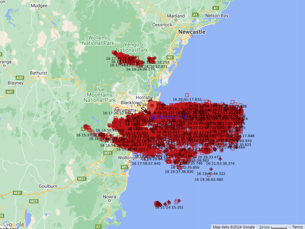
Image: location of lightning strikes within 120km of Sydney during yesterday afternoon and evening
In total, 19901 lightning strikes were detected within 120km of Sydney yesterday evening, including within some smaller storms inland from the Central Coast, and offshore from Nowra. Of these lightning strikes, 3807 ended up striking the ground.
This storm was along the leading edge of a trough extending up the state and low that was situated over the Bass Strait. This system caused scattered thunderstorms to fire up on the other side of the ranges through western and southern NSW, and even parts of Vic and SA yesterday afternoon. While showers and the odd thunderstorm is possible once again for southern and central NSW this afternoon, Sydney itself looks to be drying out for a pleasant, but windy afternoon.