Sunrise storms portend another dangerous day in eastern Australia
As the sun rose above eastern Australia on Friday morning, thunderstorms were bubbling away above Queensland and NSW.
The early-morning storms made for some mesmerising satellite images when viewed from space. However, the picturesque dawn storms are also a sign that more dangerous weather is on the way for eastern Australia today.
Thunderstorms most commonly develop between the late morning and early evening, after the ground has had a chance to warm up from the hours of sunshine. This warmth helps air rise from the surface, which is one of the key ingredients for thunderstorm development.
So for thunderstorms to develop at night or around sunrise, when the ground has cooled down, the atmosphere has to be sufficiently unstable.
When storms happen early in the morning, the atmosphere is usually primed for a big day of intense thunderstorm activity once more warmth is added to the ground.
Unsurprisingly, thunderstorms are expected to develop over a large area of eastern Australia on Friday. You can find more details about where storms are expected to occur on Friday in this article.
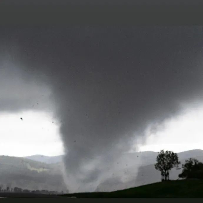
Today's thunderstorms follow an outbreak of severe storms that produced at least two tornadoes and large hail in parts of central and northern NSW on Thursday.


Images: Thursday's severe thunderstorms produced large hail in Sydney's Baulkhan Hills and a tornado near Bathurst. Source: @lushweatherpics / Twitter (top and middle images) and @dean_o_photography / Instagram (bottom image).
It's likely that we will see more damaging winds, heavy rain and hail on some areas of northeast NSW and southeast Queensland today. Supercell thunderstorms are also a risk, which are the type of storms that can produce tornadoes.
Keep a close eye on the latest severe thunderstorm warnings today if you live in Queensland, NSW, the ACT or Victoria, particularly from late morning onwards.