
Sunday Gusty Sunday - weather extremes ahead for southeast Australia
A vigorous cold front crossing the nation's southeast is set to deliver a day of extremes on Sunday as gusty winds drive heavy rain over Tasmania while upping fire danger to extreme in NSW.
As you can see in the images below, the front will first cross Tasmania on Sunday morning, bringing heavy rainfall to the state's west while driving damaging northerly winds over the state's east. Widespread 24-hour rainfall of 50-70mm is likely in the west, most of which could fall within a six-hour period early on Sunday morning, potentially leading to flash flooding in some areas. Meanwhile damaging wind gusts of 100km/h are possible over the state’s east, particularly over elevated terrain, with sustained winds expected to exceed 60km/h.
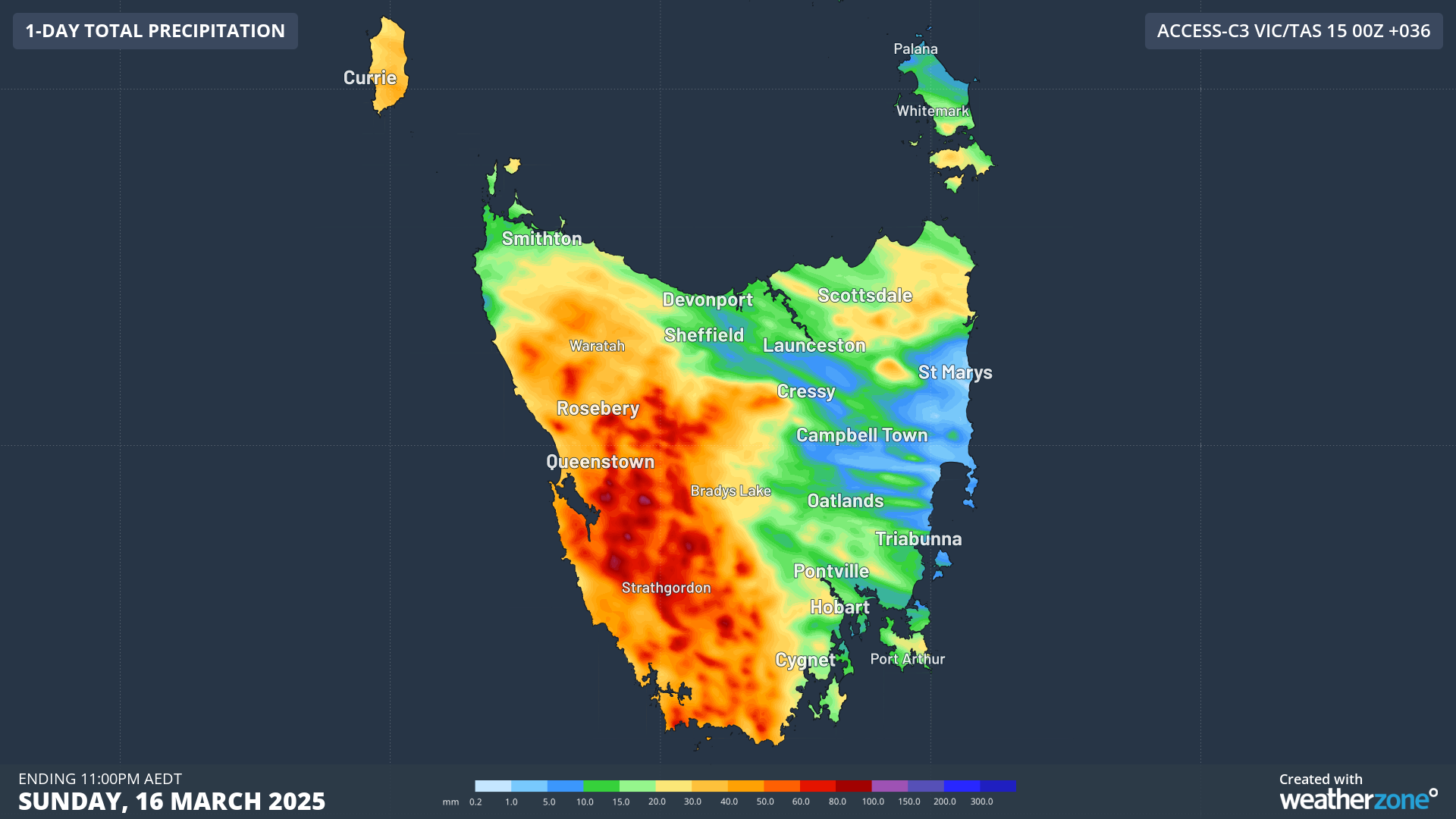 Image: Accumulated rainfall over Tas in the 36 hours to 11pm on Sunday, March 16, according to the high resolution Access-C model
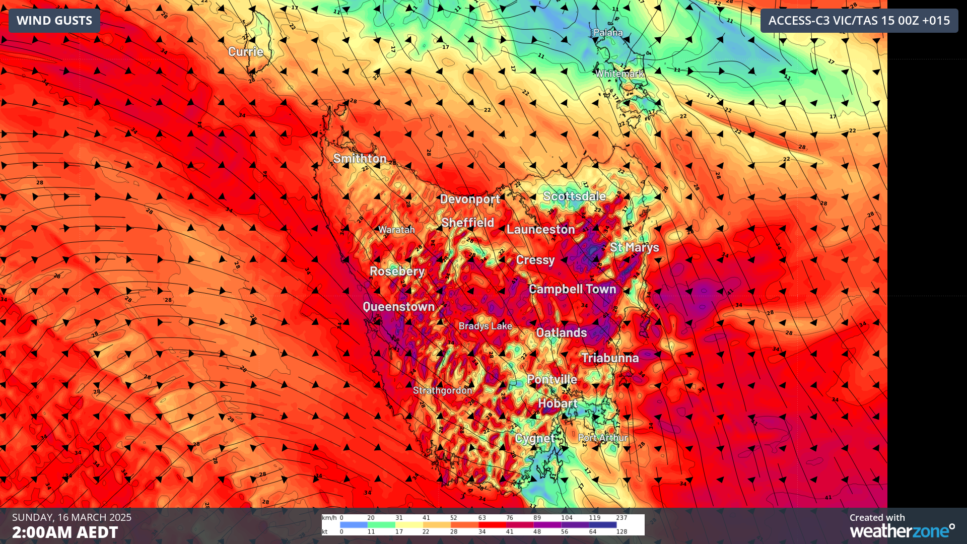 Image: Forecast wind gusts over Tasmania at 2am AEDT on Sunday, March 16, using the high resolution Access-C model.
Although conditions should begin to ease in Tasmania after sunrise, those gusty northwesterly winds will begin to affect eastern Vic and southeast NSW from Sunday morning. Damaging winds are expected, averaging 55-65km/h with gusts of 100km/h affecting these areas, gusting up to 110km/h for elevations above 1200m and up to 130km/h for alpine regions above 1900m.
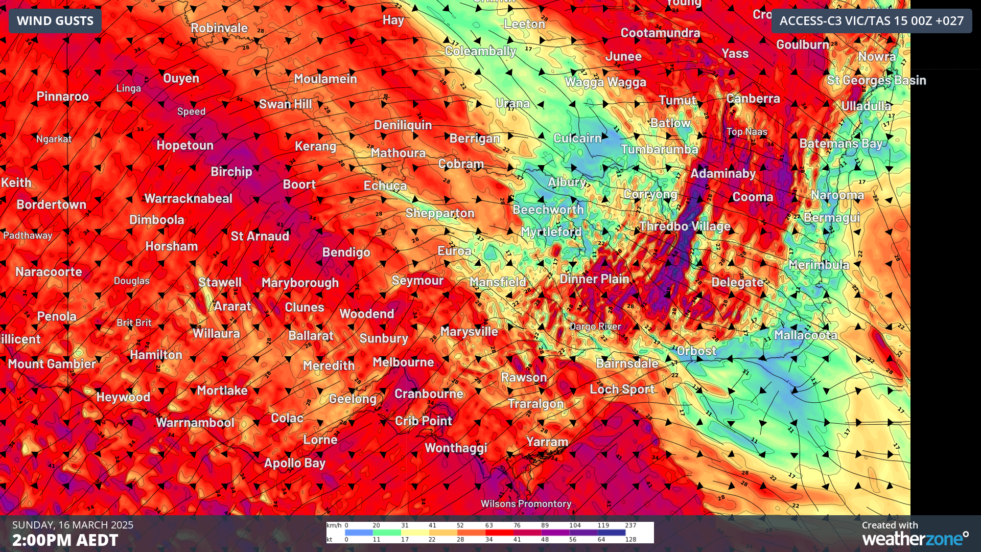 Image: Forecast wind gusts over Victoria and southern NSW at 2pm AEDT on Sunday, March 16, using the high resolution Access-C model.
While winds are expected to peak in these areas in the early afternoon (as seen in the image above) and ease by late Sunday afternoon, those gusty northwesterlies are expected to impact parts of the Greater Sydney region, too, although not as strongly. However, as Weatherzone meteorologist Felix Levesque pointed out yesterday, intense heat is expected across southeast NSW, including Sydney, on Sunday. So while those winds might not be quite as gusty as they will be further south, the combination of heat and gusty winds will lead to extreme fire danger across the region. As such, Total Fire Bans have been declared for the Greater Sydney region as well as for the central and southern ranges and the southern slopes, as you can see below:
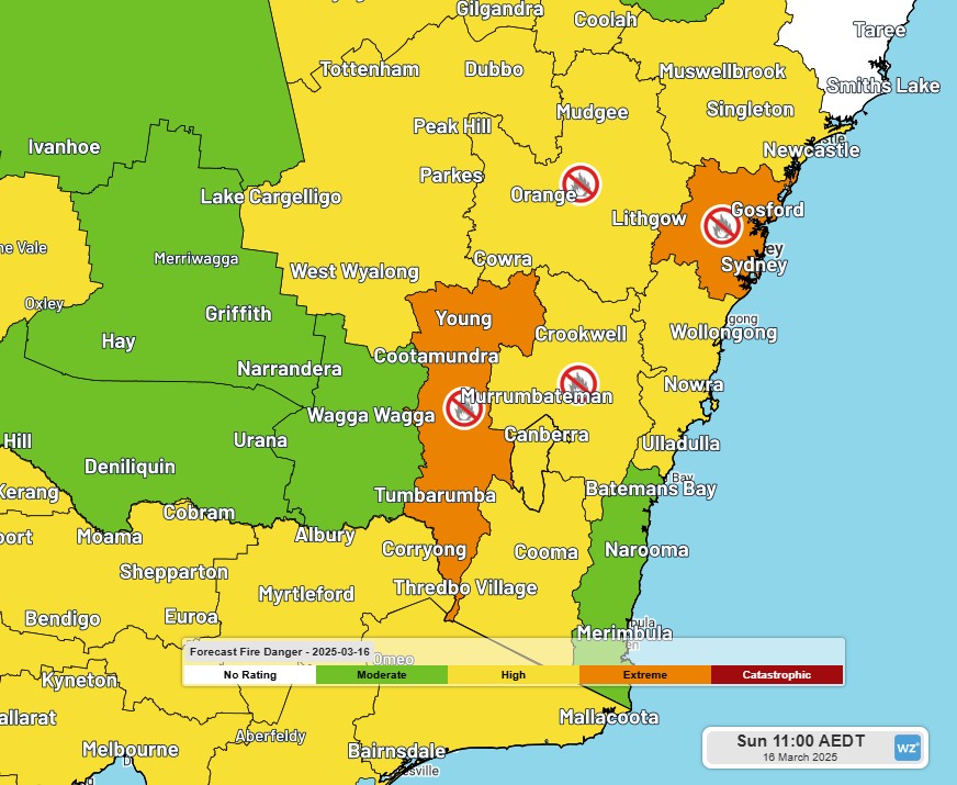 Image: Forecast Fire Danger and Total Fire Bans for southeast NSW on Sunday, March 16.
But that isn't the end of the story for Sydney and the south coast. As we mentioned in our story yesterday, a cool southerly change is expected in southern NSW as the cold front finally crosses the southeast. This change will drive very gusty and potentially damaging southerly winds over coastal areas of NSW on Sunday night (see image below) and into the early hours of Monday morning, potentially exacerbating fire weather conditions in the Sydney area overnight.
 Image: Forecast wind gusts over southeast NSW at 11pm AEDT on Sunday, March 16, using the high resolution Access-C model.
As this weather system does have a number of severe weather warnings already issued for Tas, Vic and NSW, please stay safe and make sure you stay up to date with any forecast warning changes here.