
Sun obscured across entire mainland South Australia
Yes, you read that right. The entirety of mainland South Australia, for several minutes, had the sun partially or fully blocked by some form of cloud on Sunday morning.
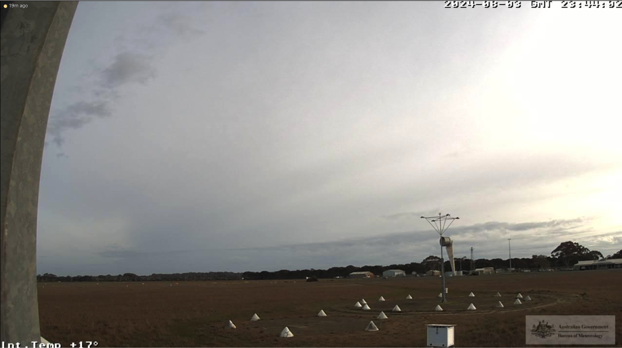
Image: Kingscote Airport on Kangaroo Island facing northwest at 9:14am local time (Bureau of Meteorology).
The image above was taken at Kangaroo Island. Take a look at the overhead cloud obscuring the sunshine. This is a representation of what much of the southeast looked like during Sunday morning.
The majority of the state's interior and west is sitting under a band of mid-to-high level cloud and an upper-level trough with origins in the Indian Ocean. This is the cloud that's responsible for the rainfall we've seen, including across Western Australia's Pilbara and east and the Northern Territory's south. The southeast is under a wispier high-level cloud, with more temperate origins from the Bight, and is not bearing rain.
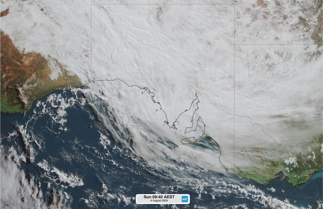
Image: Himawari satellite snapshot of South Australia at 9:10am local time, showing a broad blanket of cloud across the entire state.
This cloudband with the upper-level trough brought high 24-hour rainfall totals (to 9am Sunday) compared to the August average across the state.
- Pukatja Ernabella (18.4mm, August average 6.4mm), highest for August since 2016 and for any month since June 2023.
- Coober Pedy (3.0mm, August average 6.6mm), highest for August since 2020.
- Oodnadatta (0.4mm, August average 7.8mm), highest for August since 2022.
- Ceduna (4.6mm, August average 20.3mm), highest for August since 2022.
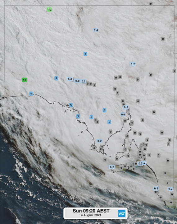
Image: 24-hour rainfall to Sunday 8:50am local time across South Australia overlaid on Himawari satellite imagery.
Showers are set to continue throughout the day and into tomorrow morning across the state. However, cloud should clear across the state by tomorrow afternoon as high pressure moves in, though the airmass will remain cool. On Monday in the southeast, temperatures are expected to reach 16ºC in Mount Gambier, Coonawarra and Naracoorte, about 1ºC above the August average.
For detailed timings on cloud cover and forecast rainfall across the country, be sure to check out our website.