
Summer storms and heavy rain to hit VIC, NSW, ACT and TAS
A burst of wet and stormy weather will sweep across southeastern Australia during the next 3 to 4 days, bringing a mix of severe storms and heavy rain in several states.
Ex-Tropical Cyclone Seth and a high pressure ridge to its south are combining to drive a mass of moisture-laden air across eastern and southeastern Australia.
This moisture will interact with a passing low pressure trough in the coming days, resulting in a spell of unsettled and likely severe weather between now and Saturday.
On Wednesday morning, showers were affecting parts of eastern NSW and a few thunderstorms were bubbling up in southern NSW and eastern VIC.
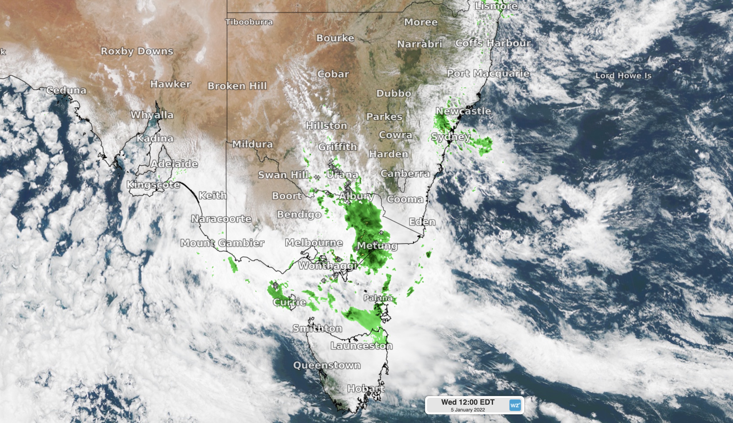
Image: Composite satellite, radar and lightning data showing rain and storms developing over southeastern Australia at midday AEDT on Wednesday.
This pattern will persist into Wednesday afternoon and evening, with storms likely to become more intense and widespread over southern inland NSW and central and northern VIC. Some of these storms could become severe, with heavy rain the most likely feature.
In addition to these dangerous thunderstorms, a strengthening winds through Bass Strait could cause damaging gusts in far southern VIC on Wednesday night, and in northwest TAS, including King Island, on Thursday.
Because these winds will be coming from the east northeast, which is an unusual direction for the region, places that are typically protected from the wind could see damaging gusts.
On Thursday, rain and storms will continue in VIC and NSW throughout the day and also spread across TAS and possibly the ACT. Meanwhile, more showers will dampen eastern NSW, including Sydney on day two of the fourth Ashes Test.
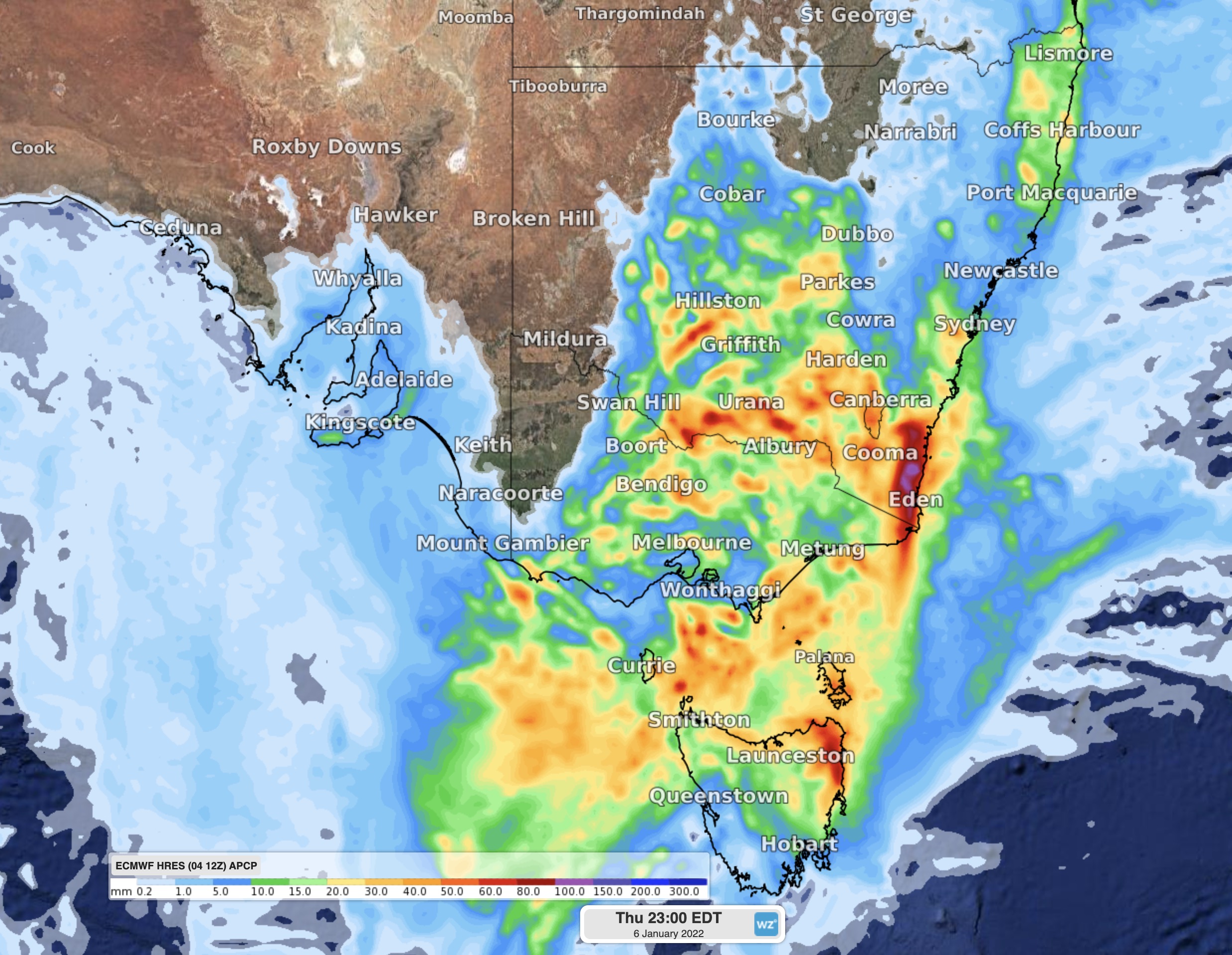
Image: Forecast accumulated rain on Thursday, January 6, according to the ECMWF model.
Severe storms are a risk over most of VIC and a broad area of southern and western NSW and the ACT on Thursday. Once again, heavy rain will be the main threat, although damaging winds and large hail are possible as well. There is also a chance of supercells in parts of VIC and southern NSW on Thursday, most likely from the afternoon.
On Friday, showers and thunderstorms will continue to develop between Tasmania and western NSW, including central and eastern VIC and the ACT. Severe storms are again a risk in VIC, NSW and the ACT on Friday, with supercells possible in each state and territory.
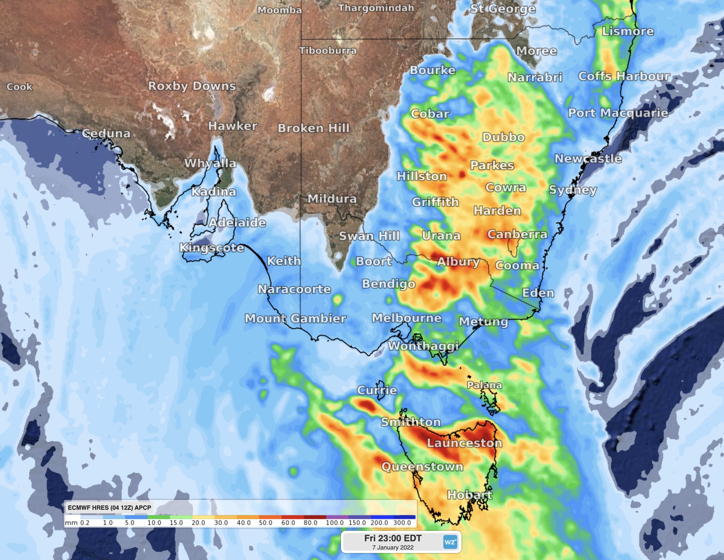
Image: Forecast accumulated rain on Friday, January 7, according to the ECMWF model.
On Saturday, calmer weather will return to most of TAS and VIC, while showers and storms develop over eastern and central districts of NSW. Some of Saturday’s wet weather should affect Sydney, with storms also a chance across the Sydney Basin.
This week’s rain may cause both flash and riverine flooding. A flood watch has been issued for minor to moderate flooding in northern TAS, where accumulated totals of 50 to 150mm are possible by Friday night. Severe thunderstorm and severe weather warnings are likely to be issued and updated over the next few days, so be sure to check the latest warnings in your area.