
Strongest winds in 1 to 3 years impacting parts of southeastern Australia
As we've been announcing for the past two days, fierce winds are battering the southeast of the country, with some locations registering their highest wind gusts in one to three years. The culprit, a strong low-pressure system now moving east across the Tasman Sea. This system caused significant and widespread damaging winds across parts of southern SA yesterday and it will continue to bring wild winds to parts of VIC and eastern NSW until early Sunday morning, including populated areas of NSW and the ACT. The system has also delivered welcome snowfalls to alpine regions, with at least 30 cm of snow accumulating overnight at the NSW and VIC resorts.
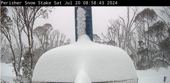
Image. The Perisher snow stake around 9 am this morning shows the welcome snowfalls.
Significant winds recorded from yesterday through to 3:00 pm AEST today include the following:
NSW (during the morning and afternoon)
- A stunning 108 km/h wind gust at Port Kembla at about 3:00 pm this afternoon.
- 126 km/h wind gust recorded at Thredbo Top Station yesterday afternoon.
- 85 km/h wind gust recorded at Mount Boyce.
- 100 km/h gust recorded at Nowra (highest in a year).
- 98 km/h at Moss Vale (highest in over a year).
- 96 km/h at Shellharbour Airport.
- 96 km/h at Albion Park (highest in a year).
- 91km/h at Throsby Point (highest in almost 3 years).
- 89 km/h at Newcastle.
- 82 km/h at Sydney Harbour.
- 82km/h at Williamtown (highest since last year).
VIC (during yesterday evening and throughout today)
- 120 km/h at Hogan Island.
- 119 km/h wind gust recorded at Mount William.
- 98 km/h wind gust recorded at Falls Creek.
- 94 km/h wind gust recorded at Kilmore Gap.
- 102 km/h wind gust recorded at Mount Buller.
- 91 km/h wind gust recorded at Cape Nelson.
SA (during yesterday evening and this morning):
- 128 km/h at Neptune Island.
- 106 km/h wind gust recorded at Cummins.
- 106 km/h wind gust recorded at Mount Crawford.
- 104 km/h at Cape Jaffa.
- 93 km/h wind gust recorded at Port Lincoln.
- 93 km/h wind gust recorded at Cultana (Defence).
- 93 km/h wind gust recorded at Edithburgh (highest in almost 2 years).
- 87 km/h wind gust recorded at Murray Bridge Airport.
- 85km/h at Naracoorte (highest in almost 3 years).
- 83km/h at Nuriootpa (highest in almost 3 years).
- 83 km/h wind gust recorded at Kingscote Airport.
- 82 km/h wind gust recorded at Adelaide Airport.
Blizzard conditions are occurring above 1200 meters in alpine regions, with conditions expected to ease early Sunday morning. Meanwhile, the peak winds in eastern NSW will occur this evening and early Sunday, with elevated areas in the Blue Mountains, Illawarra escarpment, coastal and nearby inland regions, and the Central Tablelands potentially experiencing gusts exceeding 100 km/h (image). Winds will gradually ease to fresh (strong at times) after dawn on Sunday as the low moves further east and a high pressure system takes over.
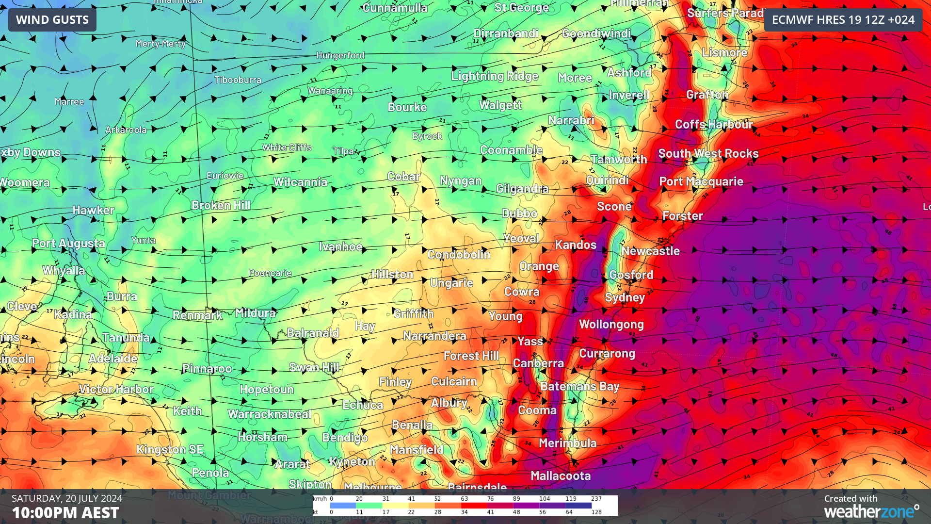
Image: 10m wind gusts at 10pm AEST according to the ECMWF model.