
Strong positive SAM influencing Australia's weather – here's what to expect
This week’s weather patterns across Australia will be influenced by a strong positive Southern Annular Mode (SAM), increasing the likelihood of rain in some parts of the country and bringing a week of dry weather to others.
What is the SAM?
The Southern Annular Mode (SAM) is an index used to monitor the position of a belt of westerly winds that flow from west to east around the Southern Hemisphere, passing between Australia and Antarctica. When the SAM is in a negative phase, these westerly winds – and the cold fronts and low pressure systems they carry – are located further north than usual for that time of year. When the SAM is positive, the westerly winds, cold fronts and low pressure systems are located further south than usual.
Negative phases of the SAM often cause an increase in frontal activity and associated wind and rainfall across southern Australia, particularly in winter, while also promoting drier weather in the east of the country. By contrast, a positive SAM is usually associated with weaker fronts and lows over southern Australia, causing reduced wind and rain, while rainfall over parts of eastern Australia is enhanced.
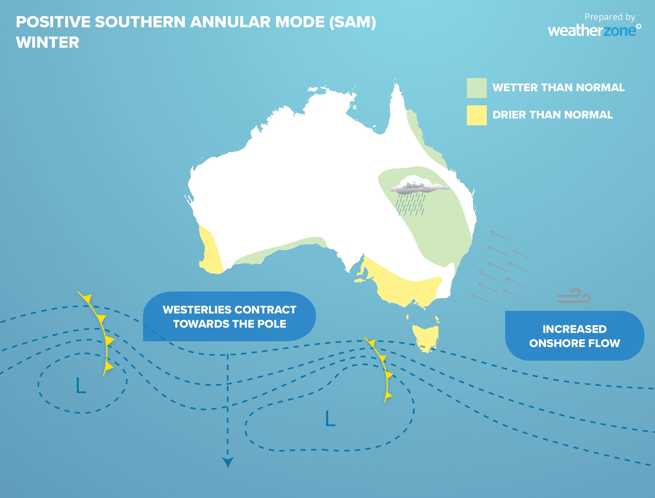
Image: Typical impacts of a positive SAM during winter.
Strong positive SAM underway
The SAM entered a positive phase in the opening days of April and has since gained strength, with the SAM index reaching +2.55 on April 5. Sustained values above +1 indicate a positive SAM event and this is now the second strongest positive SAM we have seen in almost five months.
At this time of year, a positive SAM increases the likelihood of rain over eastern Australia and reduces the chance of rain, snow and strong winds in southern Australia.
The map below shows the forecast accumulated rain this week, with areas of heavy rain predicted in Australia's east and large areas of little or no rain in the country’s south.

Image: Forecast accumulated rain this week.
The image above also shows that areas northern Australia are expected to see a lot of rain this week. This is due to the influence of a tropical wave passing to the north of Australia, called an equatorial Rossby wave, which will also increase the risk of tropical cyclone activity near northern Australia towards the end of the week.