
Strange scenes in the sky above Canberra
An oubtreak of "virga" struck the national capital on the weekend, and if you don't know what virga is, you’re not alone.
Most people have never heard of this reasonably common meteorological phenomenon, which occurs when rain evaporates before it reaches the ground.
Weatherzone wrote about virga two years ago and it happens, that was also a Canberra story. It's quite common in the ACT when storms sweep over the mountains west of the city, but the rain evaporates in the hot dry summer air over the suburbs and nearby grasslands.
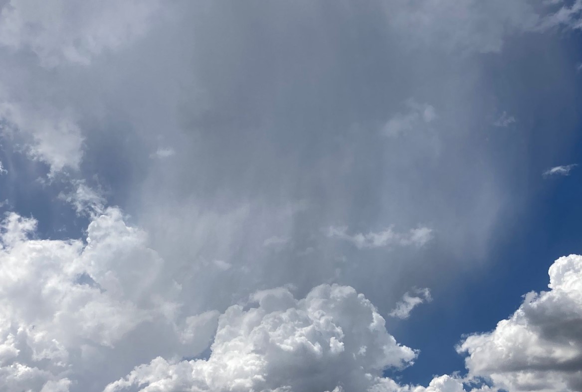
Image: And that's about as far as it fell. Source: Ant Sharwood.
The result is a sheet of rain which looks like it will leave dusty wet splotches on your car windscreen, except it never gets that far.
Even the weather radar seems to be playing tricks when virga is about. This was what the radar looked like in Canberra on the Weatherzone app on Saturday afternoon, as big storms rumbled to the north of the city, reaching all the way to Sydney.
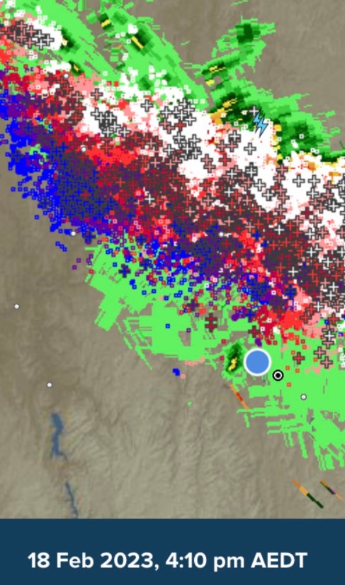
The blue dot appeared to be under an area of light green, which generally means light rain. But the radar was picking up droplets in the atmosphere far above the ground, and not a drop reached most Canberra suburbs.
Indeed no rain was recorded at the city's official weather station at the airport, which is where the black-and-white circle is located on the image above, just to the right of the blue dot.
Virga can be extremely frustrating in times of drought, but otherwise, it tends to be a pretty benign form of weather. But that's not always the case.
As Weatherzone meteorologist Joel Pippard points out, the evaporation of falling rain on hot days absorbs a lot of energy from the air around it. This cools the air down and allows it to accelerate faster towards the ground.
Once this rushing air hits the ground, it fans out quickly in all directions. This is called a gust front. The gust front can allow thunderstorms to build into squall lines, which is exactly what happened on Saturday.
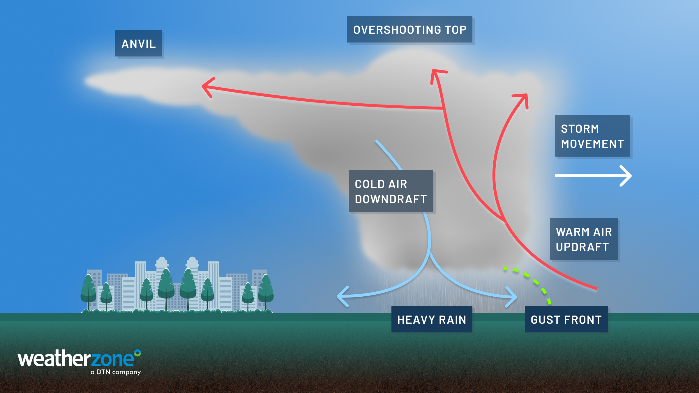
So virga is an interesting spectacle in its own right, but it can also be part of a much bigger weather dynamic, helping fuel damaging squall lines that usually move on to strike elsewhere. As mentioned, that was the story on Saturday.
Canberra is in for a mostly fine week, with the chance of showers that could actually reach the ground on Tuesday, before a brief midweek cool spell with tops as low as 21°C on Wednesday.
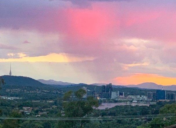
Image: Virga above Canberra back in January 2021. Source: Tim the Yowie Man.