Stormy weather setting in for eastern, northern Australia
Wet and stormy weather will linger over eastern and northern Australia for at least the next week, impacting six of Australia’s state capital cities.
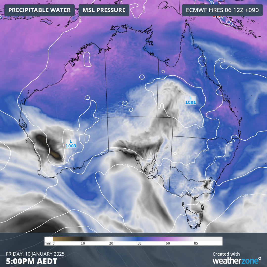
A series of low pressure troughs being fed by moisture flowing off warmer than average oceans near Australia will fuel the prolonged period of rain and thunderstorms.

Image: Modelled precipitable water and mean sea level pressure over Australia on Friday afternoon, showing areas of low pressure and abundant atmospheric moisture across the country’s north and east.
While this type of weather pattern is not uncommon in summer, the influence of abnormally warm ocean temperatures near Australia will add extra fuel to the atmosphere, increasing the likelihood of heavy rain.
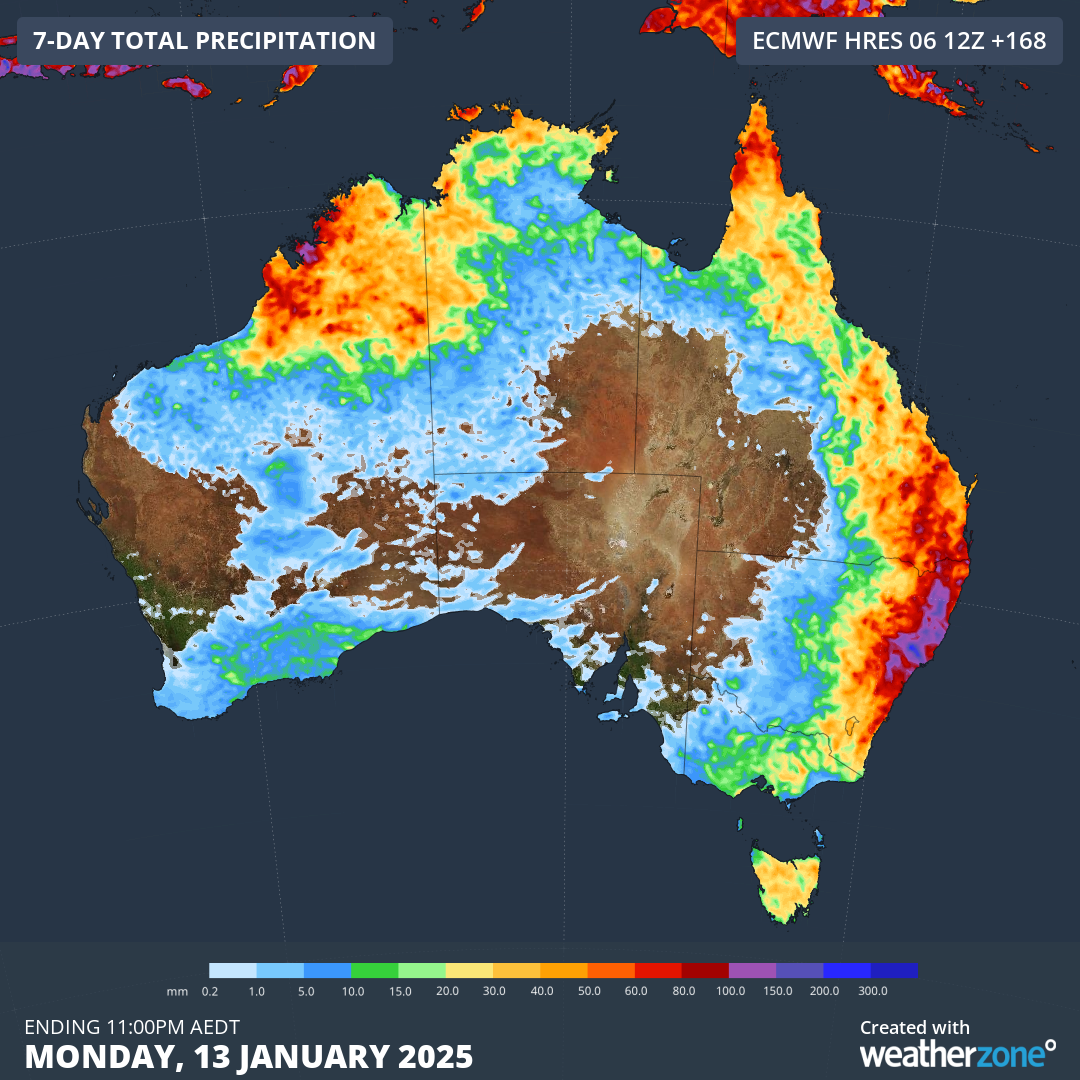
The map below shows how much rain one forecast model is predicting over the next seven days. Eastern NSW, southeast Qld and WA’s Kimberley region stand out as areas that should be the focus of the heaviest rain in the coming week.

Image: Forecast accumulated rain during the 7 days ending on Monday, January 13, 2025, according to the ECMWF-HRES model.
Sydney, Melbourne, Brisbane, Canberra, Hobart and Darwin will all see some rain during the next week and thunderstorms are also a risk in each of these cities at some stage.
Forecast rainfall amounts and thunderstorm risks are likely to flip around over the coming week due to the dynamic nature of this weather event. So, be sure to check the latest forecasts and warnings in your area and remember that it’s not safe to drive through floodwater.