Stormy run of days on the way for the outback
While it has been a quiet storm season so far in Queensland, a trough will bring a bring a small flurry of thunderstorms across western QLD and northwest NSW over the coming days.

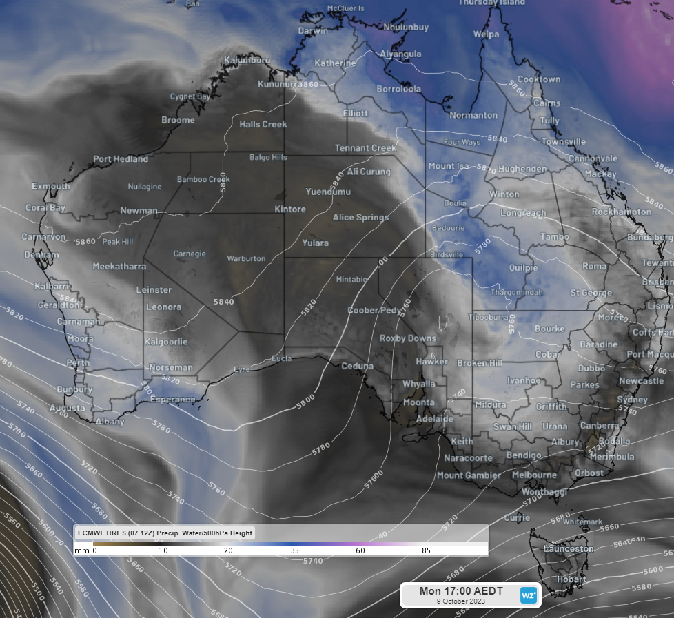
Image: Precipitable water and 500 hPa height at 5pm Mon 9th October, with a clear trough over eastern SA/western NSW
This trough, extending well into the upper troposphere, will draw warm, humid air from the Gulf of Carpentaria, which will interact with cooler air travelling from the Bight meeting right over the dusty plains of outback QLD and NSW. This will create an ideal mix to spark thunderstorms spanning from Burketown in QLD’s northwest, right down to Bourke and Broken Hill in western NSW, with some storms possibly sneaking over the western border into northeast SA.
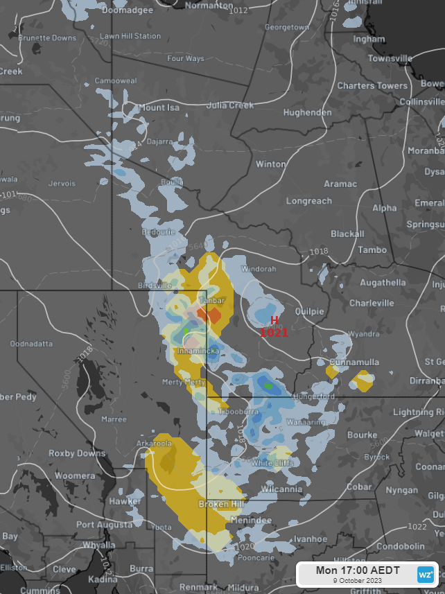
For Sunday, these storms are confined to QLD’s northern and central latitudes, unlikely to reach NSW. It will be Monday afternoon that thunderstorms fire up over western NSW and southwest QLD.

Image: GFS storm risk and 3hr precipitation to 5pm AEDT Mon 9th October
As the trough gets steered towards the east on Tuesday, thunderstorm activity will likely spread towards the NSW slopes, where the influence of easterly winds off the Tasman Sea becomes a contributing factor. Thunderstorms still look to be most likely about southwest QLD and western NSW, but there will also be a chance of some lightning bolts near the Hunter and Mid North Coast.

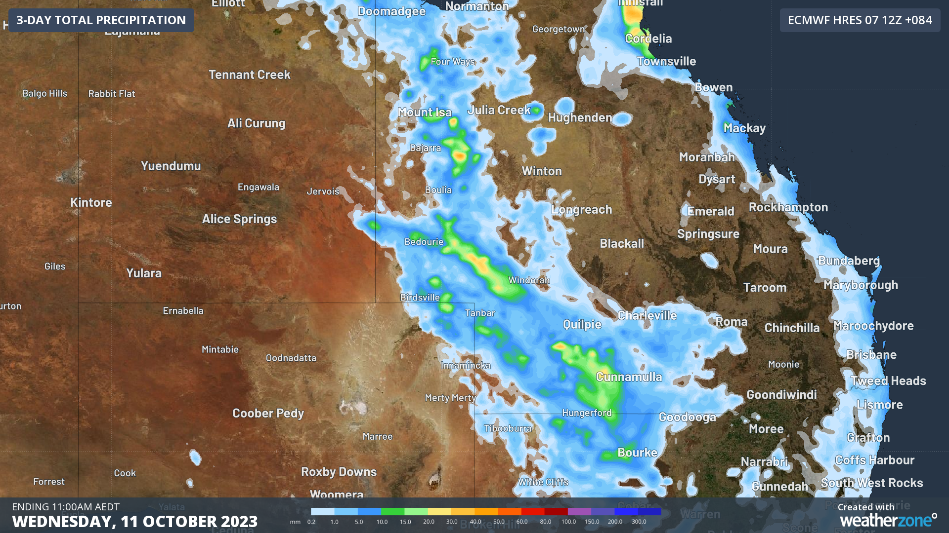
Image: Accumulated precipitation to 11am AEDT Wed 11th Oct
By the time we get to the middle of the week some healthy falls of 15-30mm could be picked up through inland areas, before a high-pressure ridge brings stable weather once more for much of the eastern states. Some lingering instability could spark one more round of storms for far northeast NSW and southeast QLD on Wednesday afternoon.