
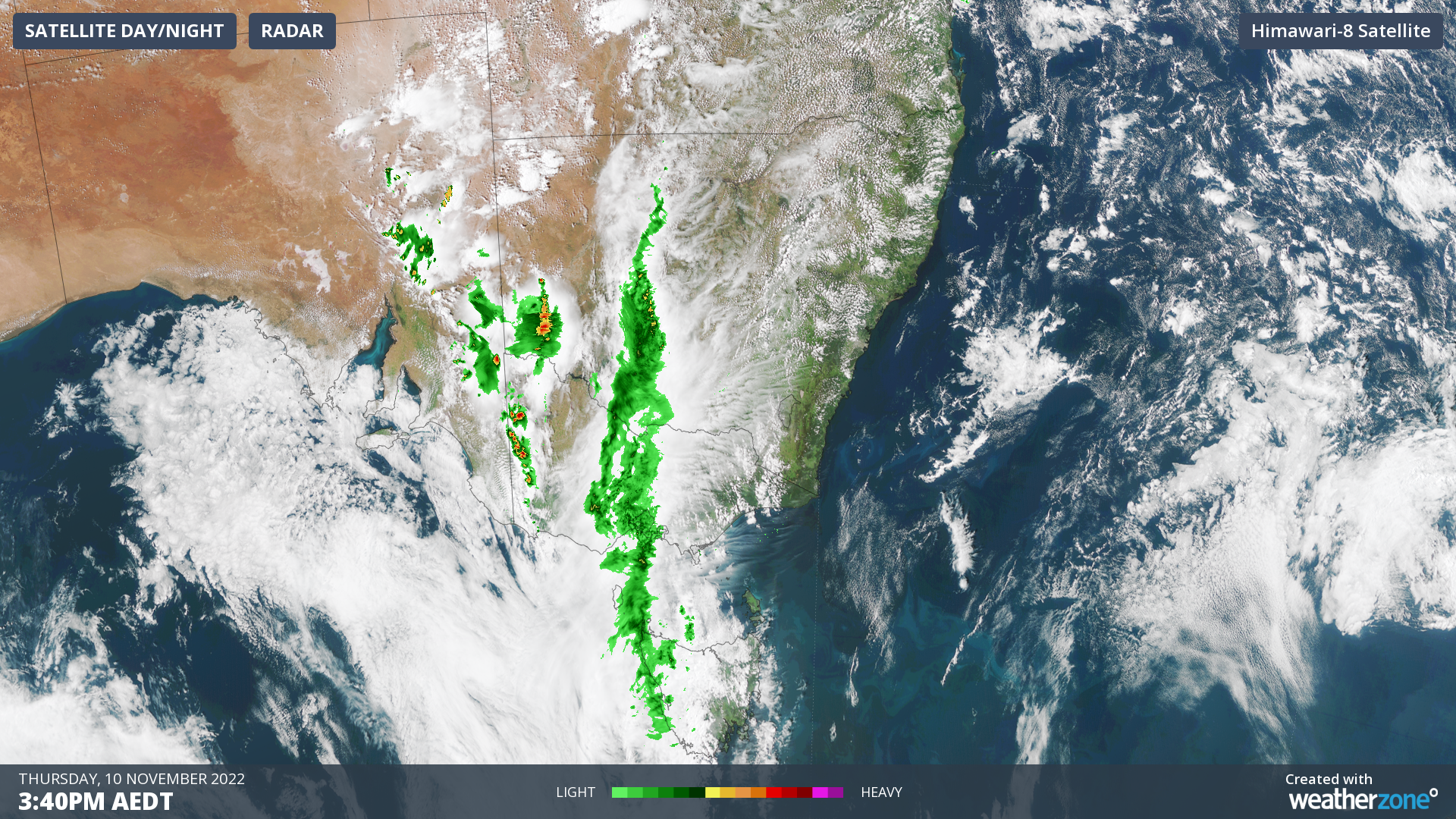
Stormy rainband from Bourke to southern Tas
Look at that line of rain and storms stretching from northern NSW all the way down across Victoria to the southwestern western corner of Tasmania.
That right there is one seriously long band of precipitation extending the best part of 2000 km, and it's just a sign of what's to come for the eastern half of the country over the next few days.
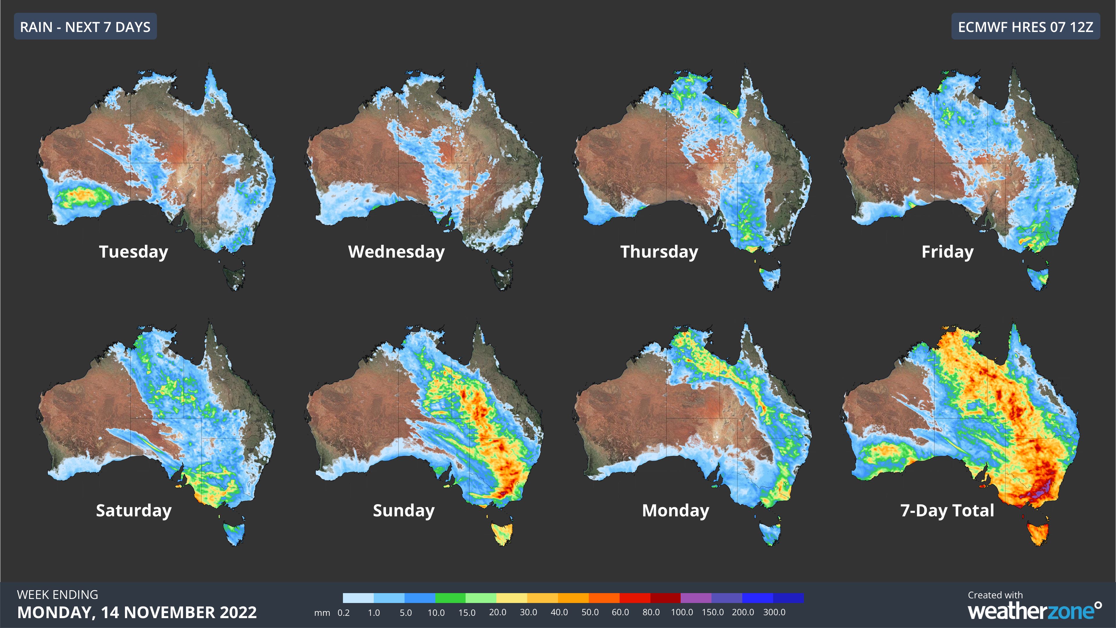
We told you on Tuesday that there's yet another very wet weather system in store for eastern Australia later this week.
Below are the maps from that story which show where rainfall is expected day-by-day. If you look at the projected map for Thursday, you can see that Thursday is thus far panning out very much as predicted in terms of the location of rainfall.
Accumulations from today's rain band are not extreme so far. We're mostly looking at single-digit totals (i.e less than 10 mm) in most places.
But there have been slightly higher readings in locations that have seen storms, and indeed, it's the storms behind that main rather narrow rainband that have the most severe and potentially dangerous weather today.
Severe thunderstorm warnings for heavy rain, damaging winds, and large hail were issued by the BoM earlier this afternoon for the:
- Lower Western and Upper Western forecast districts of NSW
- Mallee, South West and Wimmera forecast districts of Victoria
- Flinders, Riverland, Murraylands, Upper South East, North East Pastoral, Mid North, Lower South East and North West Pastoral forcast districts of SA
There is plenty more storm activity left in this system between now and the start of next week. Indeed, this system is only kicking off, so please keep checking our warnings page for the latest storm info in your area.