
Stormy Monday in Queensland, NSW
Thunderstorms will hit parts of Qld and NSW on Monday afternoon as a low pressure trough lingers over eastern Australia.
Sunday night saw a flurry of thunderstorms develop along a 2000km corridor stretching from Qld’s northwest to southeast. These storms, which formed along the low pressure trough, produced more than 160,000 lightning strikes in the 24 hours ending at 9am AEST on Monday. They also dumped 70 mm of rain to the south of Taroom and 54 mm at Arcadia Valley.
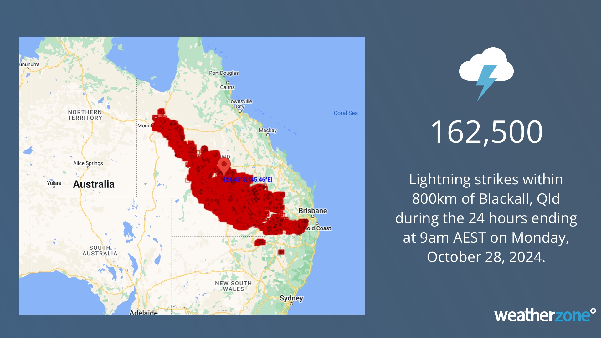
Image: Observed lightning pulses withing 800 km radius of Blackall, Qld in the 24 hours ending at 9am AEST on Monday, October 28, 2024.
Storms will once again strike parts of eastern Australia on Monday afternoon and evening due to the presence of two low pressure troughs.
One broad trough will trigger storms over northeast NSW and into southeast and central Qld. Another smaller trough could produce a few storms in central and southeast NSW, most likely along the state’s central ranges.
Some of Monday’s storms could become severe in central and northeast NSW and central and southeast Qld. In central NSW, damaging winds and large hail are the most likely threat with any severe storms. For northeast NSW and Qld, heavy rain, damaging winds and large hail are all possible if storms turn severe.
Calmer weather will return to most of NSW and Qld on Tuesday before another round of wet and stormy weather returns on Thursday.
Check the latest severe thunderstorm warnings for up-to-date information if you are in NSW or Qld on Monday.
Title image credit: iStock / Alan Davidson