Stormy afternoon for northeast New South Wales
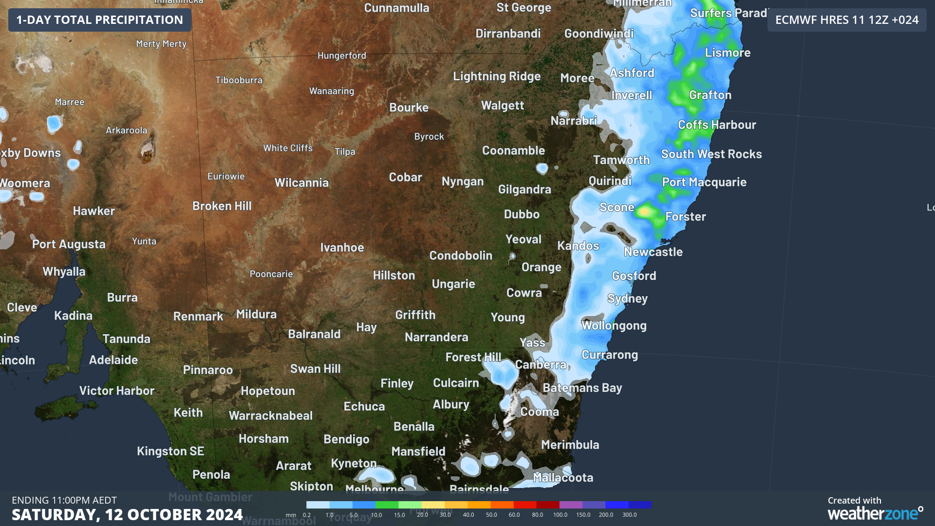
The residents of northeast New South Wales can expect to see and hear showers and thunderstorms this afternoon, with the chance that some storms will become severe.
A surface trough is currently shifting northward near the coast of northern NSW. So far this morning, the surface trough has produced mainly showers over northeast NSW while thunderstorms have been mostly confined to offshore areas. That will change this afternoon as moisture and instability continue to build over land, and thunderstorms spread across land and water.
Thunderstorms will be most likely from the coast to the ranges, including areas such as Coffs Harbour and Lismore. There is a chance that some storms will become severe during the afternoon and early evening, with a risk of large hail, damaging wind gusts exceeding 90km/h and localised heavy rainfall which may lead to flash flooding.

Image: Precipitation forecast for today from the ECMWF model.
Be sure to keep up with the latest severe weather warnings as this situation evolves.