
Storms stretch from Top End to Tasmania
Severe thunderstorms will develop over Australia's eastern inland on Tuesday, possibly affecting parts of five states and territories.
A broad low pressure trough stretching more than 3000 km across northern and eastern Australia triggered thunderstorms between the Top End to Tasmania on Monday. Weatherzone’s Total Lightning Network detected 783,514 lightning pulses within a 600 km radius of Tibooburra on Monday, between midnight and midnight.
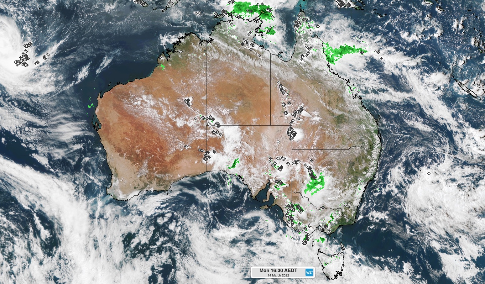
Image: Composite satellite and lighting strike observations, showing thunderstorms occurring between the Top End and Tasmania on Monday afternoon.
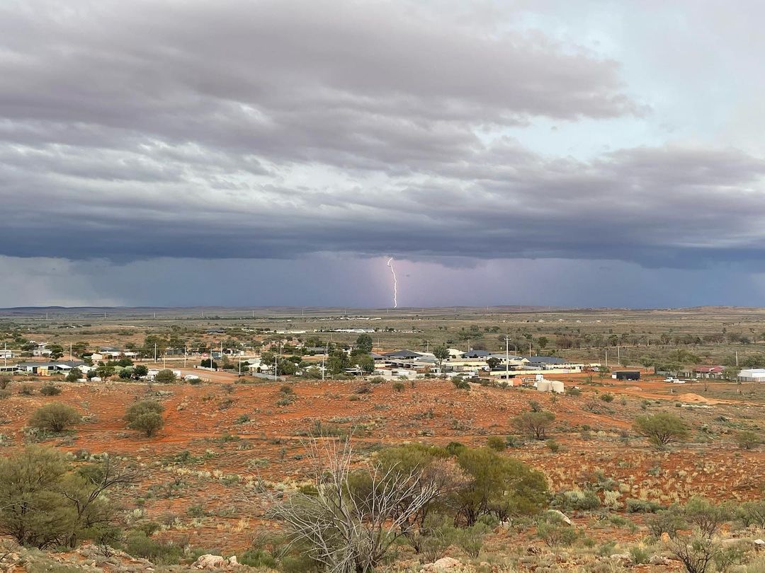
Image: One of Monday's lightning strikes at Broken Hill, NSW. Source: @just_merce_ / Instagram
On Tuesday, this same low pressure trough will spark more showers and thunderstorms across parts of Vic, eastern SA, western NSW, western Qld and eastern and northern parts of the NT.
The map below shows the predicted accumulated rainfall on Tuesday from one computer model, which gives an indication of where the showers and storms will occur.
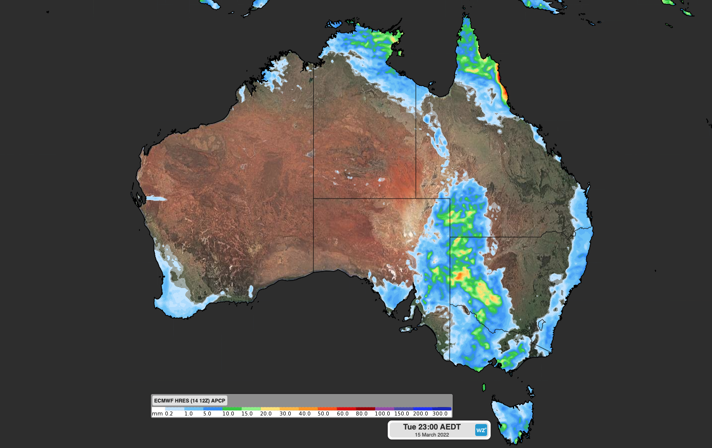
Image: Forecast accumulated rain on Tuesday, March 15, according to the ECMWF-HRES model.
Severe storms are possible across several states and territories on Tuesday, with heavy rainfall the most likely phenomena. In NSW and Qld, damaging winds are also a risk.
Rainfall totals on Tuesday will largely depend on where showers and storms develop. Some areas are likely to pick up more than 20 mm and other places nearby could see little, if any rain.
Drier weather will return to Australia’s eastern inland from Wednesday as a high pressure ridge develops across the region.