Storms possible in Sydney, Melbourne, Brisbane, Canberra, Perth and Darwin over the coming days
Showers and thunderstorms could impact up to six Australian capital cities during the next few days, with some likely to see severe storms.
A slow-moving upper-level low pressure system interacting with a moisture-laden air mass has been causing rain and storms across parts of Queensland, NSW, Victoria and SA during the last two days.
These storms produced around 1.5 million lightning strikes over eastern Australia during the 48 hours ending at 10am on Thursday.
Looking ahead, more thunderstorms will develop between Queensland and Tasmania on Thursday, Friday and Saturday, and some of these storms are likely to hit capital cities.

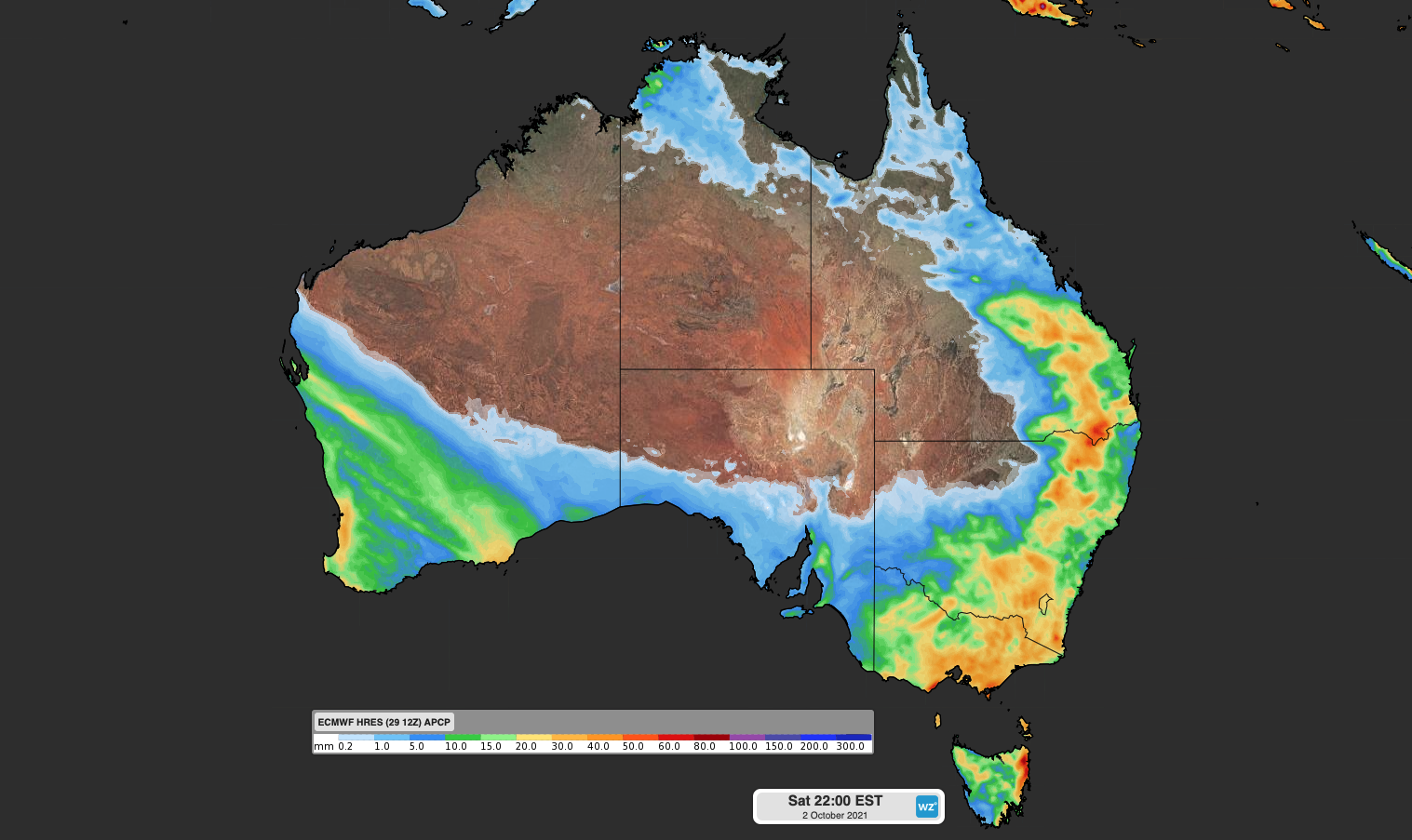
Image: Forecast accumulated rain between Thursday and Saturday, showing where showers or thunderstorms are likely to occur during the next three days.
Sydney already saw a storm roll across its southwestern suburbs on Thursday morning, delivering a brief burst of rain in the Camden area. Storms remain a risk over the Sydney Basin on each of the next three days, becoming more likely on Friday.
Brisbane also has a good chance of seeing storms on Thursday and Friday, most likely in the afternoon or early evening when the atmosphere is most unstable. Drier weather will return to the city on Saturday.
While Canberra has already seen plenty of rain during the last 24 hours, the city could see lightning on Thursday afternoon and night as thunderstorms bubble up along the southern NSW ranges. The risk of thunderstorms will linger on Friday and Saturday as well.
Melbourne will see showers on Thursday as a complex low pressure system lingers over Victoria. While the atmosphere won't be as unstable above Melbourne as some other areas in eastern Australia, thunderstorms can't be ruled out for the city in the afternoon. Storms are a risk again on Friday, most likely in the afternoon.
Any thunderstorms that develop over these four capital cities in the coming days could become severe, so be sure to check the latest warnings.
Meanwhile, a cold front crossing southwestern Australia on Friday will bring a burst of rain and storms to WA's South West Land Division.
Perth should see a decent drop of rain on Friday and could cop some lightning as well. Severe weather is also a risk with the passage of this front.
Further north, convection will increase over the NT's Top End in the coming days under the influence of humid easterly winds. This makes showers and thunderstorms an increasing risk for Darwin, particularly on Friday and Saturday.
While only some storms are considered severe, they all contain lightning. If you hear thunder, the best thing to do is stay inside until the storm has well and truly cleared from your area.