
Springtime heat coming to the west coast
The Pilbara’s heat engine, the primary driver of heat across the Australian continent during the summer months, is in full swing. The next pulse of heat is now on the way for Western Australia’s west coast, with temperatures set to reach the high 30s as far south as Perth on Monday.
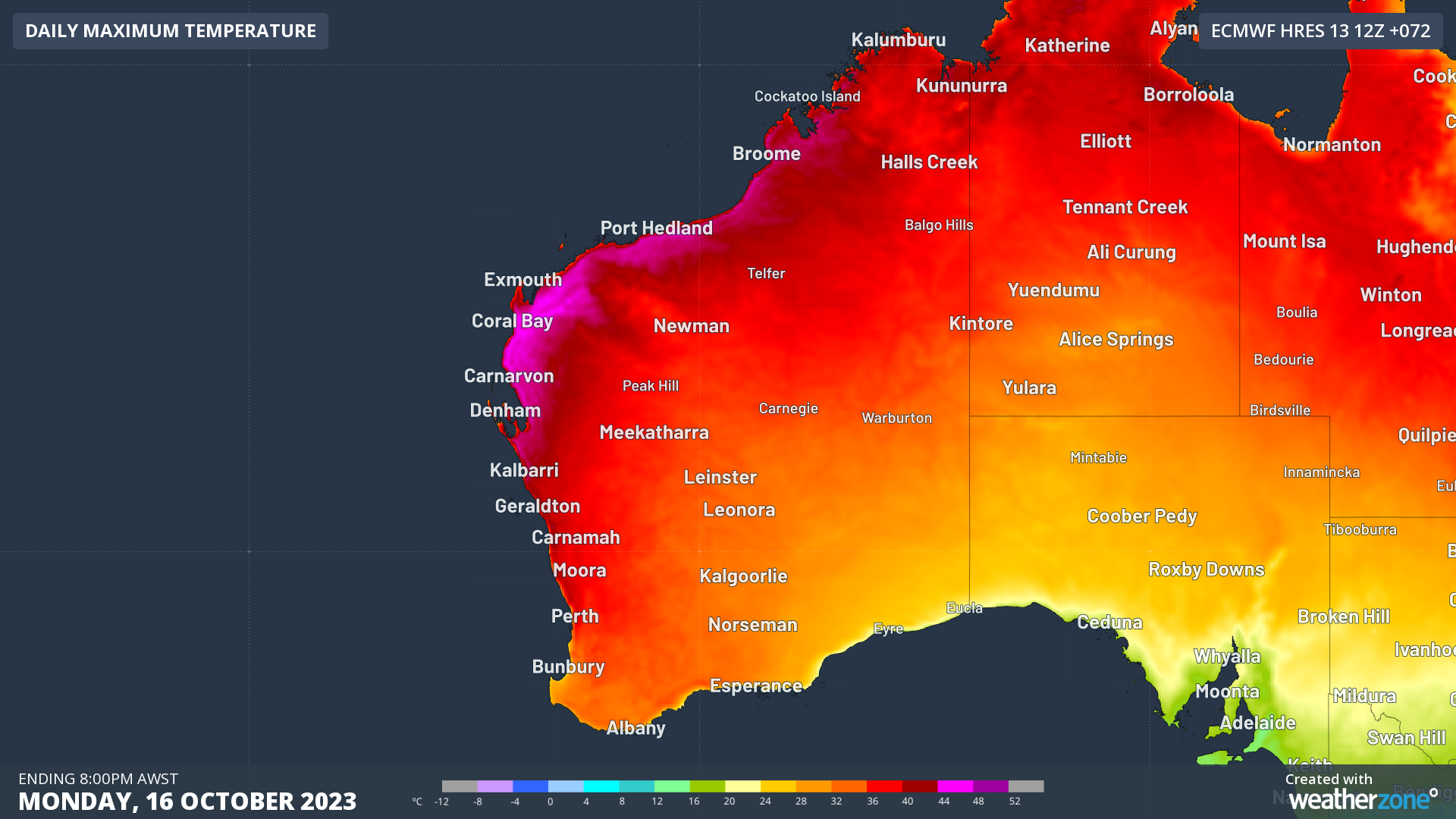
Image: Forecast maximum temperatures for Mon 16th October
A trough extending down the west coast is already tapping into the heat over the Pilbara, with daytime temperatures exceeding 40°C through the Gascoyne district, and into the high 30s across the Midwest. High pressure moving into the Bight will allow northerly component winds to increase along the western fringe, funneling warmth down to the Lower West.
The reason that Australia’s west coast can be subjected to such intense heat is largely due to the position of the trough. If the trough is offshore, this allows the hot northeasterly winds to push across the coast, effectively blocking the sea breeze as the hot air moves towards the area of lowest air pressure. If the trough is along the coast or inland, the sea breeze can develop much more easily, bringing much more pleasant, albeit windy conditions to the coast. As the trough moves further east, the sea breeze can penetrate further inland, flushing out much of the heat.
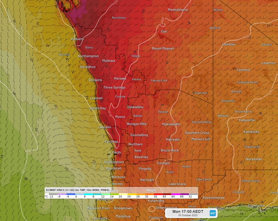
Image: Forecast temperature, winds, and MSLP along the west coast at 2pm AWST Mon 16th October
At this stage, forecast temperatures for the hottest day – Monday, are set to reach 36°C for Perth. This is about 13°C above the October average of 23.3°C. Although this is extraordinary heat for this time of year, it is not unheard of. In records dating back to 1876, there have been 18 days recorded in October where Perth had exceeded 35°C, with the October record of 37.3°C set in 1967.
Further north in Geraldton, the forecast for Sunday and Monday stands at 37°C, about 11 degrees above their October average of 25.7°C. In records dating back to 1941, Geraldton has seen 29 days in October exceeding 37°C, with the monthly record of 40.7°C set in 1979.
High pressure will start to push this trough inland on Tuesday, allowing the sea breeze to take effect along the west coast. The heat will be dragged east towards the Goldfields and Southern Coastal, as southerly winds work to cool down the west and south before the trough eventually leaves the state by Thursday.