
Southerly takes east coast out for Friday night "drinks"
As the NSW government eased COVID-19 restrictions on hospitality venues, nightclubs, and music festivals yesterday, just in time for some weekend frivolity, a southerly change decided to get in on the action and shout the NSW east coast a few rounds last night, dumping some pretty significant rainfall from the Illawarra to the Mid North Coast.
While we here at Weatherzone won’t comment on covid-related decisions made by the NSW government, we can certainly comment on the boisterous activity exhibited by a certain meteorological party animal (aka the southerly change).
As a cold front moved east out to the Tasman yesterday afternoon, a high pressure ridge began its road trip up the east coast, bringing some southerly winds along for the ride (hence, “the southerly change”). It started out innocently enough - just a lunchtime tipple of 0.2mm in Moruya on the South Coast at around 1pm.
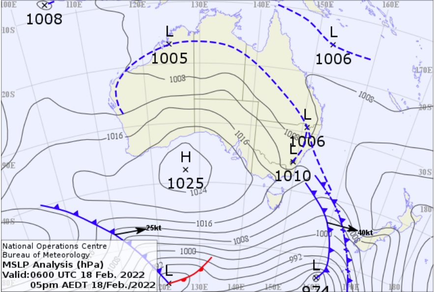
Image: Mean Sea Level Pressure Analysis for 5pm Friday 18 February AEDT, showing a high pressure ridge forming off the eastern VIC/southern NSW coast in the wake of a cold front in the Tasman Sea. Source: Australian Government Bureau of Meteorology
At around 9:30pm, our southerly friend decided a meteorological pub crawl was in order, starting at the Illawarra region. First round: A dram of 11.2mm rainfall in Kiama between 9:30pm and 10:30pm. A few rounds there before heading north to bounce around the watering holes of the Illawarra and Hunter regions for a few hours. 8.2mm rainfall at Bellambi between 10:30pm and 11:30pm, 25.4mm rainfall at Cessnock between 11:40pm yesterday and 12:40am this morning, 16mm at Singleton between 1am and 2am this morning, and so on.
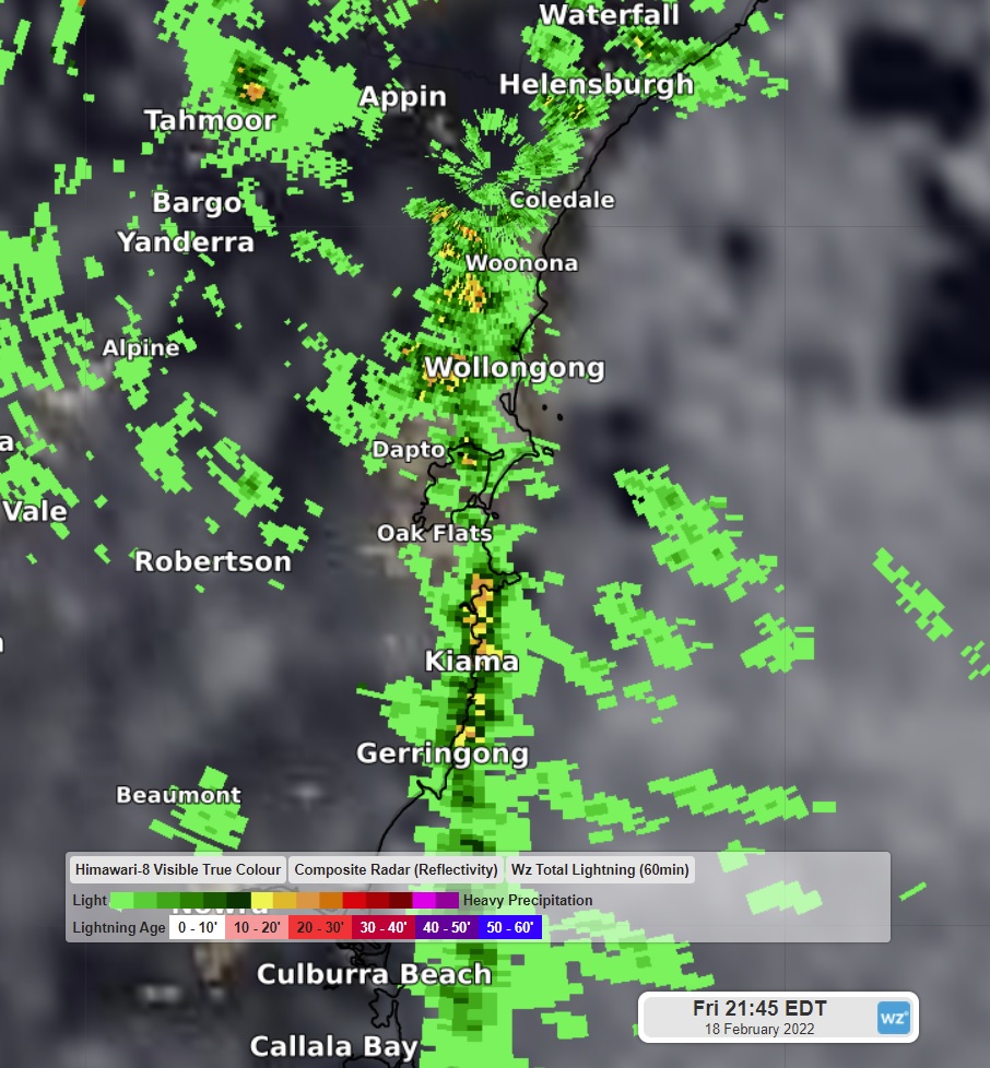
Image: Radar data over the Illawarra region at 9:45pm Friday 18 February.
As often happens with nights on the town, things did get a bit rowdy, with fights breaking out between our high pressure ridge and a low pressure trough over the northeastern part of the state. What we mean is: thunderstorms were detected over the Central Coast and Hunter regions between 10pm and 3am. And as the meteorological pub crawl continued its march north, so too did the thunderstorms, with lightning detected over the Mid North Coast from 1am to 6am.
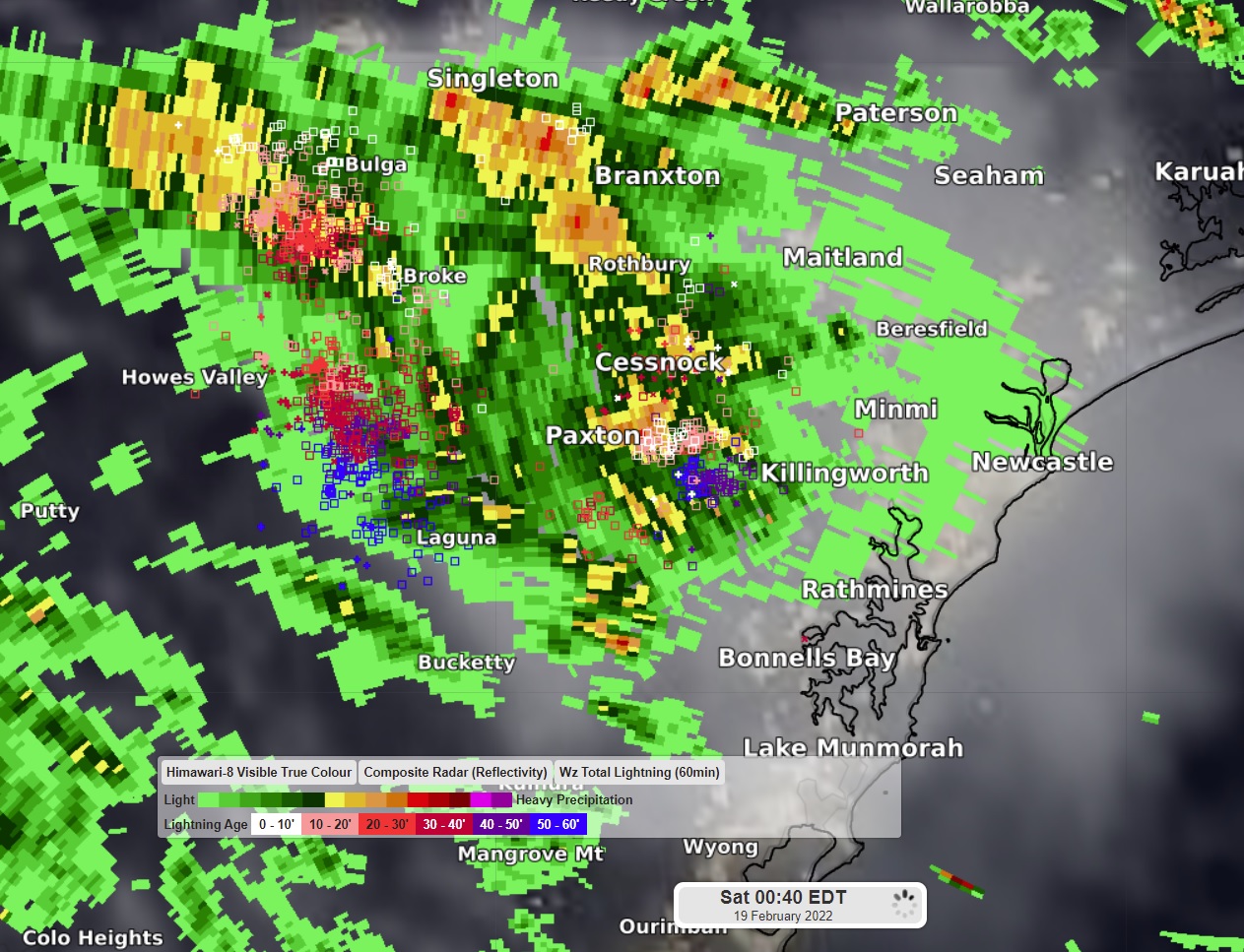
Image: Radar and lightning tracker data over the Hunter region at 12:40am Saturday 19 February.
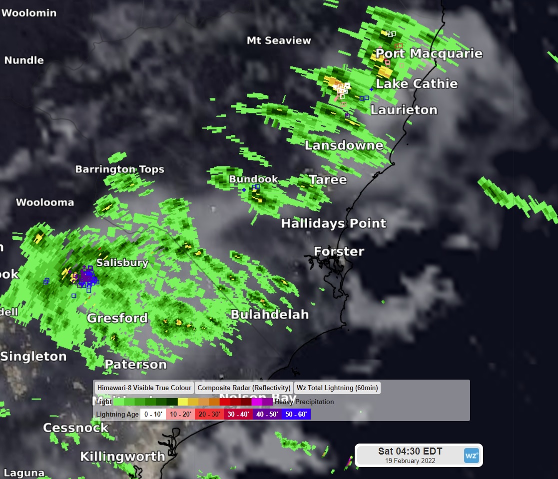
Image: Radar and lightning data over the Hunter and Mid North Coast regions at 4:30am Saturday 19 February.
Last call for drinks was just before sunrise in Kempsey with 9.2mm between 5:30am and 6:30am.
And while we’ve mentioned the most notable “beverages” of the night, it’s also worth noting the total rainfall “imbibed” by our southerly friend to 9am this morning at various locations along its festive trek up the coast. For example, 75mm at Turners Flat near Kempsey, 62mm at Beechwood near Port Macquarie, 59mm at Comboyne (about an hour’s drive southwest of Port Macquarie), 58mm at Singleton, 57mm at Quorrobolong in the Hunter region, and 57mm at Bellambi.
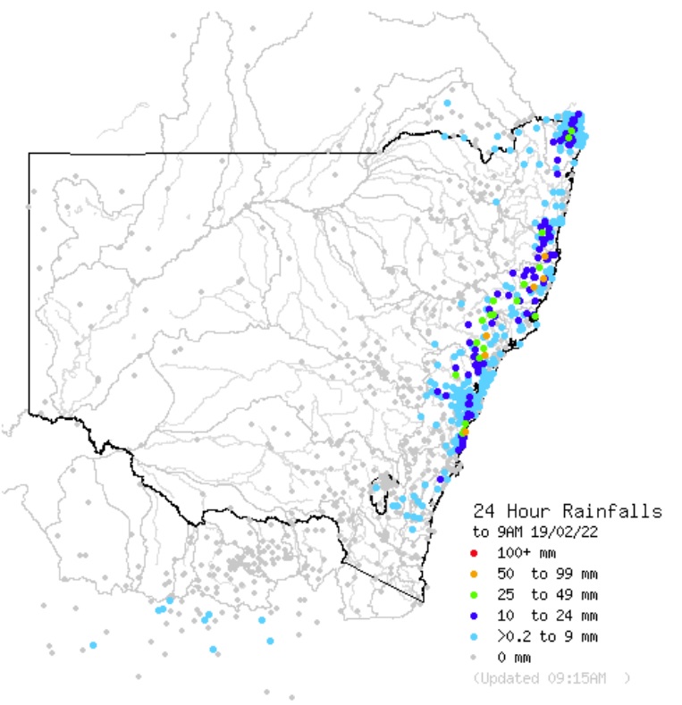
Image: 24 hour rainfall totals to 9am Saturday 19 February. Source: Australian Government Bureau of Meteorology
With the sort of weather patterns we've been seeing lately, don't be surprised if our rambunctious southerly friend doesn't decide to make a reappearance for Sydney's annual Gay and Lesbian Mardi Gras over the next couple of weeks. Let's hope that it doesn't decide to rain on anyone's parade on 5 March.