
Southeastern Australia to bask in winter warmth
Temperatures will reach 5 to 7°C above average in some capital cities this week, as a warm airmass moves across Australia's southeastern states.
This burst of warmth is being caused by warm west to northwesterly winds ahead of a cold front that will sweep across the southeast from Wednesday.
The satellite images below show much of Australia is cloud free on Tuesday, ahead of the cold front and associated rain and cloud moving east across southern WA.
Images: Himawari-9 satellite images at 9am AEST on Tuesday, July 23
The southern states will bask in warm wintry weather for the next few days, before temperatures drop behind a cold front that will arrive late Wednesday into Thursday.
The eastern states also have a pleasant week with temperatures remaining in the 20’s until the weekend.
The images below show the warm daytime temperature temperatures across parts of southern Australia on Wednesday, which will move over eastern Australia on Thursday.
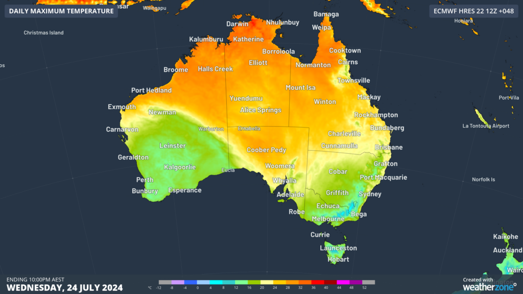
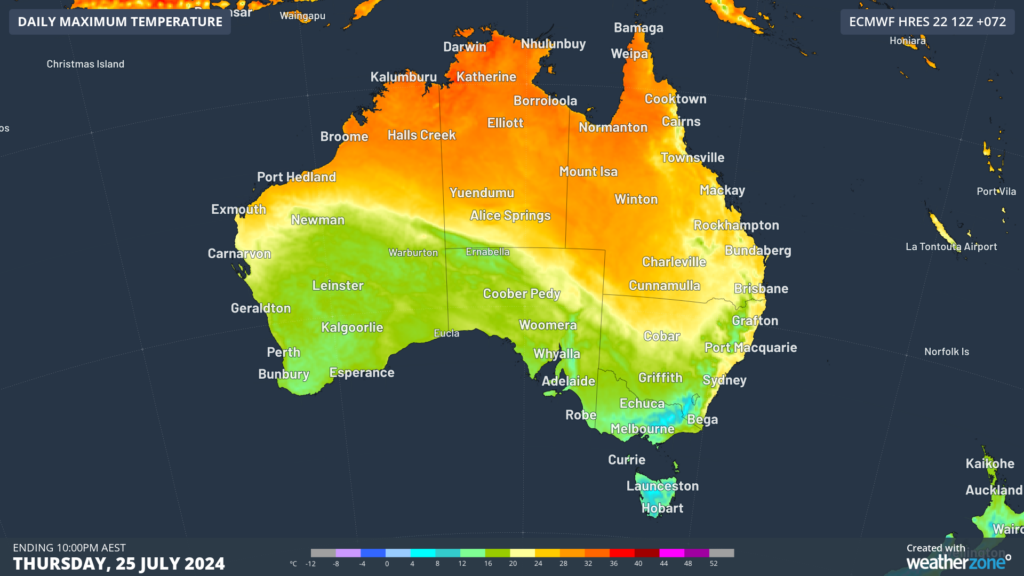
Image: Maximum temperature forecast for Wednesday, July 24 (top) and Thursday, July 25 (bottom), according to ECMWF
The peak daytime temperatures this week are:
- Sydney will be 6 to 7 °C above average on Thursday, reaching 23 to 24°C in the afternoon.
- Adelaide will be around 5°C above average on Wednesday, with a maximum of 20°C.
- Brisbane is forecast to see two 25°C days on Friday and Saturday, nearly 3°C above average.
- Hobart should reach 17°C on Tuesday and Wednesday, 4°C above the July average.
- Melbourne will be mostly sunny and 17°C Tuesday, 3°C above average.
While the days are warm, the nighttime temperatures across eastern Australia have been cold. The cloud free nights in the region mean that much of the day's warmth radiates away from earth overnight. However, minimums will warm up on Wednesday and Thursday night with some cloud acting as a blanket, with Sydney’s minimum reaching around 5°C above average.
Meanwhile the southern states overnight temperatures should continue to be much warmer than average for the next few days.
Looking ahead, a cold southerly airmass will drop temperatures across the southeast late this week into early next for several days, so enjoy this warmth.