
Southeast summer cold snap brings coldest February morning in decades
The surge of cold Southern Ocean air that dusted parts of Tasmania with a little snow has pushed northwards and made its presence felt across Victoria and NSW with a chilly morning. The morning chill is more reminiscent of autumn. Tasmania was also very chilly, with a little snow cover remaining on some of the mountains such as Ben Lomond.
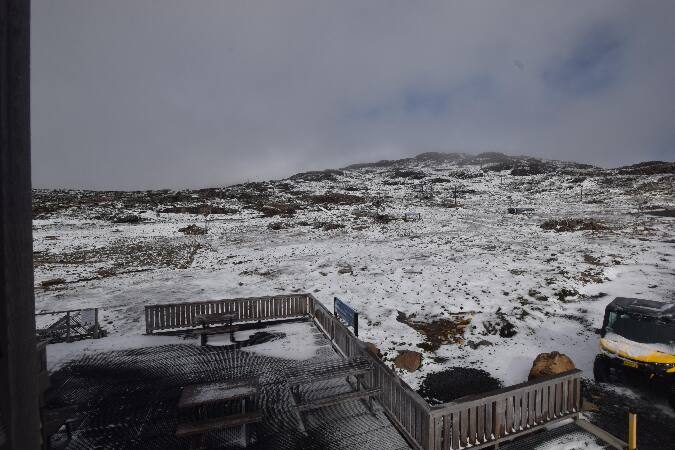
Image: Ben Lomond Village (elevation 1460m) at 9:10am EDT Sunday 16th. Source: Bellendena Ski Club
It was the coldest February morning in decades for parts of Tas, Vic and NSW. It was the coldest in 32 years for Melbourne, dropping to 9.9°C, 11 years for Sydney, dropping to 15.6°C, and 8 years for Canberra, dropping to 3.2°C. It's also been 37 years since Melbourne recorded such a low temperature this early in the year. Hobart was colder than Melbourne, dropping to 8.8°C, but you only have to go back 2 years to find a similarly cold February morning for the southern most capital.
The alpine peaks recorded temperatures below freezing. It plunged to:
- -3.3°C at Falls Creek, Vic (coldest in 27 years)
- -1.4°C at Mount Baw Baw, Vic (coldest in at least 24 years)
- -3.7°C at Mount Hotham, Vic (coldest in 17 years)
- -4.2°C at Thredbo, NSW (coldest in 5 years)
- -3°C at Perisher Valley, NSW (coldest in 5 years)
The days and nights will stay quite mild for the next few days:
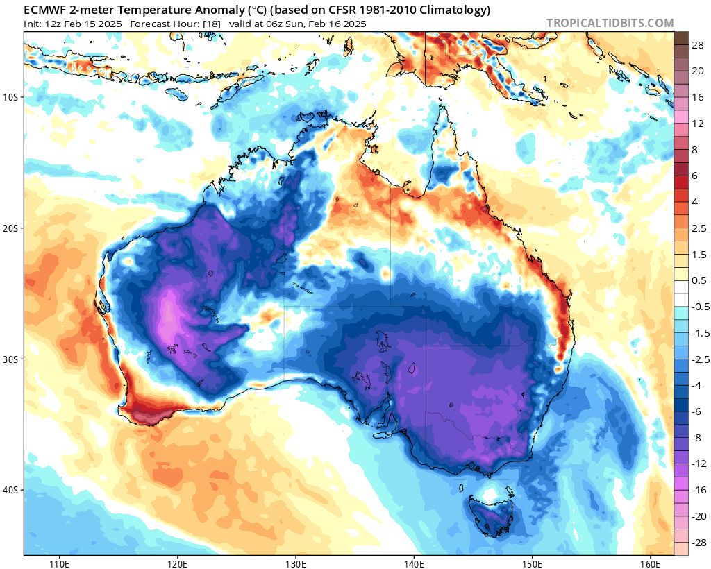
Image: European model 2-m temperature anomaly forecast for 5pm EDT Sunday 16th. Source: tropicaltidbits.com, ECMWF
The airmass is also very dry, so another thing this will do is reduce thunderstorm activity. There were severe thunderstorms for several days across NSW, Qld and Vic last week with high humidity and an upper level low present.
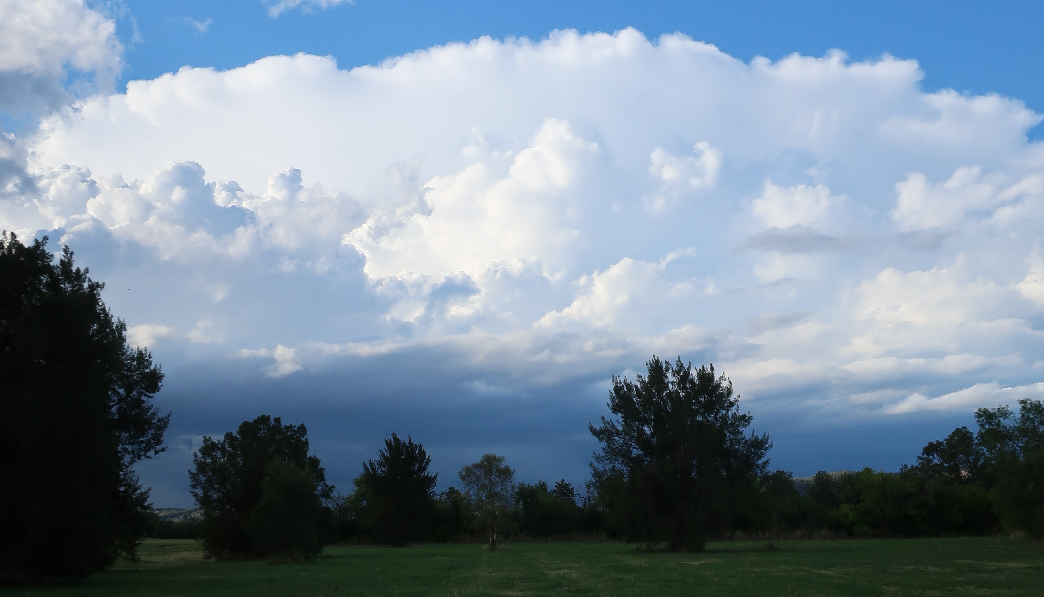
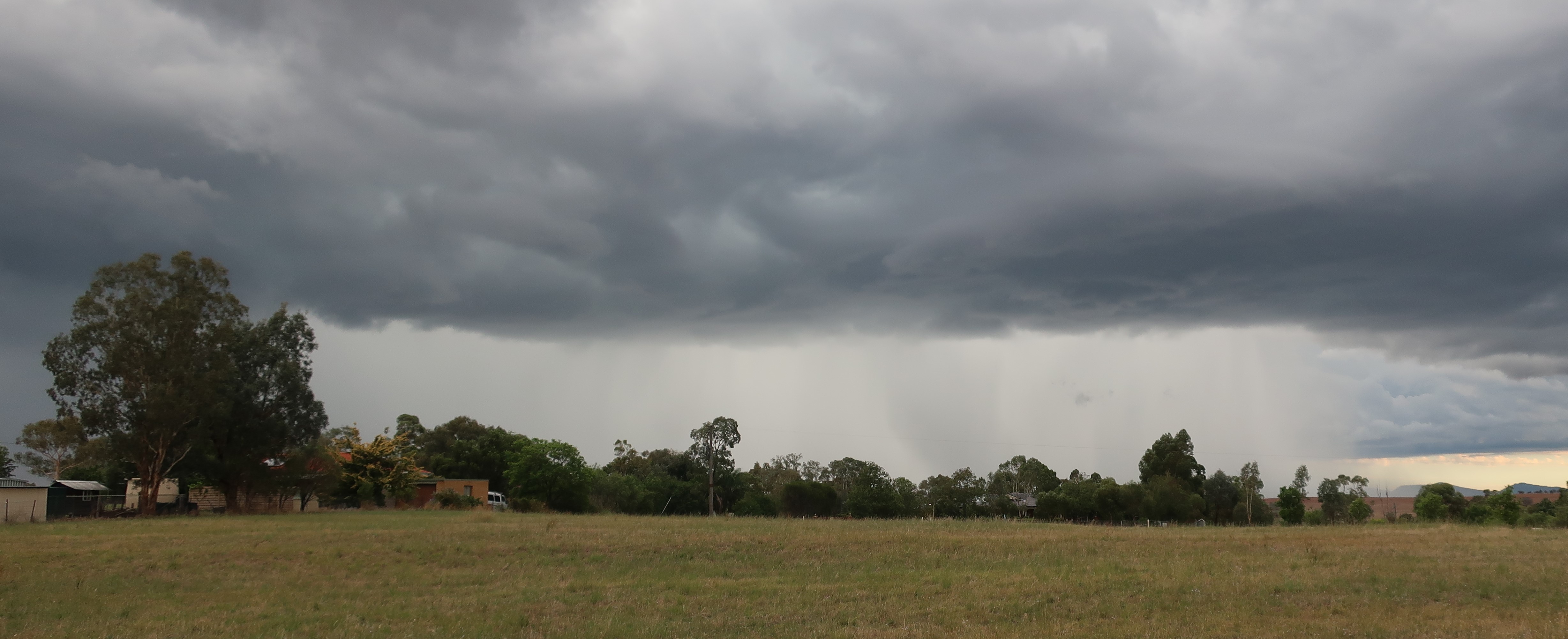
Image: Severe thunderstorms over the NSW North West Slopes on Wednesday 12th. Source: author
The dew point temperature (an absolute measure of humidity) across NSW was around 20°C across much of the state last week providing a rich source of moisture for thunderstorms. Currently the dewpoint temperature is in low single digits across much of the state, leading to dry and mostly sunny conditions for much of the coming week.
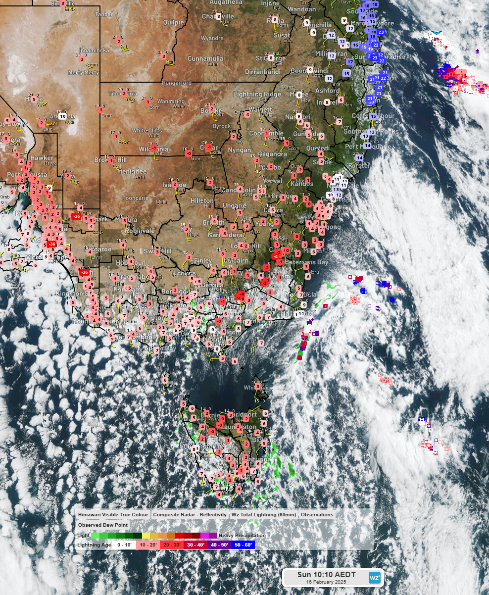
Image: Himawari-9 satellite imagery, BOM radar and observed dewpoint temperatures at 10:10am EDT Sunday 16th. Source: Weatherzone
Please stay up to date with the latest forecasts and warnings at Weatherzone.com.au