South Australia's wettest start to a year since 1984
It’s been a wet start to the year for much of South Australia, with the state just registering its wettest January in 36 years.
While the first half of January was mostly dry across the state, waves of tropical moisture triggered widespread and heavy rain in the second half of the month.
The map below shows the rainfall deciles for the month as a whole.
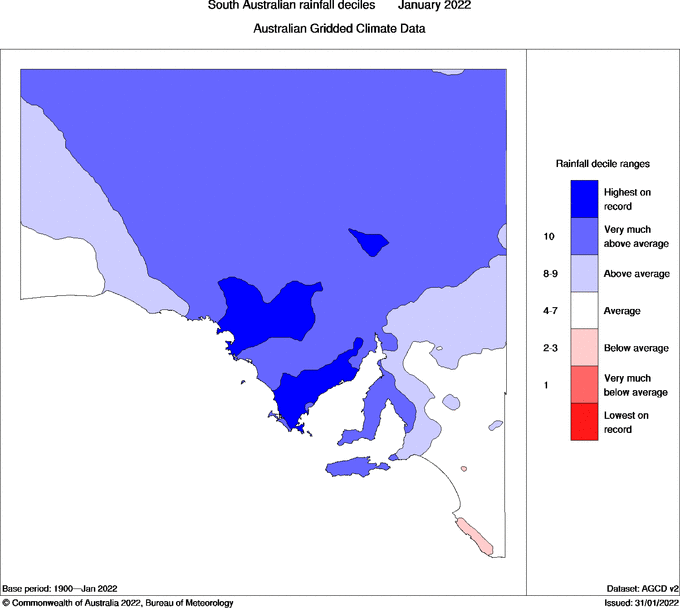
Image: Observed rainfall deciles in South Australia during January 2022. Source: Bureau of Meteorology.
The areas shaded blue on the map above saw above-average rain in January, with the darker blue wedge across central and northern parts of the state showing where rainfall was in the top 10 percent of historical records. The darkest blue regions had their wettest January on record.
Last month’s rain caused flooding in some areas, which transformed the landscape that had been left parched after a dry December.
The two images below are false-colour satellite images of the state’s north, showing water in Lake Eyre and surrounding areas at the start of the month and near the end of the month.
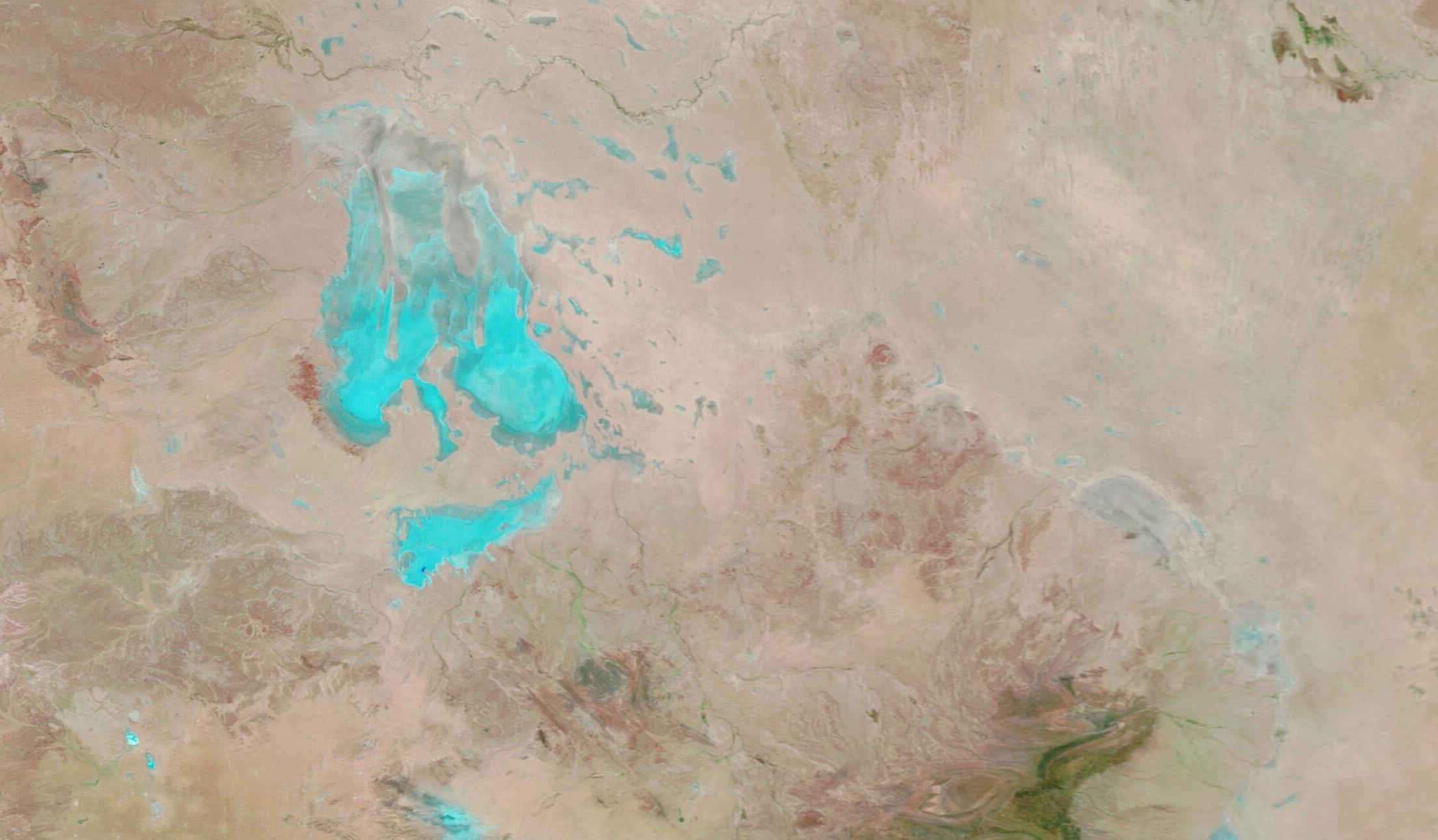
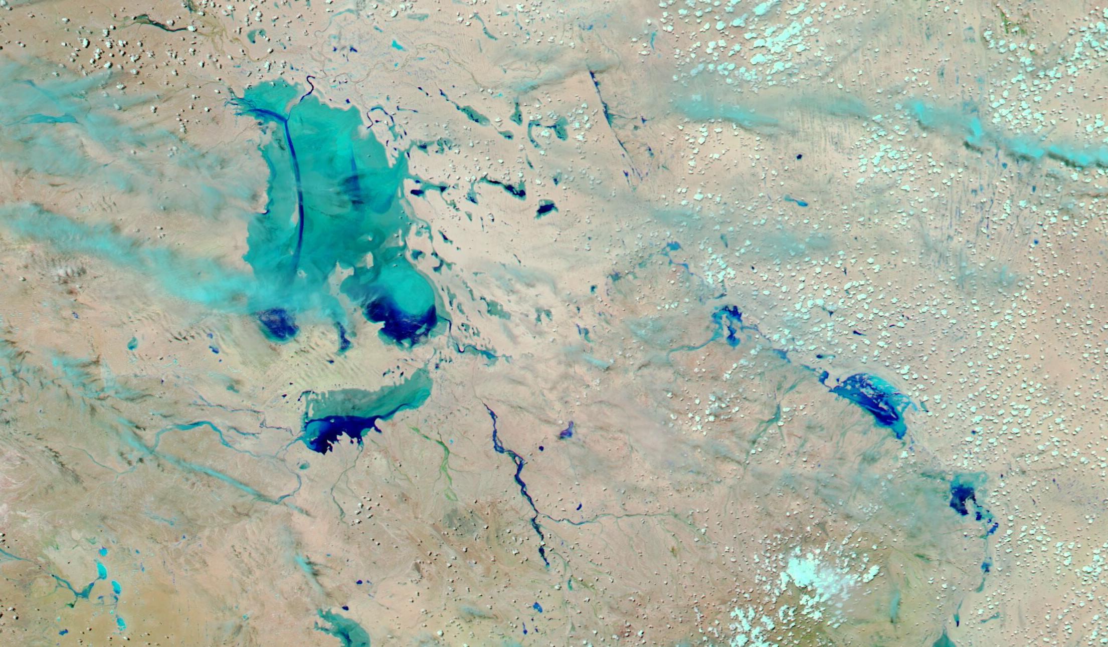
Images: False-colour satellite images captured on January 2 (top) and January 26 (bottom), showing the Lake Eyre region in South Australia. Source: NASA Worldview / Aqua and Terra satellites.
There were also similar scenes of transformation a bit further south, at Lake Torrens.
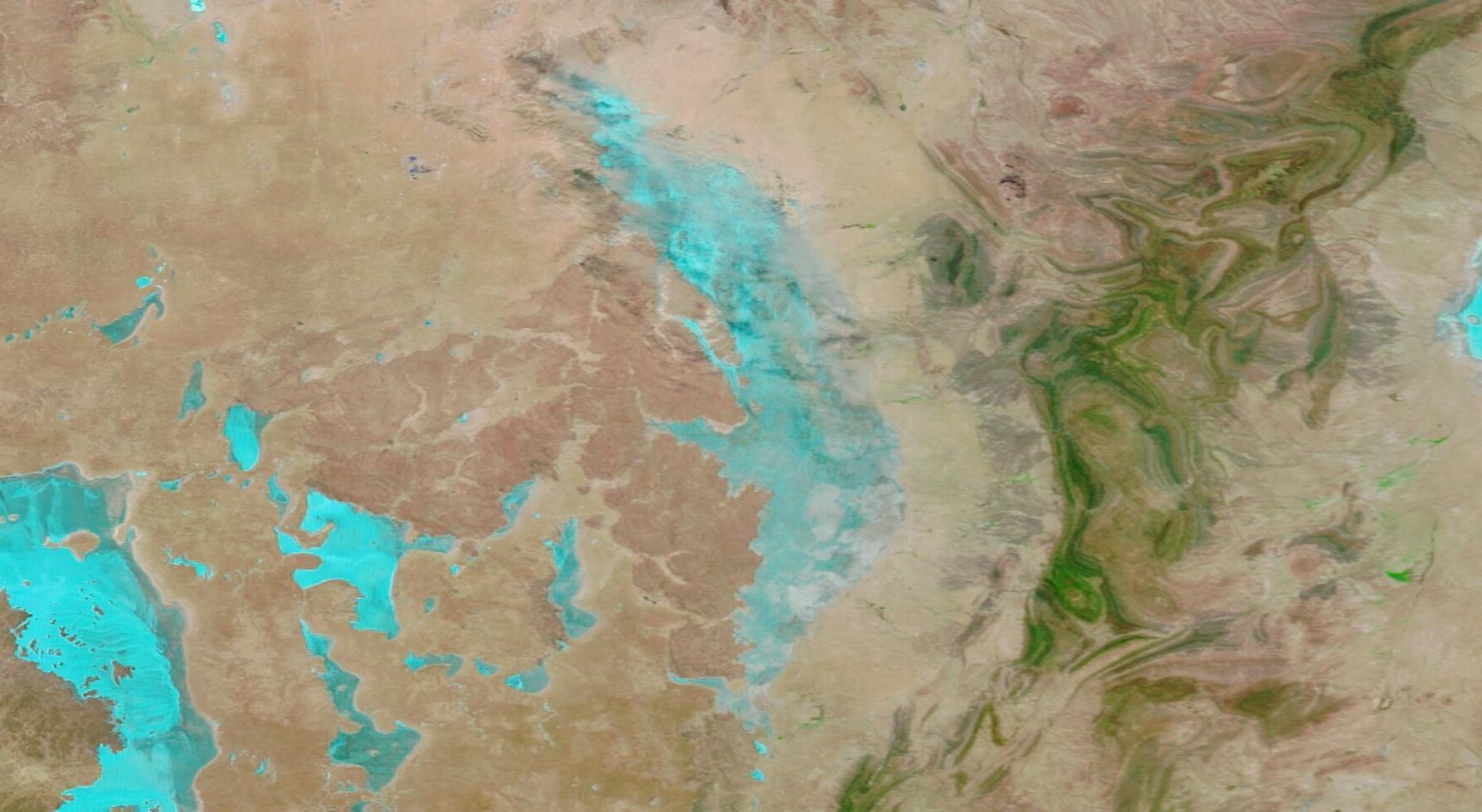
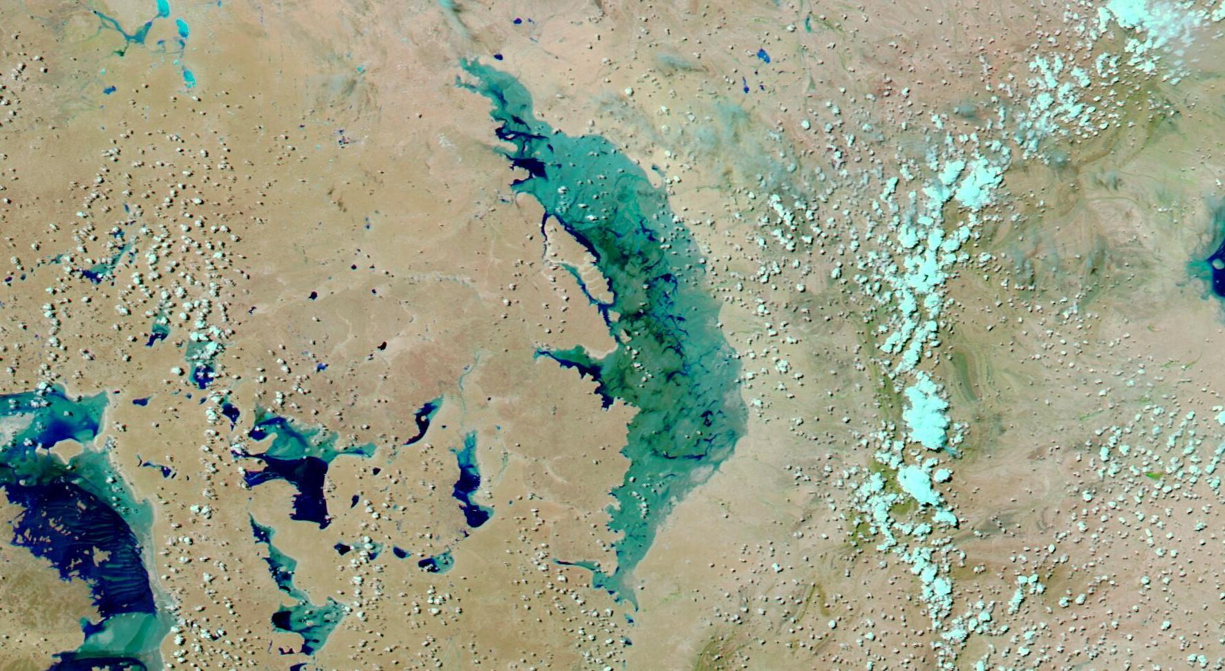
Images: False-colour satellite images of Lake Torrens on January 2 (top) and January 26 (bottom). Source: NASA Worldview / Aqua and Terra satellites.
Drier weather will return to most of South Australia during the next week as a high pressure ridge moves over southern Australia.