South Australia hit by severe thunderstorms
Severe thunderstorms over the weekend have led to the wettest day in years for some parts of South Australia, western Victoria and western New South Wales.
A slow moving low pressure trough crossing South Australia on Saturday lead to severe thunderstorms delivering large amounts of rainfall over the course of a few hours. 24-hour rainfall accumulations to 9am on Sunday 7th included:
- 43mm at Yunta Airstrip – the wettest day for the station in nearly 9 years, and wettest December day in 17 years.
- 26mm at Port Augusta Aerodrome and 22mm at Nuriootpa Pirsa – also the wettest December days in 17 years for both stations.
- 13mm at Adelaide
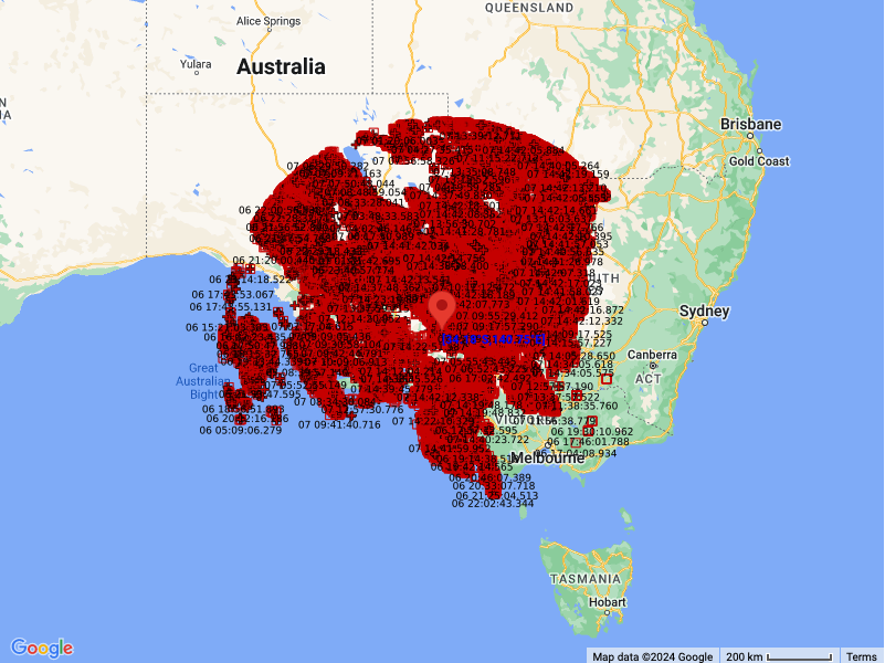
With thunderstorm activity continuing today, over 700,000 lightning strikes were recorded over parts of South Australia, western Victoria and western New South Wales since midnight on Saturday 6th.

Recorded lightning strikes since midnight Saturday 6th.
Thunderstorms will continue to affect much of eastern South Australia, western and northern Victoria, and western New South Wales today, before moving out of South Australia and focusing on eastern states on Monday 8th as the low pressure trough moves further eastwards. Severe thunderstorms will likely affect parts of South Australia, Victoria, New South Wales and Queensland between now and Tuesday 9th, with locally intense rainfall possible across northeast Victoria and southern New South Wales extending into tomorrow, so make sure keep an eye on the latest warnings at: https://www.weatherzone.com.au/warnings