
Snowy weekend ahead in the mountains
Snowfalls last weekend were the heaviest of the 2024 winter in the alpine regions of Tasmania and mainland Australia, and more snow is coming this weekend.
Indeed a period of consistent snowfalls lies ahead, and while no huge dump is on the cards at this stage, consistent light to moderate falls over the next two weeks are a distinct possibility.
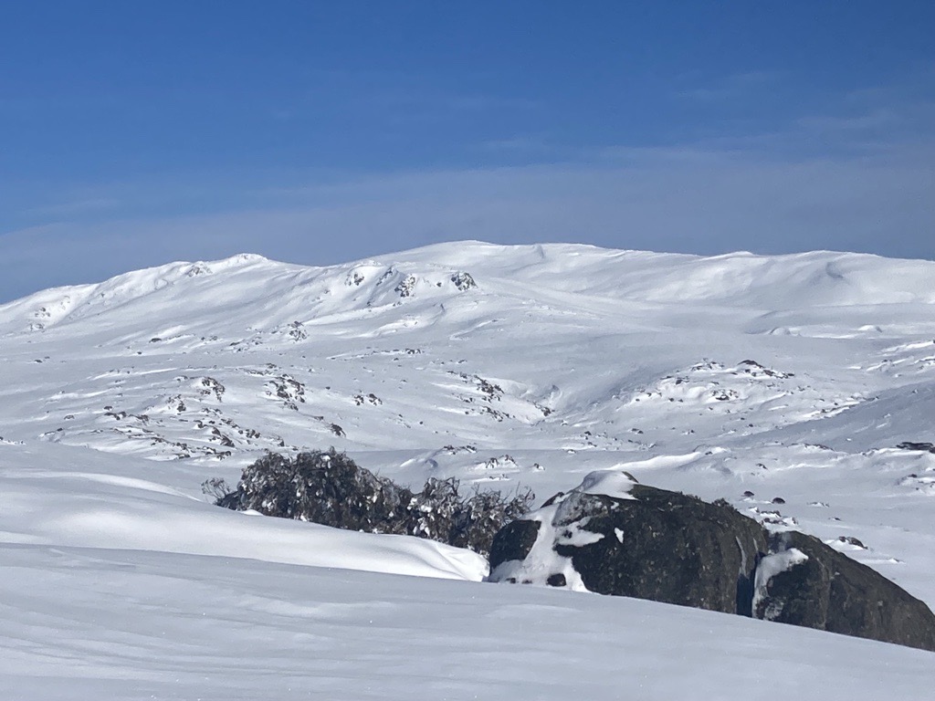
Image: Mt Kosciuszko from Charlotte Pass earlier this week.
This coming weekend's snowfalls will kick off on Saturday as a cold front moves through southeastern Australia bringing only a moderate amount of moisture, but plenty of frigid polar air.
The snow level will drop quite quickly as the chilly air arrives, with snow to 700 metres later on Saturday in alpine areas, and potentially as low as 600 metres on Sunday in Victoria and parts of New South Wales.
That means snowfalls can be expected on the Central Tablelands of NSW – for example snow showers are in the Sunday forecast for Orange – and on elevated parts of the Southern Tablelands well beyond the mountains.
And here's a thought: Could it snow at Canberra Stadium during the NRL match between the Canberra Raiders and the South Sydney Rabbitohs which kicks off at 6:15 pm on Sunday?
The short answer is that it's highly unlikely but not entirely impossible.
NRL fans with long memories will recall that on May 28, 2000, it snowed at Canberra Stadium during the NRL match between the Canberra Raiders and Wests Tigers.
On 28 May 2000 @RaidersCanberra & @WestsTigers played in the snow. The Raiders narrowly defeated the Tigers 24-22. Courtesy ABC News.
— NFSA National Film and Sound Archive of Australia (@NFSAonline) June 25, 2018
Read more: https://t.co/Aa9Hmuf4gH#Newscaf30 pic.twitter.com/eye1pXr15j
The moisture-laden late-autumn polar blast that brought snow to the footy delivered some of the lowest snow ever recorded on mainland Australia.
This weekend's system promises to be cold but not quite that cold. Nor will there be quite as much moisture as the 2000 system. But you never know your luck.
Meanwhile the ski resorts should see a nice top-up of 10 to 15 cm of fresh snow by lunchtime on Sunday. This will be the cherished "powder snow" that settles in a light fluffy layer perfect for skiing and snowboarding.
Some snow fell at higher levels of the ski resorts on Thursday this week, but temperatures were marginal and the fresh flakes that settled up high created a layer that was your typical "Aussie cement".
Glorious day after 8cm of fresh #snow at #Hotham. @SubaruAustralia ‘WRX First Tracks’ has returned to Heavenly Valley with lifts open from 7:30am. Enjoy! ???? pic.twitter.com/S1PX2TntJf
— Hotham (@_hotham) July 26, 2024
If you're lucky enough to be in the snowfields this weekend, it'll be cold and windy but the snow surface should be the best of the season.
As ever, check our snow page for the latest forecasts, cams and more.