Snow possible in northern NSW this Friday
A polar air mass will send shivers across southeastern Australia later this week, with blustery winds, rain, snow and hail likely in several states and territories.
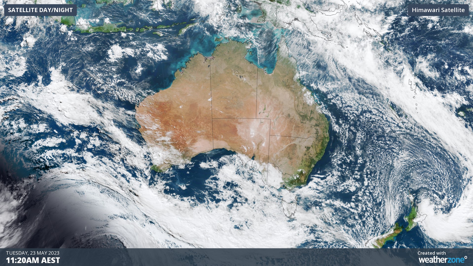
The satellite image below shows a large pool of cold air located to the southwest of Australia on Tuesday. This frigid air mass will cross the Bight on Wednesday before barrelling across southeastern Australia on Thursday and Friday.

Image: Visible true-colour satellite image captured on Tuesday morning, showing cold air masses near New Zealand and to the southwest of Australia.
The front and associated cold air mass will produce a wintry mix of low temperatures, rain, snow, hail and strong winds in Australia’s southeastern states from Thursday into Friday.
Snow will settle in parts of Tas, Vic, NSW and the ACT from Thursday into Friday, possibly reaching into parts of northern NSW. This will include a decent fall in the mainland alps, helping to create a snow base for the upcoming ski season.
At this stage, snow could fall to around 600 metres elevation in Tasmania, 800 metres in Victoria and about 1000 metres in southern and central NSW and the ACT on Thursday and/or Friday. The best chance of snow on the northern highlands of NSW will be on Friday morning as the cold air surges north.
Wind will also be a significant feature of this system, with damaging gusts possible in parts of Tas, Vic, NSW and the ACT from late Wednesday into Thursday, most likely in exposed coastal areas and about the ranges.
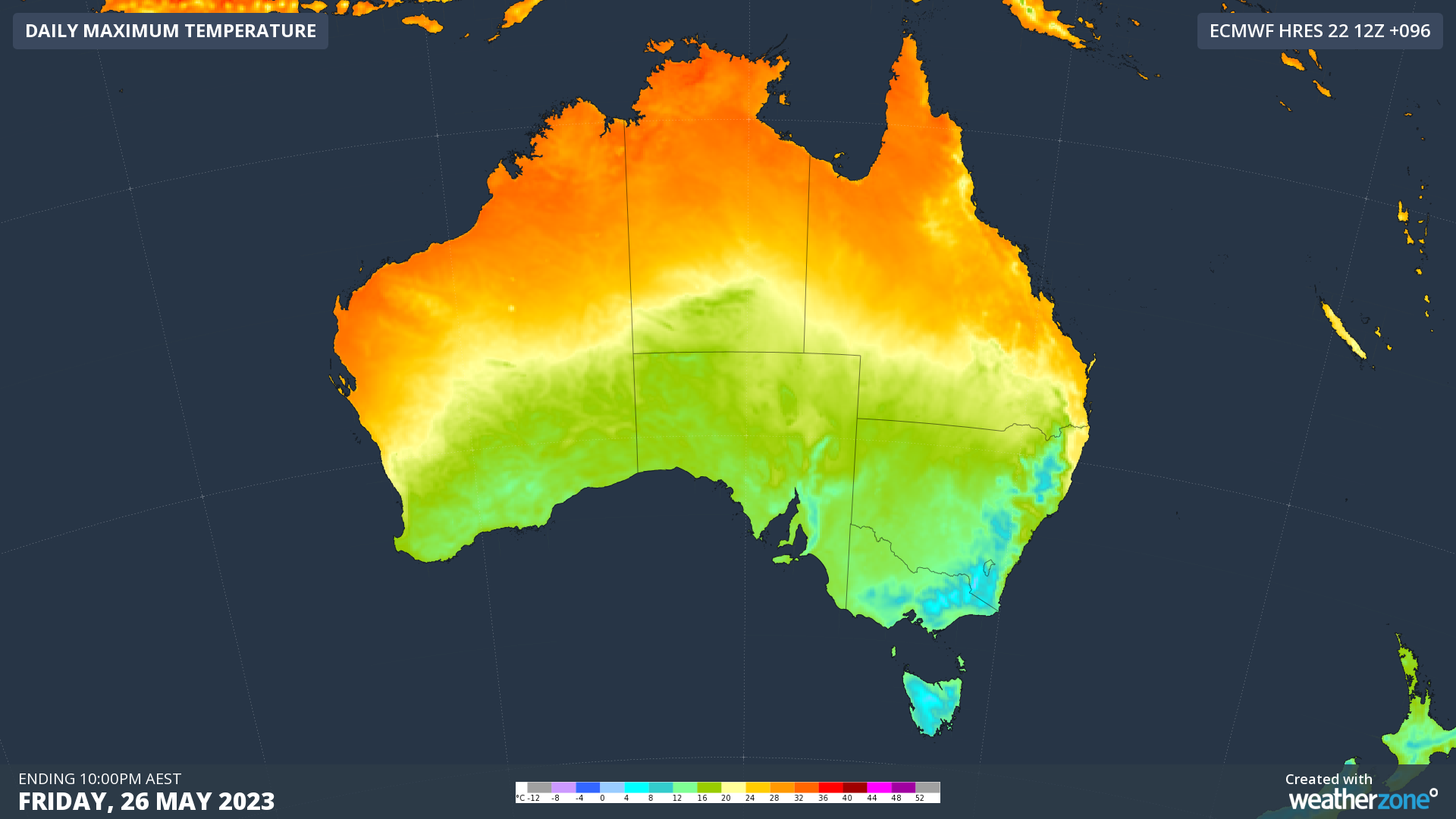
Daytime temperatures are expected to be around 4 to 6ºC below average for large areas of southeastern Australia by Friday. This cold snap will be exacerbated by wind chill, making it feel more like 10ºC below average in some places.

Image: Forecast daytime maximum temperatures on Friday, according to the ECMWF-HRES model.
Be sure to check the latest severe weather warnings in your state or territory over the next few days if you live in southeastern Australia.