Snow, flooding and damaging winds on the way
An outbreak of severe wintry weather will affect southeastern and eastern Australia this week, with damaging winds, heavy rain, thunderstorms, flooding, widespread snow and hail.
A strong cold front will impact southern Australia on Monday and Tuesday, leading to widespread rain and damaging winds. The front will then create a cut-off low pressure system over NSW, which will move slowly east and produce rain, storms, snow and hail across Victoria, NSW and southern Queensland.

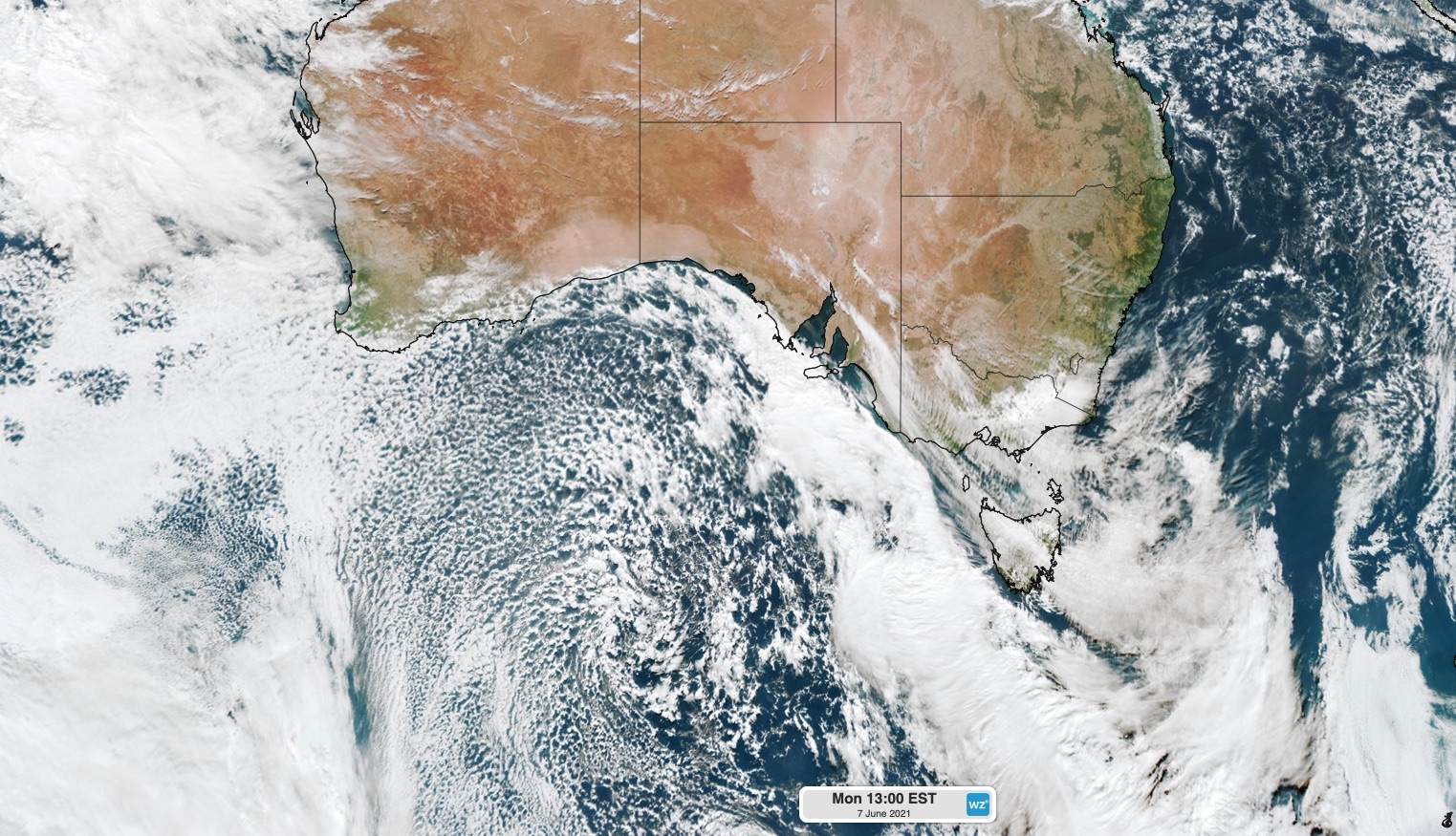
Image: Satellite image captured at 1pm AEST on Monday. The large mass of speckled clouds to the south of Australia reveals a pool of cold polar air that will spread across southern and southeastern Australia this week.
-- WIND --
The cold front will cause powerful winds in SA, Tasmania and Victoria on Monday and Tuesday. Severe weather warnings have been issues for damaging gusts in some areas.
Parts of SA and Victoria may experience northwesterly wind gusts strong enough to exceed the safe operating speeds of wind turbines, possibly leading to a reduction in wind power.
From Wednesday, a developing low pressure system will cause winds to strengthen over eastern Tasmania, eastern Victoria and southern NSW. These winds may be strong enough to cause structural damage and bring down trees.
-- RAIN --
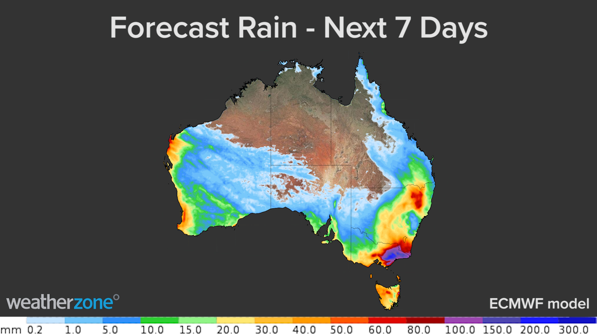
The passage of the front and low pressure system will also cause widespread rain across SA, Tasmania, Victoria, NSW, the ACT and southern Queensland between Monday and the weekend.

The focus of the rain on Monday and Tuesday will be in SA, Victoria and Tasmania. This rain may cause localised flooding in some areas, most likely in Tasmania.
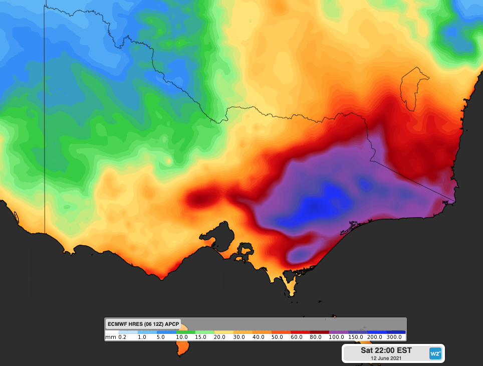
Heavy rain and thunderstorms are then likely to affect eastern Victoria and southeastern NSW on Wednesday and Thursday, as the low pressure system moves over Tasman Sea. Accumulated totals over these two days are a good chance of reaching 100-200mm and may exceed 300mm in some areas, which brings a high risk of flooding in this region. There are even indications that 100-200mm could fall in just 12 hours overnight Wednesday into Thursday morning.

Image: Forecast accumulated rain between Monday and Saturday this week, according to the ECMWF-HRES model.
-- COLD --
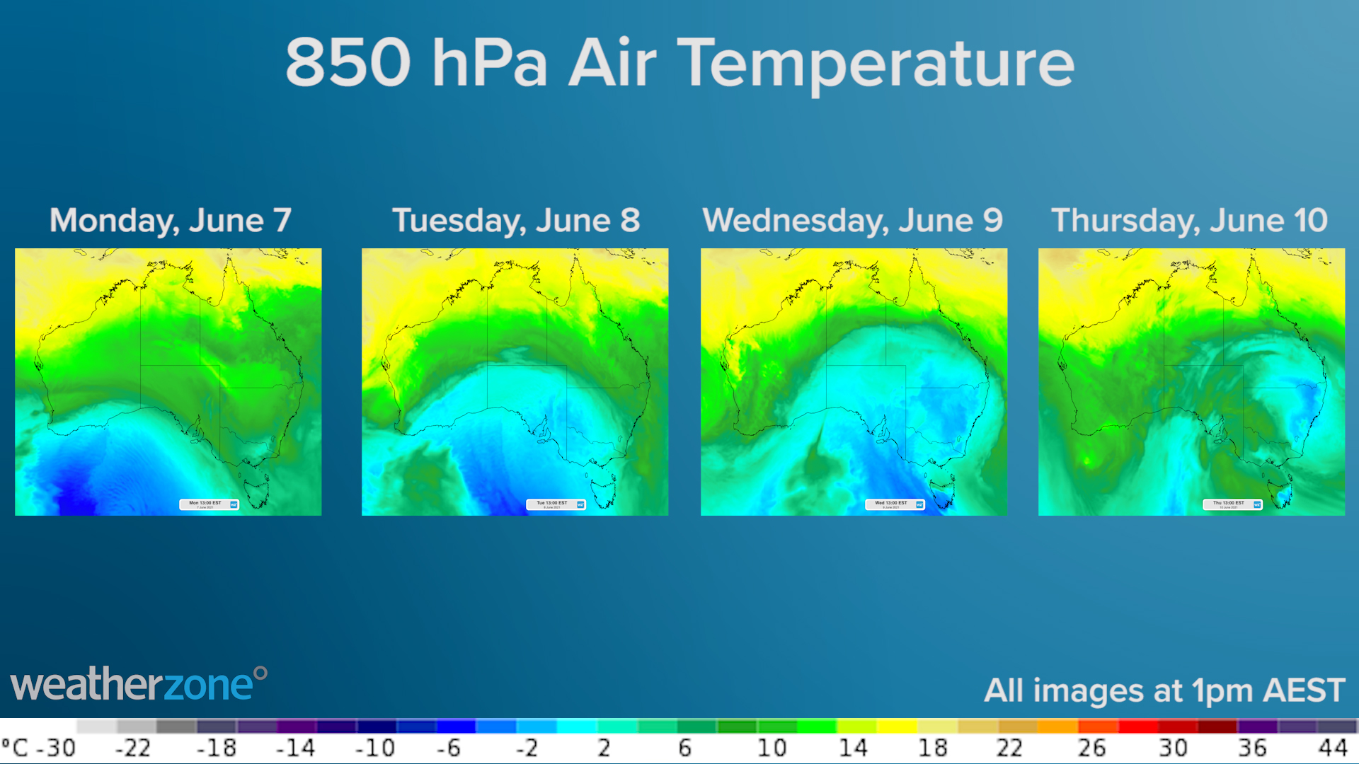
One of the main features of this weather event will be widespread, abnormally cold weather for several days and nights.
A large pool of cold air that originated near Antarctica will spread across Australia’s southeastern states between Monday and Friday. This frigid polar air will send shivers across multiple states and see a surge in heater use.

Many areas in the south and southeast will be 3-4 degrees below average for at least two days this week, beginning in South Australia and then spreading further north and east on Wednesday and Thursday.
-- SNOW --
Widespread and low-level snow will fall across several states this week. Unlike regular cold fronts, these cut-off lows often cause snow-bearing cold air to venture further north into NSW and sometimes even reaching southern Queensland.
There is still some uncertainty between forecast models regarding when, where and how much snow will fall from this system. At this stage, there is a good chance of snow in the mainland Alps for several days from Tuesday. Snow will also extend up ranges and tablelands in central and northern NSW on Wednesday and Thursday, with a chance of some snow in southern Queensland late Wednesday or on Thursday.
While the Alps are likely to see heavy snow from this system, there is a chance that snow will tend to rain in Victoria and southern NSW from Thursday as warmer air moves in from the southeast. This may erode some of the newly-laid snow base, especially for lower slopes in the mountains.
As the cold air pushes north, it may coincide with a surge of moisture and deliver a period of sustained and heavy snow in central or northern NSW on Wednesday or Thursday. Some computer models suggest that more than 20cm of snow could accumulate in up to the northern highlands in NSW by the end of Thursday.
Be sure to keep checking the latest forecasts and warnings throughout the week and be sure to have some warm clothes and heating ready to go.