
Snow and blustery winds in southeast Australia
A wintry cold front is gearing up to make its mark across southern Australia, bringing a mixed bag of damaging winds, rain, and welcome snow to the Alps from late Monday through Wednesday.
First up, let's talk about the winds. Stay alert, as gusts exceeding 90 km/h are forecast to sweep through southeast SA, TAS, VIC, the ACT, and parts of eastern and southeastern NSW (Figure 1)
Tasmania, in particular, is in the firing line, with gusts topping 100 km/h, and some areas even facing destructive winds surpassing 125 km/h, particularly over exposed coastal and elevated areas in the north and west. Victoria and NSW won't be spared either, with Tuesday and Wednesday shaping up to be the windiest days, especially in coastal and elevated regions, including parts of Melbourne during Tuesday morning and possibly coastal areas of the Sydney region on Wednesday 12th.
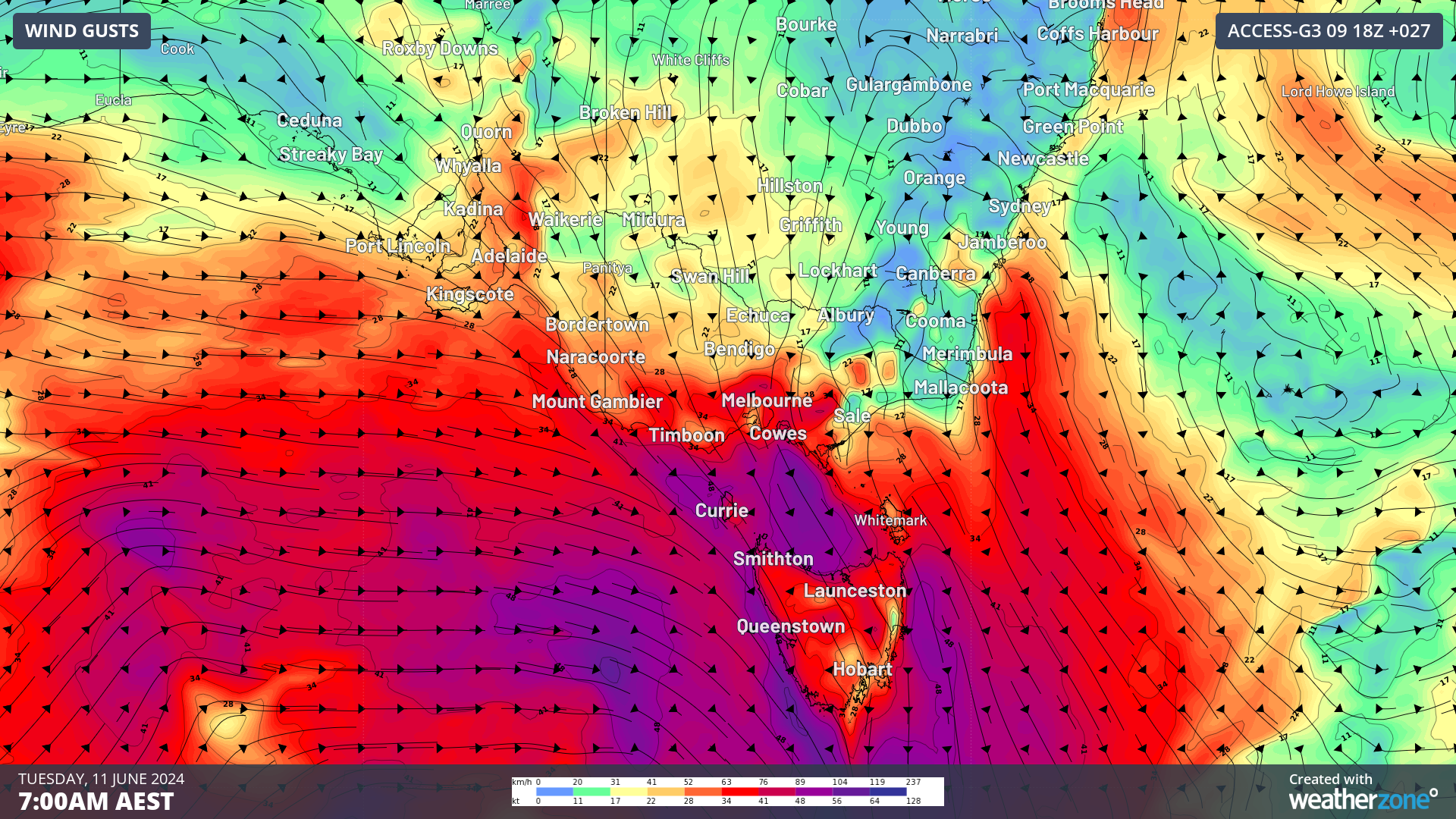
Figure 1. 10m wind gusts, Tuesday 11th morning (ACCESS-G model).
Accompanying the winds is a notable amount of rainfall. Tassie is expected to bear the brunt, with accumulations ranging from 40 to 80 mm in the west and north, and 15-30 mm in other areas of the state by Wednesday morning. Meanwhile, about 40-60 mm of rain may fall over eastern VIC and southeast NSW, particularly impacting the ranges and alpine areas (Figure 2).
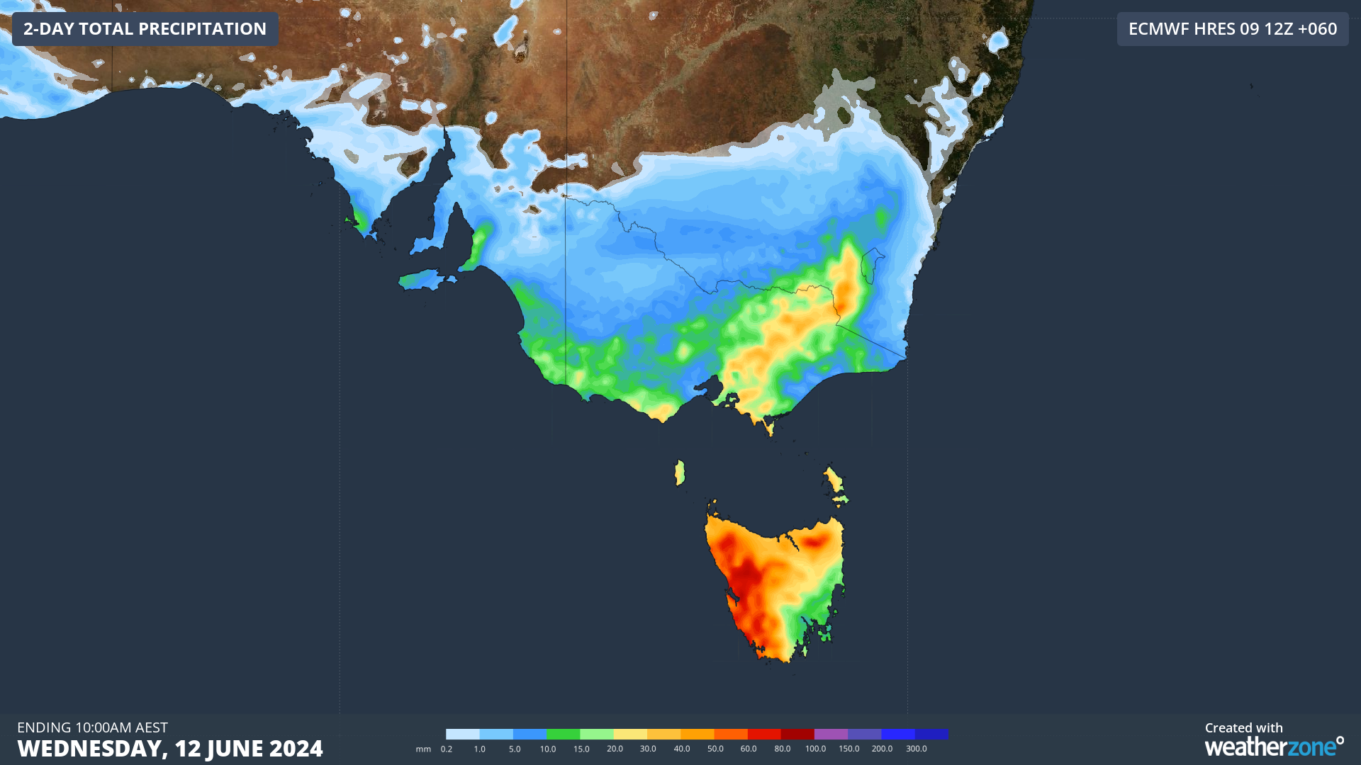
Figure 2. Accumulated precipitation to 10am AEST Wednesday 12th (ECMWF model).
Amidst the bluster and rain, a beacon of hope shines for the snow-deprived alpine regions, with a promising snowfall dose poised for the mainland Alps with this event. Fifteen to twenty five centimetres of snow are expected to accumulate above about 1500 meters, with lighter falls (up to about ~10cm) possible at altitudes as low as 1200-1300 meters. This ensures that even the lower resorts will get a coating of snow by Wednesday, while higher-based resorts are likely to see a more generous amount. Tasmania, will also be graced with a hearty batch of snow, falling to altitudes as low as about 500-600 m, with the potential to amass up to 25-30 cm.
As the wintry cold front sweeps through southern Australia, keep an eye on forecasts and warnings and take the time to secure or bring inside any items that could be tossed around or damaged by the wind. And for those venturing out, may the promise of snow bring a touch of wonder to your day.