
Smoke on the water as fires scorch WA's Dampier Peninsula
Satellite images have captured a unique phenomenon off the northwest coast of Australia this week as bushfire smoke trapped in a low pressure trough travelled 1000 km across the ocean.
Seasonal bushfires have been burning near the north coast of WA this week under the influence of warm and dry winds blowing through the Kimberley. Some of the largest fires in the region have been located on the Dampier Peninsula, to the northeast of Broome, and near Derby.
These fires have been so large that the Himawari-9 satellite, which sits roughly 36,000 km above the surface of Earth, has captured clear images of their massive smoke plumes this week.
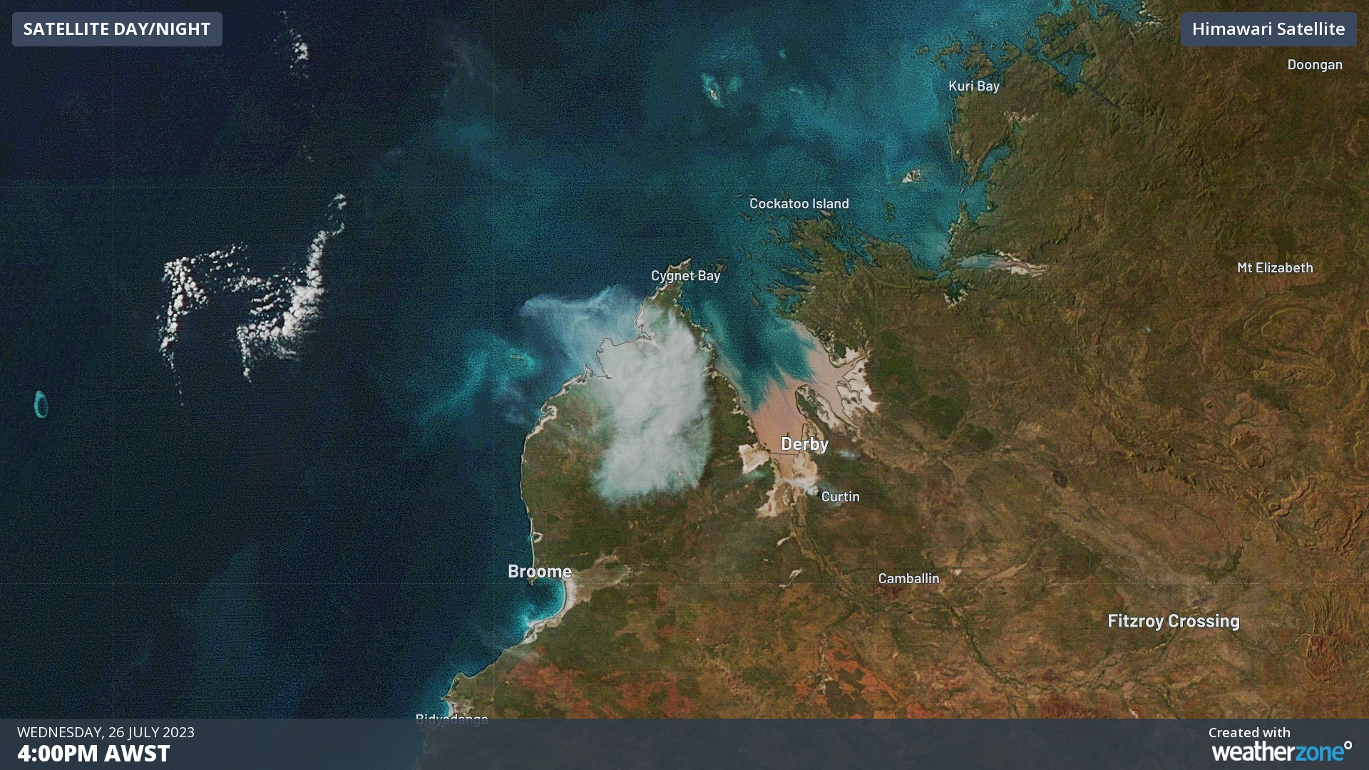
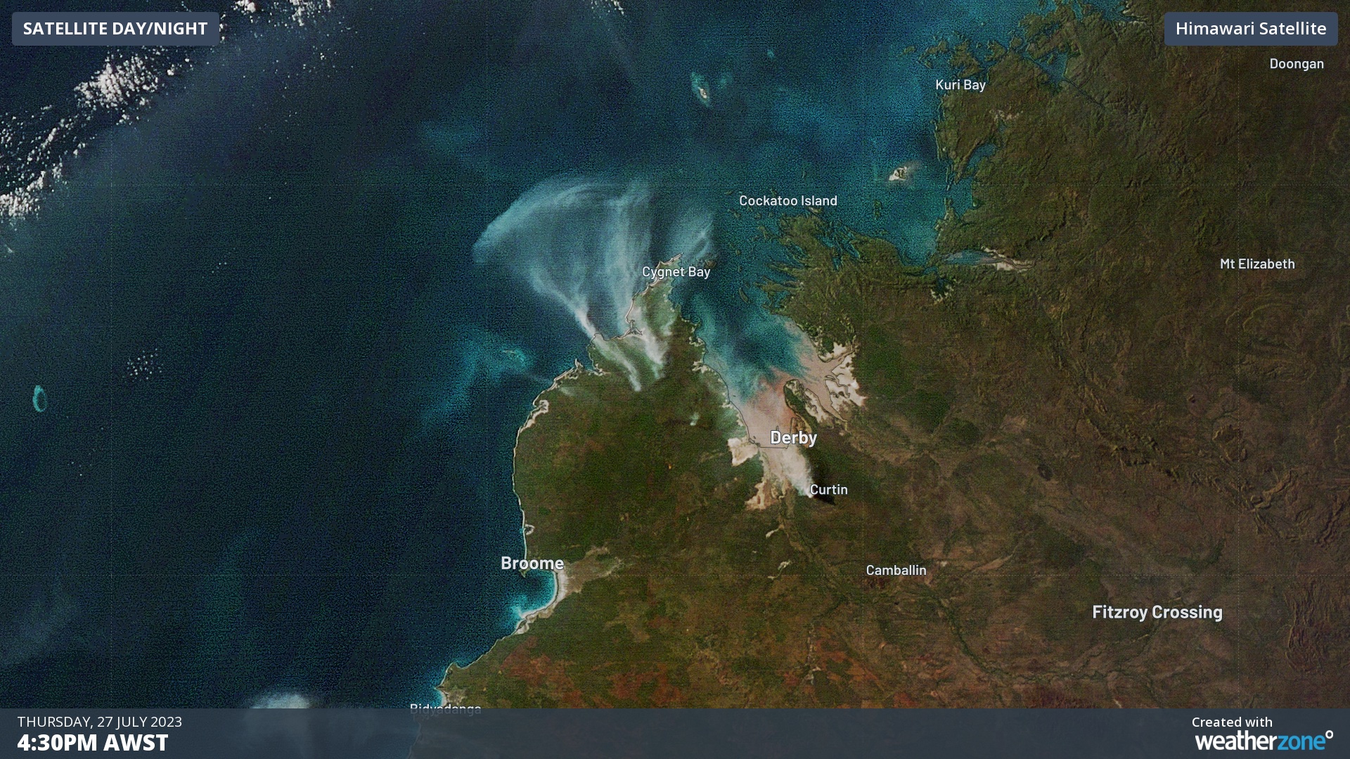
Images: Smoke over the Dampier Peninsula on Wednesday and Thursday afternoons this week.
Impressively, some of the smoke from Wednesday’s fires drifted offshore and because trapped in a small low pressure trough, forming an arc of smoke beneath a line of cumulus clouds.
This arc of smoke then drifted across the ocean from east to west throughout Thursday. While the smoke begun to dissipate on Thursday night, some could still be seen amongst the clouds on Friday morning, roughly 1,000 km away from its point of origin.
.gif)
This week’s fires have been causing road closures in parts of the Kimberley. Be sure to check the latest fire alerts and road closures before travelling through the region.