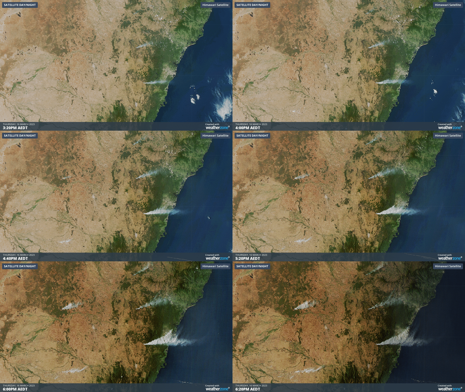
Smoke of five NSW fires seen from space
Satellites and the International Space Station have captured striking images of large smoke plumes blowing across NSW on Thursday as dozens of fires burn across the state.
The clip below shows five separate plumes of smoke over central and southern NSW in the final hours of daylight on Thursday, as seen by the Himawari-9 satellite from about 36,000 km above the ground.

These five fires were part of more than 40 separate blazes occurring across NSW on Thursday afternoon as a late-season burst of hot, dry and windy weather struck the state.
The biggest smoke plume in the animation above was caused by the Craigs Road fire near Curraweela, which was under an Emergency Warning for most of Thursday and had burnt around 2,500 hectares of grass and bushland by 10pm.
Emergency Warning: Craigs Rd Fire, Curraweela
— NSW RFS (@NSWRFS) March 16, 2023
Fire is burning in the Curraweela area, spreading east. Properties in Craigs Rd, Taralga Rd and Old Station Creek Rd are being impacted. Residents should shelter now, it is too late to leave. #NSWRFS https://t.co/rt27Wk9s9Y pic.twitter.com/hWpAwbdCtV
The Craigs Road fire was so big on Thursday that its smoke plume was also visible from the International Space Station as it passed overhead shortly before 4pm local time.
Australia: Clear skies over @Canberra, on the way to @cityofsydney then, WHAT IS THAT?? Bushfire? What does that look like from the ground?
— ISS Above (@ISSAboveYou) March 16, 2023
Captured live from the @Space_Station 434km up at 3:52pm AEDT today.@abccanberra @7NewsCanberra @9NewsCanberra @9NewsSyd @7NewsSydney… https://t.co/5WvSPHSiLU pic.twitter.com/iMksliBchS
This week’s fires in NSW are being fuelled by vegetation that grew during frequent rains of 2022 and is now drying out after a run of hot and dry weather in recent weeks.
Check the NSW RFS website for the most up-to-date information on fires across the state.