
Smoke and atmospheric gravity waves appear northwest of Australia
A massive plume of smoke and multiple atmospheric gravity waves appeared to the northwest of Australia on Thursday morning.
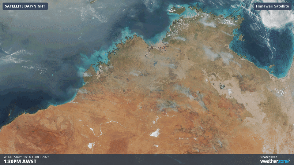
A run of dry and hot weather across the northern half of Australia in recent weeks has created perfect conditions for fires. On Wednesday afternoon, numerous large smoke plumes could be seen spreading over central and northern Australia, with prevailing southeasterly winds blowing the smoke towards the northwest.
Video: Smoke plumes across central and northern Australia on Wednesday afternoon.
The fires burning in central and northern Australia have been ejecting smoke across the Indian Ocean for several weeks. On Thursday morning, a long tongue of smoke-filled air could be seen extending around 3,000 km off the northwest coast of Australia.
One of the main reasons smoke can be seen drifting so far away from Australia this week is the presence of a temperature inversion in the lower atmosphere. A temperature inversion occurs when warm air sits above relatively cooler air, which prevents the cooler low-level air from rising into the atmosphere. These conditions are considered stable, because they prevent the uplift that can produce clouds, rain and thunderstorms.
The presence of a low-level temperature inversion to the northwest of Australia has not only trapped smoke near the surface this week, but it has also allowed numerous atmospheric gravity waves to form over the Eastern Indian Ocean in recent days.
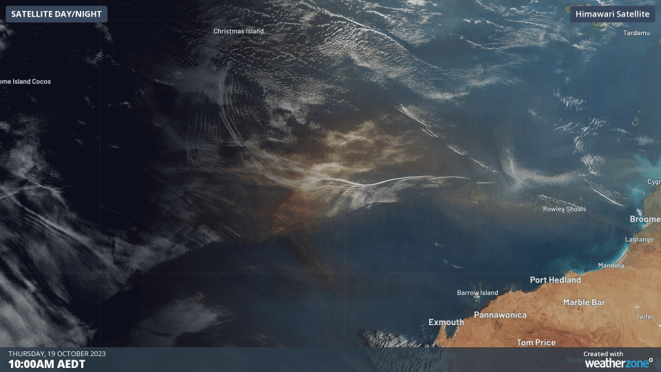
Video: Smoke-filled air and plenty of atmospheric gravity waves to the northwest of Australia on Thursday morning.
Atmospheric gravity waves occur when a disturbance – such as a thunderstorm, opposing winds or mountains – causes waves to form in the sky. They are similar to the waves that form when you throw a stone into a pond.
Atmospheric gravity waves move through the sky like the ripples in a pond, rising and falling as they progress. Because the rising air gets cooler and the sinking air becomes warmer, condensation can produce parallel bands of clouds along the crests of each wave, while the trough of each wave remains cloud-free. This can result in corduroy cloud formations that travel horizontally through the sky.
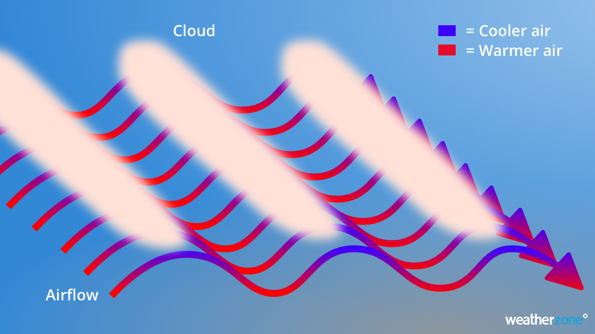
Image: Basic process behind the formation of clouds from atmospheric gravity waves.
Atmospheric gravity waves are common over the ocean to the northwest of Australia. They also form regularly in other parts of the world, including the Bay of Bengal and the Arabian Sea.