
Sharp stratocumulus cloud edge spotted over eastern NSW
A well-defined slab of stratocumulus cloud passed over a short stretch of the NSW coast on Thursday morning, creating a captivating scene from above and below.
A thin layer of moisture-laden air trapped beneath an inversion caused a widespread layer of stratocumulus cloud across inland NSW on Thursday morning. The satellite images below show the broad cloud mass in the first few hours of daylight.
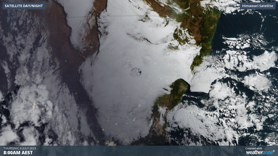
A close look at the animation above shows that most of Thursday morning’s cloud cover was trapped to the west of the Great Dividing Range in NSW. However, a narrow band of low-level westerly winds allowed a thin strip of cloud to flow through the Hunter Valley, covering a small section of the Central Coast and Newcastle regions.
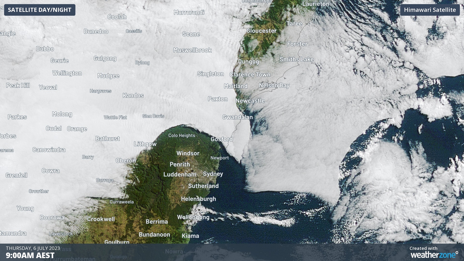
Image: A closer look at the thin band of stratocumulus cloud over the Hunter Valley and adjacent coast on Thursday morning.
From the ground, the coastal stratocumulus cloud formed an impressive slab in the sky, with a well-defined edge separating the gloomy grey cloud base from the nearby clear blue sky.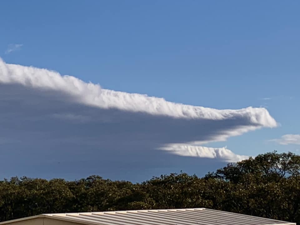
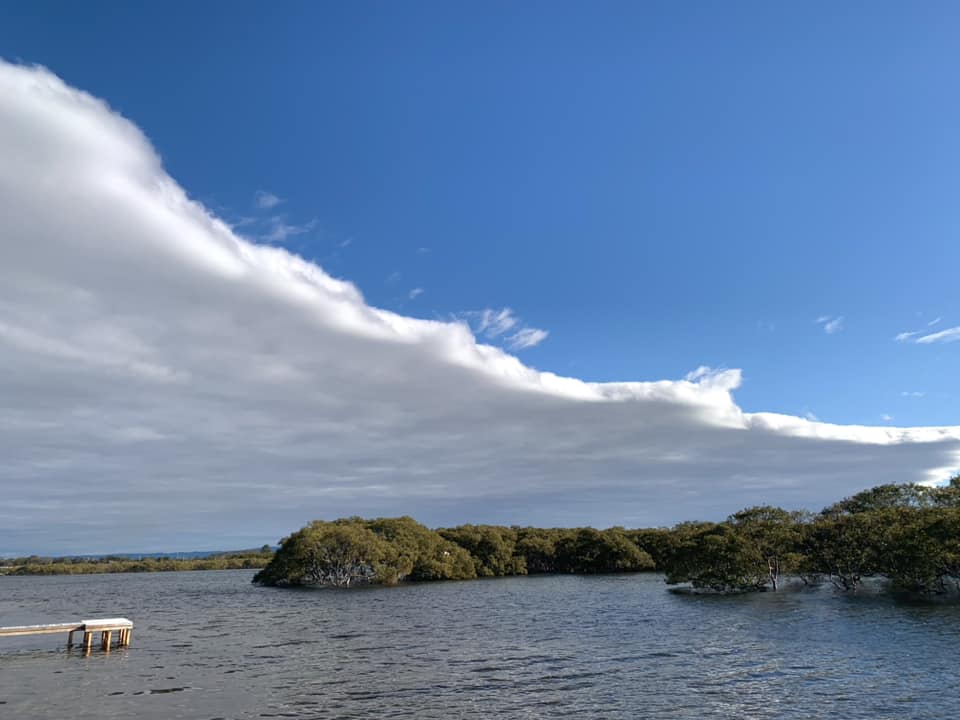
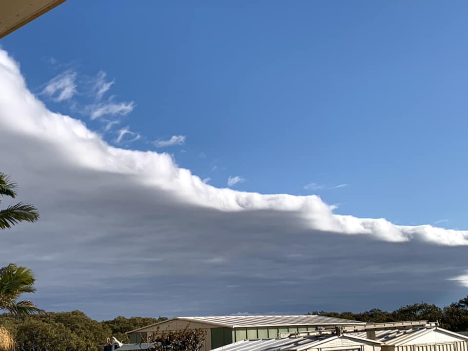
Images: Stratocumulus cloud edge seen from Swansea, NSW on Thursday morning. Source: Bill Williams via Facebook
While Thursday’s morning’s grey stratocumulus cloud made it looks like rain was on the way, the cloud’s base was more than 2 km above the ground, and it didn’t produce any precipitation.