
Severe Weather in SE Australia
Heavy rain has fallen over New South Wales, southeast Queensland, and central-north Victoria as expected. Accumulated precipitation in the last 24 hours exceeded100mm was recorded in many locations, mainly over the Northern Rivers.
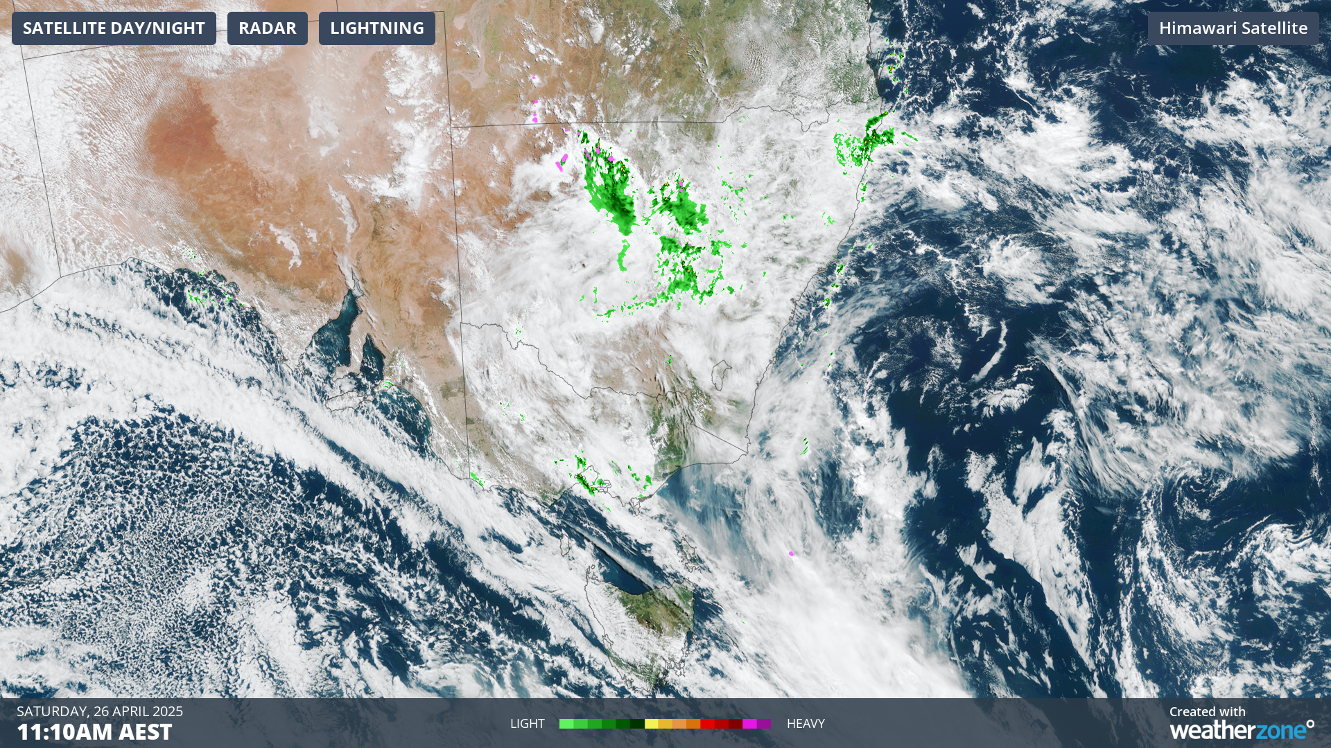
Image: Satellite imagery over southeast Australia on Saturday morning. Source: Weatherzone
Grafton Airport (NSW) recorded 101.4mm, the highest rainfall in 24 hours in April in the last 26 years.
Some places like Ivanhoe, in western NSW, and Westmere, in south-west Victoria, also received record rainfall for the month. Ivanhoe (40mm) hasn't seen this much rainfall since 2000, and Westmere (28.4mm) since 2006.
As meteorologist Felix Levesque anticipated, the forecast is for a wet weekend for much of southeastern Australia. A cloud band ahead of a trough moving across central NSW is bringing widespread areas of rain with thunderstorms.
The trough deepens today while a low looks like to develop off the coast on Sunday. Localised heavy falls are most likely with these thunderstorms; however, flash flooding, large hail, and damaging wind gusts are also possible, most likely over the central, northern, and eastern parts of NSW.
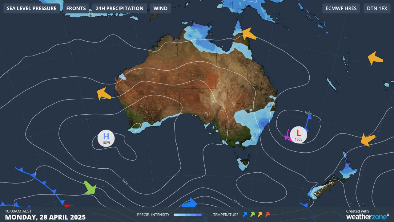 Image: Synoptic image for Monday, 28 April.
Widespread falls, severe thunderstorms, and strong winds are expected over the coming days, mainly across the central coast of NSW, including parts of Sydney. Localized accumulated rainfall peaking at 100-200mm should fall until late Monday.
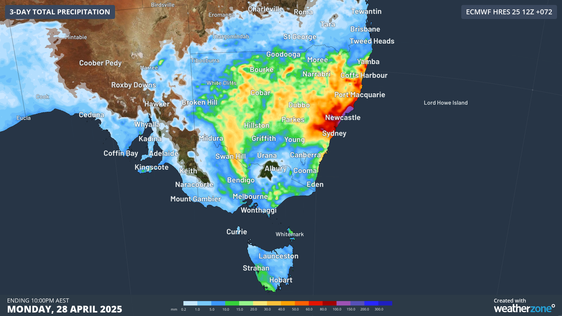 Image: Accumulated rainfall to 4am on Monday, 28 April.
Follow the warnings and forecast for your region here.