Severe weather hitting southeastern Australia
A dangerous mix of heavy rain, powerful winds and severe thunderstorms will batter parts of southeastern and eastern Australia on Friday.
Over the last 24 hours, a complex low pressure system and associated trough have caused severe weather in parts of SA, VIC, NSW and TAS.
This burst of wild weather started with damaging winds and severe thunderstorms in SA on Thursday, which brought heavy rain and large hail in some areas.
Severe storms also spilled into western NSW and western Victoria on Thursday and the dangerous weather has continued to spread across Australia's southeastern states into Friday morning.
The image below is a composite of observed visible satellite imagery and modelled mean sea level pressure shortly after sunrise on Friday.
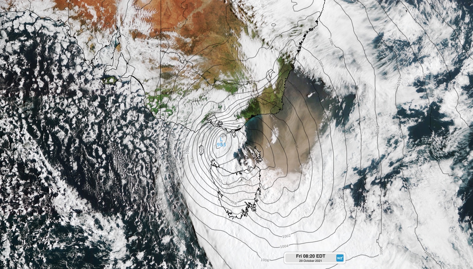
Image: Composite satellite and modelled mean sea level pressure (MSLP) on Firday morning.
The image above shows thick, rain-bearing clouds passing over Tasmania and Victoria on the western and southern sides of the deep low pressure system. There is also a large cloud of dust to the east of the low, which is being blown across Bass Strait and over northeast Tasmania. This airborne dust was scoured from the Australian mainland by powerful winds on Thursday and early Friday morning.
Wind gusts of up to 143 km/h were recorded in western Victoria in the early hours of Friday morning. Damaging winds have also battered parts of Melbourne, with wind gusts reaching 119km/h at Melbourne Airport at 6:45am and 135 km/h at 7:30am.
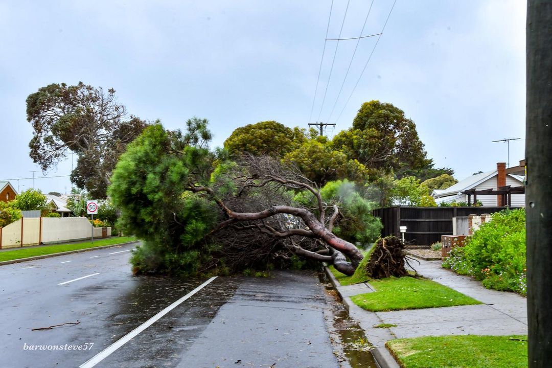
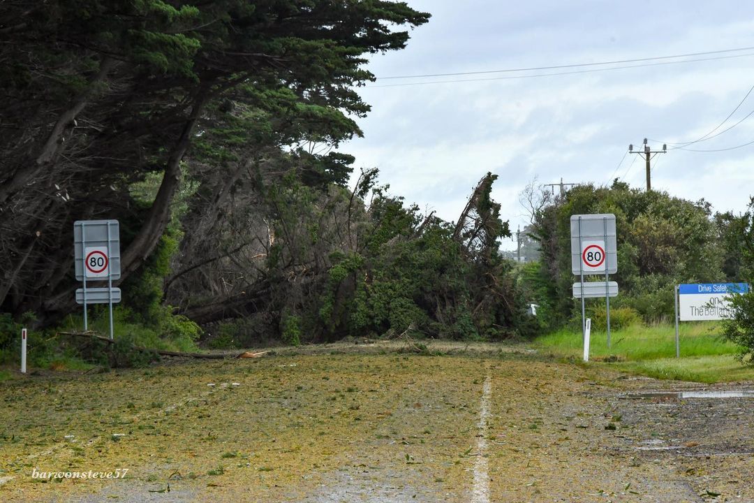
Images: Storms damage in Barwon Heads, VIC on Friday morning. Source: @barwonsteve57 / Instagram
As of 9am on Friday, Victoria's State Emergency Service has received 1,670 requests for assistance as a result of the wild weather, including fallen trees and building damage.
Well, it sure is a windy one folks. As of 9:00AM, in the past 24 hours VICSES has received 1670 requests for assistance.
— VICSES News (@vicsesnews) October 28, 2021
If you need assistance from VICSES, call 132 500. Please be patient while our incredible volunteers work through this large number of call-outs.
Stay safe! pic.twitter.com/gMUNJnu8sS
Further south, heavy rain and potentially damaging winds have also been lashing Tasmania on Thursday night and Friday morning. Some central parts of the state have already collected more than 50mm of rain from this system.
All up, there were more than half a million lightning strikes over southeastern Austarlia and nearby waters during the last 24 hours, with 509,513 lightning strikes detected within an 800 km radius of Ballarat during the 24 hours ending at 10am AEDT on Friday.
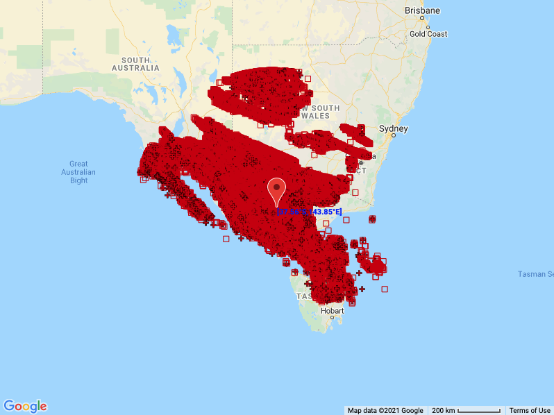
Image: Locations of the 509,513 lightning strikes detected around southeastern Australia during the 24 hours to 10am AEDT on Friday.
The low pressure system will continue to cause damaging winds over parts of Tasmania, Victoria, NSW an the ACT on Friday. At 10am AEDT, severe weather warnings were in place for parts of these four states.
Rain will ease in Victoria on Friday morning, although heavy rain will continue to soak parts of Tasmania into Friday afternoon as the low moves further south, before easing overnight.
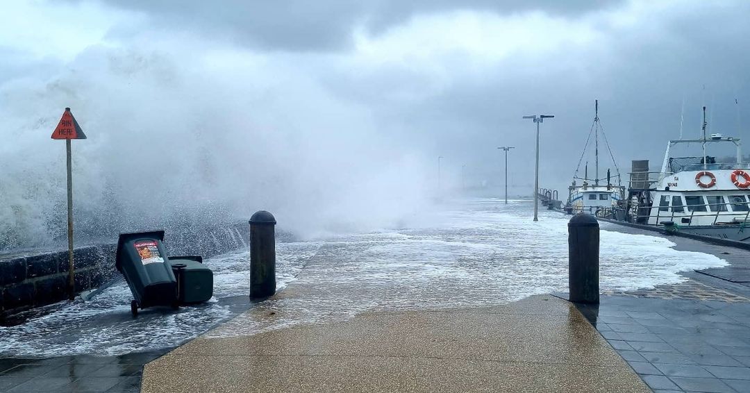
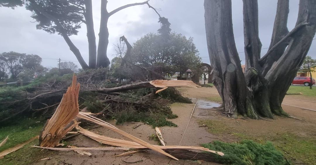
Images: Wild winds and large waves caused damage at Mornington, VIC on Friday morning. Source: @guy.robinson.142 / Instagram
Meanwhile, a low pressure trough extending up through eastern Australia will also trigger showers and dangerous thunderstorms on Friday.
Storms are possible over a broad area of NSW and QLD stretching roughly 2,000 km from Sydney up to Cloncurry. Some of these storms will become severe, most likely over northeast NSW and the southern and western interior of QLD.
Warnings will be updated regularly throughout Friday across multiple states and territories, so be sure to check the latest warnings in your area for up-to-date information.